
Hoi Ha Wan Marine Park
The bay is called Jones' Cove on old colonial charts, but hardly anyone uses that name now. Hoi Ha Wan — the bay of the Hoi Ha village — is the name everyone knows, and it describes the place more honestly: a sheltered inlet at the northern tip of the Sai Kung Peninsula, protected on three sides by green hills that keep the swell out and the water clear. The corals underneath are some of the most diverse in Hong Kong. Fishing, bottom trawling, and the collection of any marine life are prohibited. What remains, beneath the surface, is a reef ecosystem that has been left largely alone, accumulating complexity and colour across decades of legal protection.
What Lives in the Water
Hoi Ha Wan's designation as a marine park in 1996 reflected what scientists and divers already knew: the bay is biologically exceptional. Sheltered from wave action and with consistently good water quality, it hosts numerous species of hard and soft corals that have largely disappeared from more exposed or more heavily fished parts of Hong Kong's coast. The park covers approximately 2.6 square kilometres, its seaward boundary drawn by connecting the headlands of Heung Lo Kok and Kwun Tsoi Kok through the northern tips of Flat Island (Ngan Chau) and Moon Island (Mo Chau). Inside that boundary, the reef communities have had time to develop the kind of structural complexity — layered corals, abundant fish, invertebrates occupying every available surface — that makes this bay a destination for snorkellers and divers from across the territory.
Fire and Shell: The Limekiln Industry
Before the corals were protected, the bay had another industry — one that depended on burning them. The lime kiln trade, which ran from roughly 1800 to 1939, was one of the oldest commercial activities in Hong Kong's rural coast. Kiln operators collected oyster shells and coral skeletons, packed them into stone kilns, and fired them at high temperatures. The heat drove off carbon dioxide from the calcium carbonate, leaving calcium oxide — quicklime — used in construction mortar and as an agricultural soil amendment. Four lime kilns once operated along the eastern shore of inner Hoi Ha Wan. Two remain comparatively intact today, their arched stone mouths still visible among the scrub. They are among the oldest surviving industrial structures on the Sai Kung Peninsula, quiet relics of an economy that preceded the marine park by more than a century.
The Village at the Shore
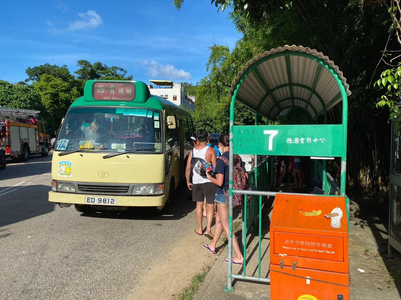
Hoi Ha village sits at the innermost point of the bay, where the water is calmest and the hills close in. Like many Sai Kung villages, it lost most of its population to the city over the latter half of the twentieth century, leaving a scattering of old houses among newer weekend cottages. The village's relationship with the marine park has shifted over that time: the fishing that once sustained it is now prohibited in the protected zone, but the park itself draws hikers and divers who patronise the small cluster of cafes and guesthouses that have taken root near the pier. Getting there still requires commitment. The New Territories Green Minibus route 7 runs from Sai Kung Town Centre every thirty minutes during the day — the first departure at 7:55 am, the last return at 6:25 pm — and beyond that there is only the narrow road and your own feet.
A Park That Still Has Presence
Marine parks can be invisible from the shore — boundary lines on a map, regulations on a sign. Hoi Ha Wan is different. The prohibition on mechanised vessels inside the park means that when you stand on the pier or wade into the shallows, the water is quiet. No engine noise, no propeller wash disturbing the sediment. Kayakers and paddleboarders drift past. The Wan Tsai peninsula forms the western shore of the bay, and beyond its spine the wind comes off the South China Sea, but in here the air is still. The stillness is intentional; it is what legal protection looks like when it works. Beneath the surface, the corals register that stillness in the way corals register everything — slowly, incrementally, growing a little more each year that the boats are kept out.
From the Air
Hoi Ha Wan is located at approximately 22.469°N, 114.336°E at the northern end of the Sai Kung Peninsula, about 18 nautical miles northeast of Hong Kong International Airport (VHHH). From altitude, the bay is visible as a compact, deeply sheltered inlet on the peninsula's northern coast, flanked by the Wan Tsai peninsula to the west. Flat Island (Ngan Chau) and Moon Island (Mo Chau) mark the seaward boundary of the marine park. The surrounding terrain of Sai Kung North is hilly but lower than the peaks to the south; ridgelines in the area reach roughly 400 metres. The bay's calm water often shows a distinct colour contrast with open water beyond the headlands.
Nearby Stories
- Sha Chau and Lung Kwu Chau Marine Park 5.9 km away
- Wanshan Archipelago 22 km away
- Hong Kong 12 25 km away
- Second Battle of Chuenpi 27 km away
- Mount Guanyin (Dongguan) 43 km away
- Battle of Penghu 474 km away
- Penghu Air Raids 482 km away
- Checheng Fu'an Temple 592 km away