
Hoi Ha
The name is a translation trick. In Hakka — the language of the people who settled this shore — the words mean something like "below the sea," or simply "seaside." But Hoi Ha (海下) reads to a Cantonese speaker as counterintuitive, even odd, because the character 下 ordinarily means "below" in the abstract rather than the maritime. That linguistic tension is a small signature of how this village has always sat a little apart: Hakka-rooted in a Cantonese city, rural in a place that never stopped urbanizing, and anchored to an industry — lime-burning — that the wider world quietly forgot.
Yung Family's Cove
Hoi Ha village was established in 1811 by Hakka settlers sharing the family name Yung. They arrived at the innermost shore of Hoi Ha Wan — a calm, finger-shaped inlet on the Sai Kung Peninsula in northeastern Hong Kong's New Territories — and built houses, cleared land, and began farming. What drew the Yungs to this particular cove is not recorded, but the geography speaks for itself. The inlet is sheltered on three sides, the water is clear, and the surrounding hills drop steeply enough to discourage casual intrusion. Archaeologists later found the site had been visited long before the Yungs arrived: pottery sherds from the Tang, Ming, and Qing dynasties, along with prehistoric stone implements, turned up in territory-wide surveys. Hoi Ha sits at the end of a very long line of people who recognized that this bay is worth the walk.
Coral Into Lime
For much of its history, Hoi Ha's economy rested on a chemical reaction: heat calcium carbonate — found in abundance in oyster shells and coral skeletons — and it transforms into calcium oxide, otherwise known as quicklime. The limekiln industry operated across Sai Kung villages from roughly 1800 to 1939, and Hoi Ha had four kilns of its own. Villagers collected coral and shells from the bay just steps from their homes, loaded them into kilns built from rubble stone and lined with crude brick, and burned them into lime used in construction mortar and agricultural soil amendment. The finished product was loaded onto boats and rowed or sailed across to Hong Kong Island to be sold. Two of the four kilns still stand on the eastern shore of the inlet — comparatively intact, restored by the Antiquities and Monuments Office in 1982 with help from the villagers themselves. They are among the clearest remaining evidence of an industry that shaped Sai Kung's coastal communities for a century and a half.
What the Second World War Ended
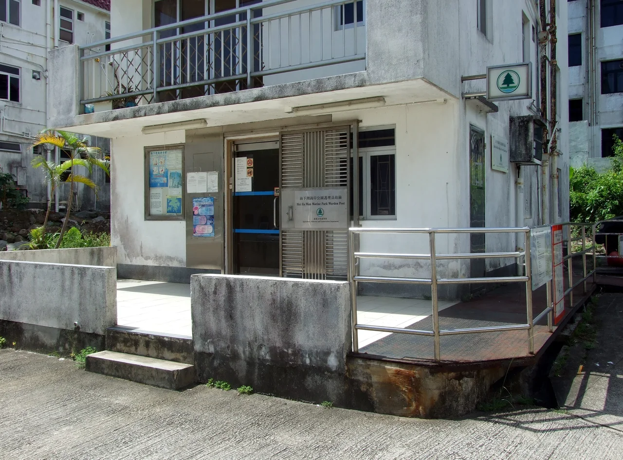
The decline of lime production was gradual, then total. Cement, more consistent and easier to source as Hong Kong's import trade expanded, began displacing lime in construction after the Second World War. The kilns at Hoi Ha fell silent. The bay that once loaded lime boats became a recreational destination, and in 1996 the waters around the inlet were designated part of Hoi Ha Wan Marine Park — one of Hong Kong's earliest marine protected areas. Today the Agriculture, Fisheries and Conservation Department maintains a warden post at the village. The village itself remains a recognized settlement under the New Territories Small House Policy, which means indigenous male villagers retain the right to build small houses on the site. But the population is thin, the garment and manufacturing booms of Kowloon and the New Towns never touched this cove, and the stillness the Yung family first found here in 1811 persists in its own way.
Marine Park at the Shore
Hoi Ha Wan Marine Park wraps around the inlet that gives the village its name, protecting a coastline known for its coral communities. The park is a draw for snorkelers and kayakers willing to make the journey by minibus and country trail across the Sai Kung Peninsula. For visitors who arrive at the village itself rather than just the water, the lime kilns reward a short detour. They sit quietly on the eastern bank — two domed stone chambers, open at the top, furred with vegetation — easy to miss if you don't know to look. The Antiquities and Monuments Office designation gives them a measure of official recognition, but no sign shouts for attention. They suit the place: understated, persistent, and set against a view of water and hills that has changed less than almost anything else in Hong Kong.
From the Air
Hoi Ha sits at 22.46°N, 114.33°E on the inner shore of Hoi Ha Wan, a sheltered inlet on the northeast side of the Sai Kung Peninsula. Approach from the southwest following the Sai Kung coastline; the village is tucked behind a ridge that separates it from Pak Sha O to the south. Recommended viewing altitude is 1,500–3,000 feet. The lime kilns are on the eastern shore of the inlet, visible as small stone structures. The nearest major airport is Hong Kong International (VHHH), approximately 45 km to the southwest on Lantau Island. Sha Tin and Tolo Harbour are visible to the west at this altitude. Visibility is typically best in the October–December dry season; summer typhoon season and persistent marine haze can obscure the coastline.
Nearby Stories
- Sha Chau and Lung Kwu Chau Marine Park 5.9 km away
- Wanshan Archipelago 22 km away
- Hong Kong 12 25 km away
- Second Battle of Chuenpi 27 km away
- Mount Guanyin (Dongguan) 43 km away
- Battle of Penghu 474 km away
- Penghu Air Raids 482 km away
- Checheng Fu'an Temple 592 km away