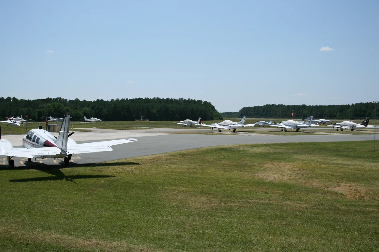

Horace Williams Airport
An airport named for a philosopher is a strange thing to find on the FAA charts, but for seventy-eight years that's what sat one nautical mile north of downtown Chapel Hill: KIGX, Horace Williams Airport, named for the man who chaired the Department of Mental and Moral Science at the University of North Carolina during the first half of the twentieth century. The airport had a single 4,005-foot asphalt runway designated 9/27, four hundred and twenty acres of land at 512 feet elevation, and a long, slow, often-bitter argument over whether it should still exist. In May 2018, the argument finally ended. A NOTAM went out. The airplanes were moved out before May 1. On May 15, the runway officially closed - and a solar energy project moved in.
Martindale Field
Before it bore a philosopher's name, the field belonged to Lee Martindale, a Chapel Hill contractor who carved out one of the first airstrips in North Carolina in the late 1920s and called it Martindale Field. He offered pilot training and air shows - the kind of barnstorming flying that made small-town airports in the interwar South community gathering places as much as transportation. By 1940 the university wanted in. UNC bought the field, expanded it onto land donated by Professor Horace Williams, and renamed it for him. Williams himself was a fixture of campus folklore: the philosophy chair who had taught Thomas Wolfe and a generation of writers, who lived to eighty-one and willed his estate to the university. He never flew. But his name stayed bolted to the airport for nearly eight decades.
The University's Strip
Horace Williams Airport was never a busy field by national standards, but for the university it mattered. UNC's Area Health Education Centers - the AHEC program that flew medical specialists to rural North Carolina hospitals - was based here, with six aircraft running missions to small towns that needed obstetric, cardiac, or pediatric care they otherwise couldn't reach. Private pilots tied down their Cessnas on the apron. A flying club ran a flight school for years. Through all of this the airport sat awkwardly inside Chapel Hill's residential edge - within easy reach of four schools, a church, and a YMCA. Several crashes in the surrounding neighborhoods over the decades made everyone uneasy. The university eventually pushed the flying club's flight school out. Conflict between the town and the airport's defenders simmered through the 1980s and 1990s.
Carolina North
In 2000 the university announced what it called the Carolina North project - a planned expansion of UNC's campus onto the airport land. The airport, the trustees decided, had to go. General aviation pilots and lobbyists fought back hard, arguing that once a small airfield closed in a region like the Triangle, it would never be replaced. They pointed out that the FAA had kept approving airport upgrades, that the staff was meticulous, that something about small airplanes was worth preserving against the steady advance of buildings and traffic. Three different times between 2000 and the 2010s, the closure was blocked in the state legislature. The university redrew the Carolina North plans. The economy stalled the project. The airport stayed open longer than anyone expected. The AHEC flights were eventually relocated to Raleigh-Durham International, freeing the airfield for development that still hadn't quite arrived.
Sun Over Runway 9/27
On May 15, 2018, after years of delay, Horace Williams Airport closed for good. The aircraft were gone by May 1. The closure wasn't for Carolina North after all - economic realities had stalled that project. The land was instead leased for a solar energy installation, the kind that has spread across rural North Carolina as the state has pushed renewable generation. Today, if you fly over the site of KIGX, you see panels arranged in long rectangular arrays where the runway used to run east and west. The administration building still stands. The airport marker is gone. The closure ended a chapter that began with Lee Martindale flying barnstormers off a dirt strip and ran through the AHEC program reaching rural North Carolinians who otherwise wouldn't see a specialist. Pilots had argued infrastructure like this never comes back once it's lost. They were probably right. What replaced it generates electricity from sunlight - a fair trade, depending on which side of the argument you've spent the last twenty years on.
From the Air
Former airport ICAO KIGX at 35.935°N, 79.066°W, 1 nautical mile north of downtown Chapel Hill, North Carolina. Elevation 512 feet MSL. Single asphalt runway 9/27 (4,005 ft x 75 ft) permanently closed May 15, 2018; the site is now a solar farm and should NOT appear in current navigation databases. The closest active general aviation field is Raleigh-Durham International (KRDU), 9 nm east. Person County Airport (KTDF) lies northeast; Sanford-Lee County Regional (KTTA) lies south. Recommended overflight 2,000-3,000 ft AGL to see the solar array clearly.
Nearby Stories
- Orange County Speedway 3.7 km away
- Tobacco Road 8.7 km away
- Haw River 15 km away
- Johnston County, North Carolina 18 km away
- Soul City, North Carolina 25 km away
- Chinqua Penn Plantation 29 km away
- North Carolina Aviation Museum 40 km away
- Cherry Hill Plantation 45 km away