
Howth
On 26 July 1914, the writer Erskine Childers sailed his yacht Asgard into Howth harbour, tied up at the pier, and unloaded 900 Mauser rifles for the Irish Volunteers. Many of those rifles would be fired less than two years later during the Easter Rising, and many more in the Anglo-Irish War that followed. The fishing village at the end of the Dublin peninsula has been a stage for things larger than itself for a very long time - Vikings, Normans, pirates, poets, presidents, drummers - all coming up the same stone pier above the same bay, looking back at the same city across the water.
Edar's Peak
The Irish name for Howth is Binn Eadair - Edar's peak, or Edar's hill - and the place appears in Ptolemy's second-century map of Ireland as an island called Edri Deserta. Once Howth Head really was an island; today it is connected to the rest of Dublin only by a narrow strip of sand at Sutton called a tombolo. Settled since prehistoric times and pinned in Irish mythology, the peninsula was first plundered by Vikings around 819, and Norse forces dominated it after Brian Boru's defeat of the Vikings in 1014 sent survivors fleeing here to regroup. The Norse held on through the eleventh century. Then, in 1177, Norman knights Almeric Tristram and John de Courcy landed with their force, defeated the Danish inhabitants in a battle near the Baily lighthouse, and Tristram - shortly to become St Lawrence after fulfilling a vow to the saint - took the lordship of Howth. King Henry II confirmed the grant in 1181 for the price of one knight's fee, and the family held the peninsula until 2019.
George IV's Footprints
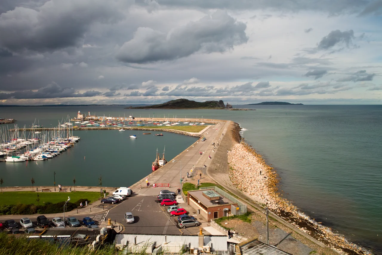
For a brief window in the early nineteenth century, Howth was meant to be Dublin's main connection to Britain. Construction of a harbour for the mail packet ships began in 1807, on the theory that Howth was less prone to highway robbery than the alternative at Dun Laoghaire, where the coaches had to cross open country. But silting plagued Howth from the start; the harbour needed constant dredging just to keep packet ships afloat, and in 1809 - only two years after construction began, and 350,000 pounds later - the service was transferred to Dun Laoghaire. The harbour stayed, though, and in August 1821 King George IV stepped ashore here on his state visit to Ireland. A local stonemason carved the imprint of the king's shoes into the West Pier, and the footprints are still there, worn smooth by tourists' soles two centuries on. By 1841 the village held 1,538 people; by then it had stopped pretending to be a port for empires and was simply a fishing town.
Yeats's Cliff
William Butler Yeats lived at Balscadden House on Balscadden Road from 1880 to 1883 - he was in his teens then, and Howth's wild, fast-running streams and clifftop heath worked their way into his imagination. A blue plaque on the house quotes his most famous couplet: "I have spread my dreams under your feet / Tread softly because you tread on my dreams." The peninsula reappears in his 1893 essay Village Ghosts, and decades later in the poem Beautiful Lofty Things: "Maud Gonne at Howth station waiting a train." James Joyce dropped Howth into Ulysses repeatedly and made Howth Castle the centrepiece of Finnegans Wake. The list of people who have made their homes on this peninsula reads like a directory of modern Irish culture: the actor Brendan Gleeson; U2's drummer Larry Mullen, overlooking Burrow Beach; the singer Dolores O'Riordan of The Cranberries; the Riverdance founders Moya Doherty and John McColgan; the broadcaster Gay Byrne; actress Saoirse Ronan; and the late President of Ireland Patrick Hillery.
The Cliff Path
Six kilometres of footpath circle Howth Head from the DART station, climbing past the harbour, up onto open heath, and around the seaward edge of the peninsula past the Baily Lighthouse before dropping back into the village. The walk takes about two hours at a leisurely pace and is the reason most weekend visitors come. Below the path, fulmars and kittiwakes ride the updrafts; razorbills and guillemots crowd the cliffs in breeding season; peregrines hunt overhead. Seals haul out on the rocks near the harbour. Beyond the eastern cliffs lies Ireland's Eye, the small uninhabited island ringed with bird colonies, reachable by small boat from the West Pier in summer. Beyond that again sits Lambay Island. Each holds a Martello tower from the early 1800s, part of a defensive chain built around the Irish coast during the Napoleonic Wars, when invasion from across the Channel still seemed plausible enough to fortify against. The towers are mostly empty now. The view from each is extraordinary.
Fish, Boats and Belonging
Howth is still a working fishing harbour - one of Ireland's tier-two ports - with a state fisheries centre, an ice-making plant, a dry dock and boats coming in each morning. Around the harbour, the restaurants do brisk business in cod and ray and crab; the fishmongers sell what was swimming hours before; and the seals, who were once fed by tourists and now politely are not, still haunt the quays for whatever escapes from the buckets. Up the hill the old Hill of Howth Tramway ran around the peninsula between 1901 and 1959, climbing from station to summit to station; one of its restored carriages, the No. 9 Tram, is exhibited at the National Transport Museum of Ireland in the grounds of Howth Castle. The peninsula remains under a Special Amenity Area Order covering some 1,500 acres - more than half the head - protecting the heathland, the cliffs, the streams, and the views. Of all the places near Dublin you could fly over and want to land, Howth is the one that looks back at you and seems to know you.
From the Air
Howth sits at the very northern hook of Dublin Bay, at approximately 53.3851 degrees N, 6.0591 degrees W. From altitude the peninsula appears as a distinctive hammer-headed promontory connected to mainland Dublin by the Sutton tombolo - a narrow sand isthmus that makes Howth Head look almost like an island. Ireland's Eye is the small island a kilometre north of the harbour; Lambay lies five kilometres further north. Howth is a waypoint for aircraft on approach to Dublin Airport (EIDW), roughly 14 km west. Weston Airport (EIWT) sits well to the south-west. Best viewed in clear conditions from the south, when the Baily Lighthouse on the southeast headland shows clearly against the green and grey of the heath.
Nearby Stories
- Wicklow Mountains 12 km away
- Mornington 14 km away
- German submarine U-1051 16 km away
- Abbey of Kells 18 km away
- Irish Military Intelligence Service 20 km away
- HMS Manners (K568) 37 km away
- Templemore 42 km away
- Irish Sea Bridge 43 km away