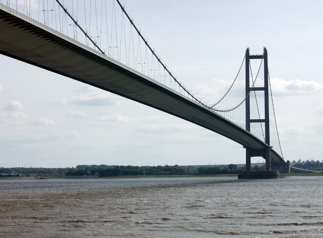

Humber Bridge
The two concrete towers stand 36 millimetres farther apart at the top than at the bottom. The difference is the curvature of the Earth, made visible in engineering. From the south bank at Barton-upon-Humber, the cables of the Humber Bridge sweep across 1,410 metres of estuary in a single catenary curve, the longest in Britain and in the entire Western Hemisphere. For seventeen years after it opened in 1981, this was the longest single-span suspension bridge on the planet. Today it is the only suspension bridge of its scale that you can still cross on foot or by bicycle, and on a windy day the deck moves three metres beneath your boots.
The Bridge Politics Built
Engineers had been sketching plans to cross the Humber since 1927, when Sir Ralph Freeman first proposed a suspension bridge. For four decades the schemes piled up and nothing happened. Then came the 1966 Kingston upon Hull North by-election. Labour Prime Minister Harold Wilson needed the seat, and his Transport Minister Barbara Castle was sent to sanction what had been deferred for forty years. The Humber Bridge was, in effect, an electoral bribe so blatant that local cynics later joked the toll booths should be painted Labour red. Construction did not actually begin until 27 July 1972. By the time the bridge was finished in 1981 at a cost of 91 million pounds, much of the road network it was meant to relieve had already been built. The protest song that Christopher Rowe wrote during the long wait, simply titled 'The Humber Bridge,' remained the bridge's unofficial anthem.
A Concrete Catenary
Bernard Wex, an Imperial College engineer who would die in 1990 having watched his bridge become Britain's most famous, finalised the design in 1964. He chose concrete towers rather than steel, partly for cost and partly because the pale columns would suit the estuary landscape better than industrial steel. Each tower is a pair of hollow vertical columns, 155.5 metres tall, slipformed in a continuous concrete pour. The north tower stands on solid chalk. The south tower had to be built 500 metres out into the water on fissured Kimmeridge Clay, using a caisson design so difficult it delayed completion by years. Cable spinning ran from September 1977 to July 1979. Each of the two main cables weighs 5,500 tonnes and contains 37 strands of 404 individual wires, capable of bearing 19,400 tonnes. The deck is a box girder, 140 tonnes per section, each floated up the estuary on a barge and hoisted into place.
The Crossing
Queen Elizabeth II opened the bridge officially on 17 July 1981, three weeks after traffic first started rolling across it. The Archbishop of York gave a prayer of dedication. The Red Arrows flew over in tight formation, their smoke trailing red, white, and blue against a grey Yorkshire sky. The bridge is a dual carriageway with pedestrian and cycle paths on both sides, and it was designed to last 120 years. In strong winds the centre of the deck deflects more than three metres from its rest position, the entire span moving slowly side to side like a tightrope under load. Wind tunnel testing at Teddington verified the deck against speeds up to 105 mph, though storms with much lower wind speeds have triggered emergency repairs in recent years. The original A-frame deck supports wore out by 2011 and had to be replaced piece by piece, on a bridge that does not stop carrying traffic.
Tolls and Endings
For thirty years the Humber Bridge was the most expensive toll crossing in the United Kingdom. The 3-pound charge each way was so contentious that in 2004 motorcyclists held a slow-pay protest, paying in large-denomination notes with gloves and helmets removed, and a 7-mile queue formed. After years of campaigns including the local newspapers' A Toll Too Far drive, George Osborne announced in 2011 that 150 million pounds of the bridge's debt would be written down, allowing the toll to be halved. In January 2026 the original toll booths finally closed for good, replaced by a free-flow electronic gantry system. The Akashi Kaikyo Bridge in Japan surpassed the central span in 1998, and by 2025 the Humber had slipped to fourteenth in the world rankings. None of that matters when you stand on the eastern walkway at dusk, watching cargo ships pass underneath toward Goole, the cables curving up into the gathering dark.
From the Air
Located at 53.71 degrees N, 0.45 degrees W spanning the Humber Estuary between Hessle on the north bank and Barton-upon-Humber on the south. The 2.22-kilometre suspension bridge is an unmistakable visual landmark from cruise altitude, visible from out to sea and from as far as Patrington 25 miles east. Nearest airports: Humberside (EGNJ) about 6 nautical miles south, Leeds Bradford (EGNM) about 40 nautical miles west. The estuary mud flats stretch east toward the North Sea; flat Lincolnshire farmland spreads south. Best viewed at low altitude in late afternoon when the cables catch the western sun.
Nearby Stories
- Harworth Colliery 2.5 km away
- Winestead Drain 3.2 km away
- Battle of Selby 9 km away
- Beningbrough Hall 12 km away
- Sledmere House 12 km away
- RAF Scampton 15 km away
- Alford Windmill 23 km away
- SM UC-47 27 km away