.jpg)
Winestead Drain
In January 1839 someone in East Yorkshire described a machine called a Floating Clough. It was made of timber, with serrated wooden projections sticking out sideways and lengthways, and it was meant to clear silt from a country drain that used to be a small river leading to the Humber Estuary. You sank it into the channel at high tide. The outgoing tide caught it and dragged it three miles downstream, scraping the bed and 'dressing the mud on the sides' as it went. It was a piece of brilliant nineteenth-century improvisation in the service of a lost cause. The river was not coming back. Patrington Haven's days as a port were already numbered.
The North Channel That Was
Until the late 17th century, what is now Winestead Drain was called the North Channel of the Humber, and it was a real arm of the estuary. It separated Sunk Island and Cherry Cobb Sands - then both saltmarshes covered at high tide - from the rest of the South Holderness mainland. Boats came up it. Patrington Haven, two miles inland from the open Humber, was a working port handling grain to London, coal coming back from the West Riding, and around 3,000 chaldrons of lime per year imported via overland trade routes that crossed Yorkshire. Then human hands started rearranging things. Drainage works reclaimed Sunk Island and Cherry Cobb. Sandbanks were built up. By 1850 the North Channel had been cut off at its western end and reduced to a small eastward-flowing drain. The tidal scour was gone, and once tidal scour goes, channels silt up fast.
Acts and Cloughs
Parliament passed Drainage Acts between 1764 and 1807, including the specific Winestead Drainage Act of 1774, trying to manage the slow disaster of a port turning into a swamp. In 1819 the Winestead Level Internal Drainage Board installed a clow, which is a type of sluice gate, at the lower end of the channel. From that point the watercourse was no longer the North Channel; it was Winestead Drain. Trustees kept up the navigation for a few more decades. The Floating Clough experiment of 1839 was one of several increasingly desperate efforts. The board of Trustees was dissolved in 1865. The last ship sailed from Patrington Haven in 1867. The warehouse at the head of the navigation still stands. Most of it is now a private house.
Drinking Water Like Poison
What followed for the people living along the drain in the mid-19th century was not romantic. The Winestead Level Drainage Board notes for 1862 record that drinking water was poisoned, that animals fell ill from drinking the water, and that the local railway stationmaster described the smell as 'so great to produce nausea all day, and for railway passengers to close the windows.' Slow-moving silty water in a low-lying agricultural drain, taking in foul effluent from a village called Hollym where there was no drainage for foul water, produced exactly the public health conditions that prompted the Victorian sanitation movement elsewhere in Britain. Nobody starred Winestead Drain in any newspaper campaign. It just stayed quietly toxic for years.
A Pumping Station and a New Wetland
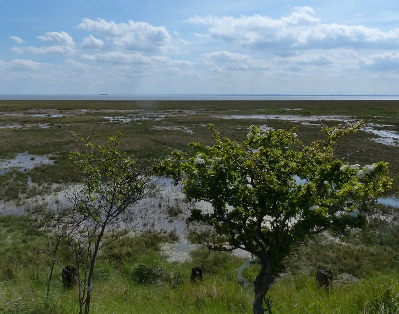
At the river mouth, a pumping station built in 1977 controls the flow between the drain and the tidal Humber, holding back the salt water that would otherwise come in on every tide. It failed during the floods of 26 June 2007 - the river reached 2.42 metres, its highest ever recorded - and the area went under. Plans now call for moving the pumping station 750 metres inland and incorporating an eel pass into the new design. Meanwhile, more than a thousand acres of farmland at Skeffling and Sunk Island are being converted back into intertidal saltmarsh, to compensate for habitat losses elsewhere on the Humber. Welwick Saltmarsh, 44 hectares on the eastern side of the drain mouth, is home to short-eared owl, hen harrier, peregrine falcon and marsh harrier. Otters were recorded on Winestead Drain as far inland as Winestead village in the 1960s. The river that lost its working life as a port is slowly being asked to become useful again, this time as wetland - a quiet ecological second act for a piece of water that once carried lime, coal and grain to and from London.
From the Air
Winestead Drain rises at approximately 53.72N, 0.02E west of Withernsea and flows south then east for 15.5 km to enter the Humber Estuary at approximately 53.65N, 0.05E. Recommended viewing altitude is 1,500 to 2,500 feet AGL. The drain shows clearly as a straight engineered watercourse cutting across flat farmland. The Welwick Saltmarsh nature reserve sits at the river mouth on the Humber's north bank. The Easington Gas Terminal is visible 4 nm south-east. Nearest airport is Humberside (EGNJ) approximately 8 nm west. Watch for low cloud over the flat Holderness landscape and bird activity over the salt marsh.
Nearby Stories
- Humber Bridge 6.5 km away
- MS Piłsudski 7.8 km away
- SM UC-47 17 km away
- Sledmere House 19 km away
- Alford Windmill 19 km away
- RAF Scampton 20 km away
- HMS Cobra 26 km away
- Alexander L. Kielland (Platform) 317 km away