Indonesia–Papua New Guinea Border
The line is almost absurdly simple. Two straight north-south segments, connected by a brief detour along the Fly River, divide the island of New Guinea into Indonesian and Papua New Guinean halves across 824 kilometers. No mountain range dictates the route. No river defines it for most of its length. The 141st meridian east was chosen by colonial administrators who had never walked the terrain, and the peoples living on either side — speaking hundreds of languages across dozens of ethnic groups — were not consulted. Today, this border remains one of the most remote and contested in the world.
A Line on a Map
The border begins on New Guinea's northern coast, just west of the Papuan village of Wutung near Mount Bougainville, and runs due south along the 141st meridian. It crosses the Oenake Range, the Kohari Hills, the Bewani Mountains, the Border Mountains, and the Central Highlands — terrain so rugged that much of it has never been surveyed on foot. When the line reaches the Fly River, it follows the watercourse in a C-shaped curve before resuming its southward march at a slightly adjusted longitude of 141° 01'10" east, cutting across the Kai Lagoon and reaching the Bensbach River estuary on the Torres Strait coast. The border's origins trace back to the 1529 Treaty of Zaragoza, which divided New Guinea between Spain and Portugal near the 147th meridian. When the Netherlands began colonizing the Indonesian archipelago, they pushed eastward, claiming the northwest coast of New Guinea as far as the 140th meridian in 1828.
Refugees and Resistance
The border has never been merely a cartographic exercise. Since Indonesia took control of western New Guinea in the 1960s, the region has been shaped by conflict. The ongoing West Papuan independence movement and Indonesia's military response have turned the borderlands into a zone of fear and displacement. In 1984, more than 10,000 Papuans from the Indonesian side crossed into Papua New Guinea, fleeing crackdowns in the aftermath of an uprising. They arrived in a country ill-equipped to receive them, and many ended up in camps where they and their descendants have remained for decades. A 1986 friendship treaty between the two countries pledged peaceful resolution of border disputes, but tensions have persisted. The border was reopened in September 2021 after pandemic closures, only to be shut again by November.
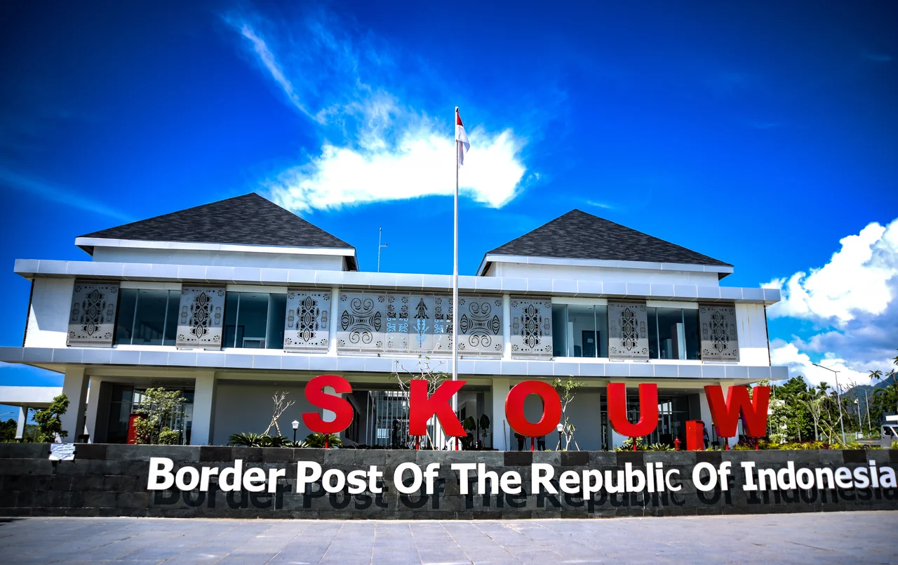
One Crossing Point
For an 824-kilometer frontier, the border is remarkably impermeable. There is just one official, binational crossing: between Jayapura on the Indonesian side, at the border post of Skouw, and Vanimo in Papua New Guinea. Indonesia has established additional border posts at Waris in Keerom Regency and at Sota and Torasi in Merauke Regency, with another under construction at Yetetkun in Boven Digoel Regency. But for the communities that live along the line, the formal crossing is often irrelevant. Traditional trade routes, family connections, and cultural ties predate the border by centuries. People cross through the forest, along rivers, and over mountain passes that no checkpoint covers. The border exists with full force on maps and in treaty law, but in the dense interior of New Guinea, it remains an abstraction imposed on a landscape that does not recognize it.
The View from Above
From the air, the border is invisible for most of its length. The rainforest canopy shows no seam. The rivers flow across it without hesitation. Only near the coast, where settlements cluster and roads approach the line, does the boundary take physical form in cleared land, border posts, and the faint traces of military patrols. The terrain on both sides is among the least developed on Earth: vast swamps in the south, impenetrable highlands in the center, and narrow coastal strips in the north where most of the population concentrates. It is a reminder that borders are human inventions, imposed on places that have their own logic — ecological, cultural, hydrological — that no meridian can contain.
From the Air
Coordinates: 10.83°S, 139.20°E, near the southern coast where the border meets the Torres Strait. Best viewed from 25,000–35,000 ft; the border is invisible from the air, but the Fly River's C-shaped detour is a visible landmark. Nearest airports: WAJJ (Sentani/Jayapura), AYVN (Vanimo). The terrain ranges from coastal swamp to highland jungle.
Nearby Stories
- Marchinbar Island 206 km away
- Bremer Island 235 km away
- Booby Island (Queensland) 257 km away
- Wasur National Park 257 km away
- Janszoon Voyage of 1605–1606 268 km away
- Yirrkala 268 km away
- Badu Island 343 km away
- New Guinea Mangroves 394 km away