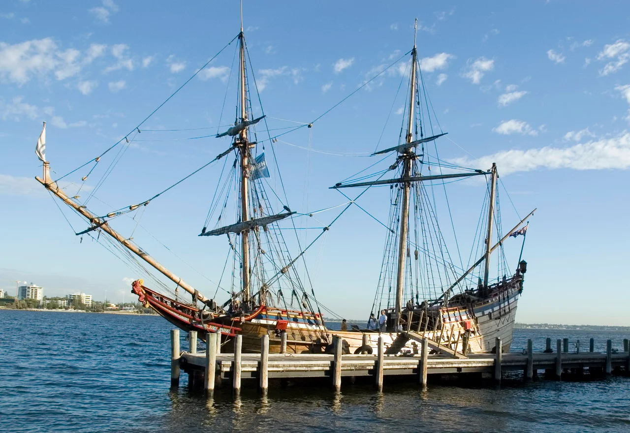

Janszoon Voyage of 1605–1606
She was called the Duyfken — the Little Dove — and she was barely the size of a modern fishing trawler. On 26 February 1606, her hull scraped past the mangrove mouth of a river on the western shore of Cape York, and roughly twenty Dutch sailors became the first Europeans known to have set foot on the Australian continent. They did not know where they were. Captain Willem Janszoon believed this low, swampy coast was simply more of New Guinea, trailing southward. He was wrong by a continent. And the people watching from the tree line were the Wik and their neighbours, whose families had lived on this land for tens of thousands of years before any sail appeared on their horizon.
The Little Dove
The Duyfken was a pinnace — a fast, shallow-drafted yacht the Dutch East India Company used for scouting where larger ships dared not go. Janszoon had sailed her out of Bantam in west Java on 18 November 1605, under orders to chart the coast of New Guinea and sniff out anything that might "yield a great amount of wealth." Spices, gold, trade: that was the mission. The Company cared little for unknown southern lands and everything for a faster route to the riches of the Spice Islands. So when the Little Dove crossed the Arafura Sea and slipped into the Gulf of Carpentaria, Janszoon simply kept following what he took to be one continuous shore. He never noticed the open water of the Torres Strait to his east — the very channel that proves Australia is a separate continent.
A River With No Name
Janszoon called the place of landfall R. met het Bosch — the river with the bush. Today it is the Pennefather River, just north of modern Weipa, and a granite memorial marks it as the spot where recorded European contact with Australia began. The crew nosed south along the coast, naming features as they went: Albatross Bay, the doubled rivers of Archer Bay, a stream they dubbed the Visch for its fish. But the land disappointed them. It was flat, salt-laced, and hard. There was no spice here, no gold, no obvious profit — only heat, mosquitoes, and a coastline that refused to become the New Guinea they expected. The disappointment, though, was about to become the least of their troubles.
Cape Keerweer
The Dutch pushed as far south as a headland Janszoon would name Cape Keerweer — Dutch for "turn around." The name is a confession. Here, the expedition met the Wik people, and the meeting collapsed into violence. By Dutch accounts and Wik oral tradition alike — a rare case where both sides preserved the story — sailors went ashore and abducted or coerced local people, forcing men to hunt and assaulting women. The Wik struck back. Around nine of Janszoon's crew were killed and their boats burned; the Dutch, in turn, shot down many of their attackers. This was the first known armed conflict between Europeans and Aboriginal Australians, and it set a grim template. Janszoon turned the Little Dove around and never went further. The land had drawn its own line.
The Strait That Stayed Hidden
Janszoon sailed home convinced New Guinea and this new coast were one. He was almost comically unlucky: just months later, in October 1606, the Spanish navigator Luís Vaz de Torres threaded the strait that now bears his name, proving the gap existed — yet Torres never reported land to his south, and the two halves of the puzzle were never joined. For more than 160 years, Dutch charts stitched Cape York to New Guinea as a single mass. Not until James Cook sailed through in 1770, armed with whispers of the old Spanish route, was the strait finally fixed on European maps. The Little Dove had touched a continent and sailed away without ever grasping what it had found — leaving the recognition, and the reckoning, to those who came after.
From the Air
The landfall site at the Pennefather River sits at roughly 12.22°S, 141.73°E, on the Gulf of Carpentaria shore just north of Weipa. The nearest airport is Weipa Airport (YBWP), about 25 km south; RAAF Base Scherger (YBSG) lies a short hop east. The coastline here is classic Gulf country — flat, mangrove-fringed, braided with tidal rivers that glint silver against the red bauxite soil. Best viewed at 2,000–4,000 ft AGL in the dry-season morning light, when low sun rakes across the river mouths. Wet-season afternoons (November–April) bring towering build-ups and poor visibility, so plan transits early.
Nearby Stories
- Weipa 18 km away
- Moreton Telegraph Station 38 km away
- Aboriginal Shire of Mapoon 85 km away
- Wenlock Goldfield 91 km away
- Northern Peninsula Area Region 119 km away
- Australia–Indonesia Border 263 km away
- Indonesia–Papua New Guinea Border 278 km away
- Gulf of Carpentaria 289 km away