
Wenlock Goldfield
In January 1915, an Aboriginal woman named Kitty Pluto was carting surface wash from one camp to another along the Wenlock River when she stumbled on a gold nugget. She had no claim, no lease, no stake in the speculative fever swirling around her. Yet her accidental find opened the richest patch of what was then the Batavia Goldfield, and Queensland's records hold a remarkable distinction: Kitty Pluto is the only woman ever credited with discovering a goldfield in the state. The town that grew around her find, deep in the central spine of Cape York Peninsula, would outlast every other diggings on the peninsula before fading back into bush.
The People Who Found the Gold
The standard story of an Australian goldfield is a story of prospectors and prospectuses, of men with picks and ambition. The Wenlock complicates that story in its first chapter. Gold was proclaimed at Retreat Creek in 1892, but the rich ground at Lower Camp stayed hidden until Kitty Pluto's chance discovery in 1915. She was the wife of an Aboriginal man known as Pluto, after whom the upper settlement, Plutoville, took its name. Another Aboriginal man, Friday Wilson, also worked the claims. These were not footnotes to the field's history; they were central to it. On a remote frontier where survival depended on knowing the country, Aboriginal knowledge and labour underwrote the entire enterprise, even as the official record reduced them to a line or two.
Quid a Minute
By the 1930s, while the rest of Australia ground through the Depression, the Batavia was the most productive goldfield on Cape York, working six payable mines with names that read like prayers and gambles: New Year's Gift, Prohibitionist, Double Chance, Band of Hope, Golden Casket, Hidden Treasure. Around 160 people lived here at the peak. The miner Frank White remembered a three-head stamp battery that ran all night, its rhythm thudding through the dark while exhausted men tried to sleep. They lulled themselves with words timed to the machine: "Quid a minute, quid a minute," thud-thud-thud, pause, thud-thud-thud. A shift worker's wage was five quid a week. The battery sounded like wealth pouring out, even when it wasn't.
Scorched Earth
In 1942, with Japanese invasion of northern Australia feeling imminent, the Australian Army climbed up to the Wenlock and dismantled the mines. They stripped out the smaller, portable machinery so that an advancing enemy could not use it. This was scorched earth, and it remains one of the few documented instances of the policy being applied on Cape York Peninsula. After the war the Fisher family reopened the mines, carting machinery up from the harbour at Portland Roads over a road they built themselves, bridging seven creeks to do it. The field limped on. In 1950 the Wenlock River broke its banks and flooded every working. By 1957, William Stanley, the last of the old hands, had died at his camp.
A Garden Edged in Beer Bottles
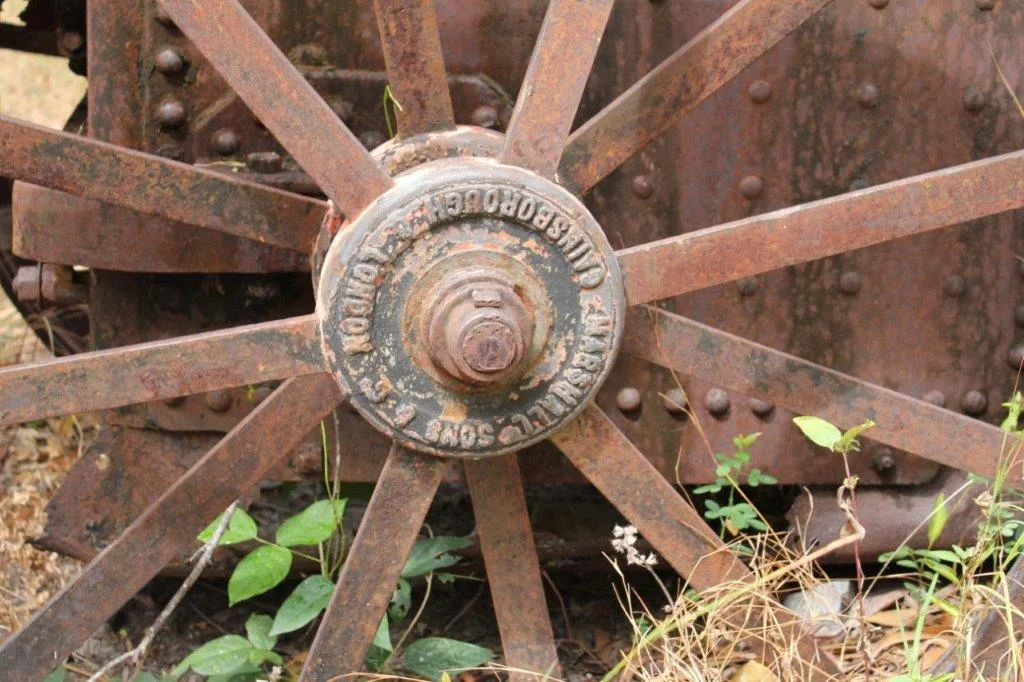
Today the Wenlock is a heritage-listed ruin, and what survives is unexpectedly tender. A partly collapsed timber headframe leans over the Golden Casket shaft. A Huntington mill, the most intact of only two recorded in North Queensland, sits on its concrete base beside rusting boilers and a Marshall steam engine. But the most evocative remnant is the camp itself, smothered now under the largest concentration of mango trees ever recorded at a North Queensland mining site, planted by people who meant to stay. Near the trees runs a garden path edged with upturned beer bottles, and parallel ditches that may have been a communal vegetable patch. A lone grave on the riverbank marks Thomas Power, who reputedly died in a gunfight in 1930.
From the Air
Wenlock Goldfield sits at 13.09 degrees south, 142.94 degrees east, on the east bank of the Wenlock River in central Cape York Peninsula, about 100 km north of Coen. The site is remote, deep in tropical woodland, and most easily oriented by the silver thread of the Wenlock River itself. The nearest sealed runway is Lockhart River Airport (YLHR) on the east coast, roughly 75 km to the northeast; Weipa Airport (YBWP) lies to the west on the Gulf of Carpentaria. Recommended viewing altitude is 2,000 to 3,000 feet AGL to trace the river, old workings, and the dark stand of mango trees marking the camp. Visibility is best in the dry season (June to October); the wet season brings flooding and cloud.
Nearby Stories
- RAAF Base Scherger 40 km away
- Lockhart River, Queensland 47 km away
- Coen Carrier Station 72 km away
- Weipa 76 km away
- Archer River 76 km away
- Princess Charlotte Bay 132 km away
- Raine Island 152 km away
- Bathurst Bay 164 km away