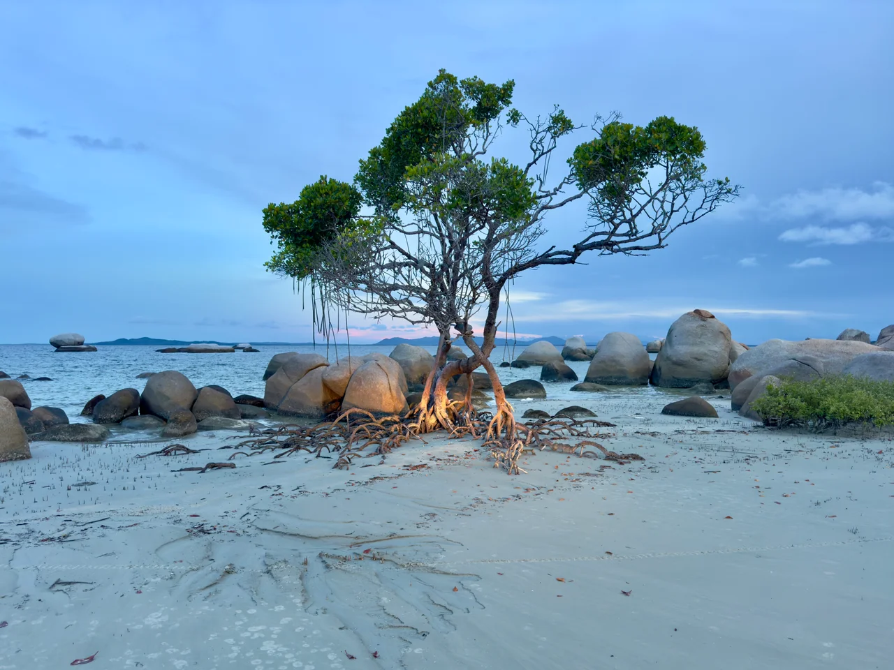

Lockhart River, Queensland
In 2003, a nine-panel painting won Australia's High Court Centenary Art Prize, and a justice of that court called it bold, beautiful, confident and contemporary. The artist was Rosella Namok, born in 1979 in a community most Australians could not find on a map: Lockhart River, a few hundred people on the storm-lashed east coast of Cape York Peninsula, where the road washes out for half the year. Her painting was titled, in plain words, "Today Now... We All Got To Go By The Same Laws." From one of the most isolated towns in the country, the painters of Lockhart River had walked their saltwater country straight into the heart of the nation.
Saltwater Country
This is Kuuku Ya'u and Umpila country, the homeland of saltwater peoples who have lived along these beaches and reefs for thousands of years, reading the sea and the seasons of a coast scattered with islands: Chapman, Lloyd, Rocky, Sherrard, Sunter. The rhythm of life here is set by water. The wet season runs from November to May, oppressive and drenching, and Lockhart River records only about thirty-six clear days a year out of more than two metres of annual rain. The land is rainforest and heath; the sea is everything. To understand the community is to understand that the ocean is not a backdrop but a relative, a law, a larder, and the deep subject of its art.
A Mission Built From Many Peoples
The community as a place carries a harder history. In 1924 the Anglican Church established a mission near the Lockhart River, and over the following decades Aboriginal people were gathered, and at times forcibly relocated, from across the peninsula and placed together at the site. Lamalama people were removed from the Port Stewart area in the 1930s, though many later returned to their own country. When the Second World War reached the Cape in 1942, the superintendent simply left, and the Aboriginal residents were told to scatter into bush camps and fend for themselves. The mission reopened months later, poorly funded. Only in 1987 did the community gain secure Deed of Grant in Trust title to the land, and with it the right to govern its own affairs.
The Art Gang
In 1997, a community art project lit a fuse. A group of younger artists began painting, and what they made looked like nothing else in Aboriginal art. Not the dot paintings of the central deserts, not the bark traditions of Arnhem Land, but bold, figurative, intensely personal work drawn from rainforest, beach, sky and sea, and from the experience of being young and Aboriginal in a remote coastal town. They became known as the Lockhart River Art Gang. Rosella Namok was among them, and her finger-drawn lines, often raked through wet paint, evoke rain on water and the sweep of tides. Their work now hangs in major Australian galleries, and the Lockhart River name has become, against every odd, a recognized brand in contemporary art.
The Road and the Runway
Getting here has always been the central fact of life. The locality takes its name from the Lockhart River, 14 km to the south, named in 1880 by the explorer Robert Logan Jack after a friend, Hugh Lockhart, in the careless colonial habit of stamping a stranger's name on someone else's country. Today the lifeline is Lockhart River Airport, with a sealed, all-weather runway and pilot-activated lights, because for much of the year flood closes the roads and the plane is the only way in or out. That isolation has cost the community dearly, including a 2005 air disaster in the nearby ranges that took fifteen lives. Yet the same remoteness has helped keep language, culture and a singular artistic vision intact and alive.
From the Air
Lockhart River sits at about 12.79 degrees south, 143.34 degrees east, on the east coast of Cape York Peninsula, roughly 800 km north of Cairns. The community lies just inland of Quintell Beach on the Coral Sea, ringed by the dark rainforest of Kutini-Payamu (Iron Range) National Park. Lockhart River Airport (YLHR, IATA IRG), also known as Iron Range Airport, has a 1,500 m sealed all-weather runway 4.7 km west of town with 24-hour pilot-activated lighting. Weipa Airport (YBWP) lies across the peninsula to the west. Pilots should note the heavily timbered ranges immediately west and northwest of the aerodrome, including the ridge of South Pap. Recommended viewing altitude is 2,000 to 3,500 feet over the coast. The wet season (November to May) brings frequent low cloud and rain; the dry season is far clearer.
Nearby Stories
- Moreton Telegraph Station 11 km away
- Wenlock Goldfield 36 km away
- RAAF Base Scherger 72 km away
- Raine Island 102 km away
- Shire of Aurukun 116 km away
- Raine Island Beacon 130 km away
- Cape Melville 150 km away
- HMS Pandora (1779) 154 km away