
Raine Island
From the air, Raine Island looks like nothing at all - a pale smudge of sand and low scrub on the very lip of the Great Barrier Reef, 620 kilometres north of Cairns, where the continental shelf drops away into the blue of the Coral Sea. Land in a single glance from horizon to horizon. Yet for a few weeks each summer, the water around this 32-hectare speck churns with what may be the greatest reptile gathering on the planet. Drone footage taken here in 2020 went viral for a reason: the sea itself seemed to be made of turtles.
An Armada in the Shallows
Raine Island is the largest green sea turtle nesting site on Earth, and it is not a close contest. In a strong season, more than 60,000 females - by some counts as many as 64,000 - drag themselves up the same narrow beach to lay their eggs, the same beach turtles have used for more than a thousand years. They come in pulses that rise and fall with the El Nino-Southern Oscillation, so that some years bring fewer than a thousand and others bring tens of thousands. On a peak night the cay can vanish under bodies, each female heaving a frame the weight of a refrigerator across the sand by moonlight. This single island once produced an estimated 90 percent of the region's green turtles. What happens here, in other words, decides the future of the species across the northern reef.
When the Refuge Turned Deadly
Then, quietly, the nursery began to fail. Through the 1990s, hatching rates fell. As the cay's shape shifted over decades, its beaches crept outward and lower, so that high tides drowned the eggs buried in the sand. Worse, the gentle slopes had hardened into small sandy cliffs, and thousands of exhausted females - having crossed an ocean to nest - died trying to climb them or rolled onto their backs and baked in the sun. A place built by instinct to give life had become a trap. Saving it would take more than goodwill. Between 2014 and 2020, an unlikely partnership of the Queensland Government, the mining company BHP, reef foundations, and the Wuthathi and Meriam Traditional Owners did something audacious: they rebuilt the island.
Reshaping an Island by Hand
Heavy machinery was barged to one of the most remote and protected places in Australia. Crews moved roughly 40,000 cubic metres of sand to reprofile some 35,000 square metres of nesting beach, raising it clean above the reach of the tides and smoothing the killing cliffs into ramps a tired turtle could climb. The work doubled the viable nesting habitat. Drones, satellites and 3D models tracked every change. The Queensland Government estimates the effort has spared hundreds of thousands of eggs from drowning and added more than 600,000 hatchlings to the reef. Scientists keep watching, because a warmer future brings a stranger problem - hotter sand produces more female hatchlings, skewing the balance of the species and giving the Turtle Cooling Project, a collaboration of WWF Australia and several universities, an urgent question to answer.
The Beacon and the Bones of Ships
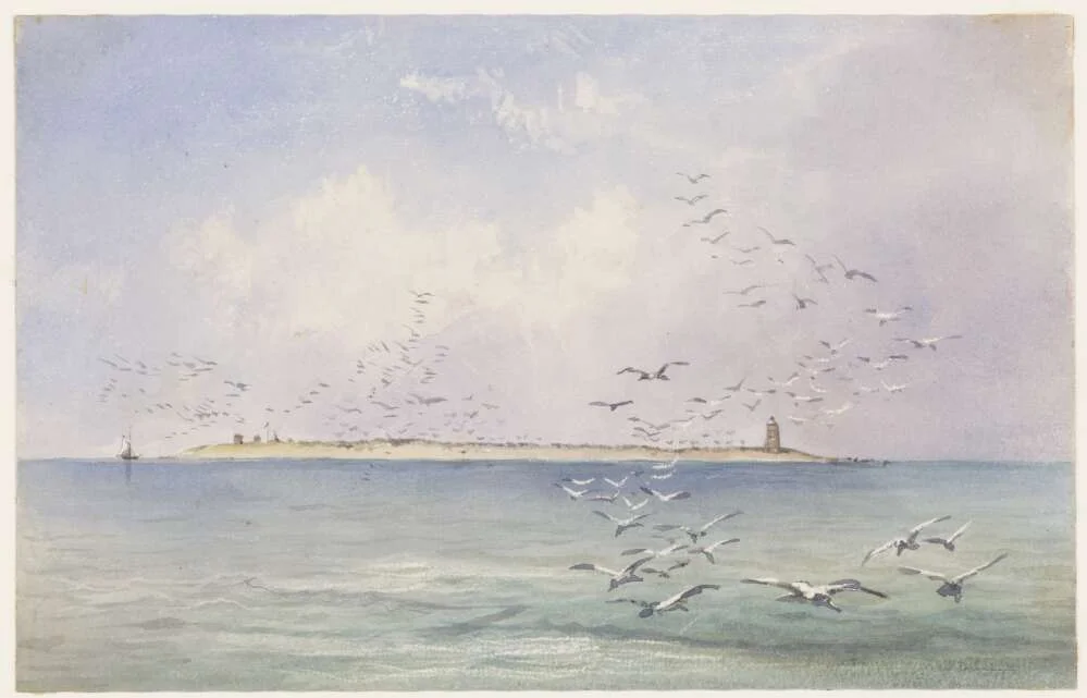
Turtles are not the island's only history. Stand near the eastern shore and you will find the oldest European structure in tropical Australia: a stone beacon, some twelve metres tall, raised in 1844 by twenty convict labourers on orders from the British Admiralty. They quarried the island's own phosphate rock, burned its shells into lime for mortar, and scavenged timber from the wreck of the Martha Ridgway nearby - one of more than thirty ships the surrounding reef has claimed, among them HMS Pandora. The beacon was never a lighthouse, yet it can be seen from thirteen nautical miles, a four-month feat of forced labour built so the next ship might not founder. Above it wheel the seabirds: more than thirty species nest here, making Raine Island a rookery in two registers, of feather and of shell. The whole cay is closed to the public, watched over as one of Australia's true wild places. This land and these waters belong, in law and in long custom, to the Wuthathi people, who share their interests across the reef with the Torres Strait Islander communities of the Erubam Le, Ugarem Le and Meriam Le.
From the Air
Raine Island lies at 11.59 degrees south, 144.03 degrees east, on the outer edge of the Great Barrier Reef off Cape Grenville, Cape York Peninsula. From altitude the cay appears as a small light-coloured oval ringed by extensive fringing reef, set against the deep blue of the Coral Sea drop-off and the Raine Island Entrance shipping channel just to its east. The historic stone beacon marks the island's eastern end. The nearest airfields are Lockhart River (YLHR) to the south on the Cape York coast, Horn Island (YHID) in the Torres Strait to the north, and Weipa (YBWP) on the western side of the peninsula; all services are remote and the island airspace and surface are strictly protected, so approaches should remain high and offshore. Best viewing is in the clear, stable air of the dry season (roughly May to October); the wet season brings heavy cloud and convective storms over the reef.
Nearby Stories
- Kutini-Payamu (Iron Range) National Park 99 km away
- Somerset Graves Site 108 km away
- Aboriginal Shire of Mapoon 122 km away
- Lockhart River, Queensland 131 km away
- RMS Quetta 163 km away
- Lizard Island 338 km away
- Japanese submarine Ro-33 339 km away
- Mrs Watson's Cottage 366 km away