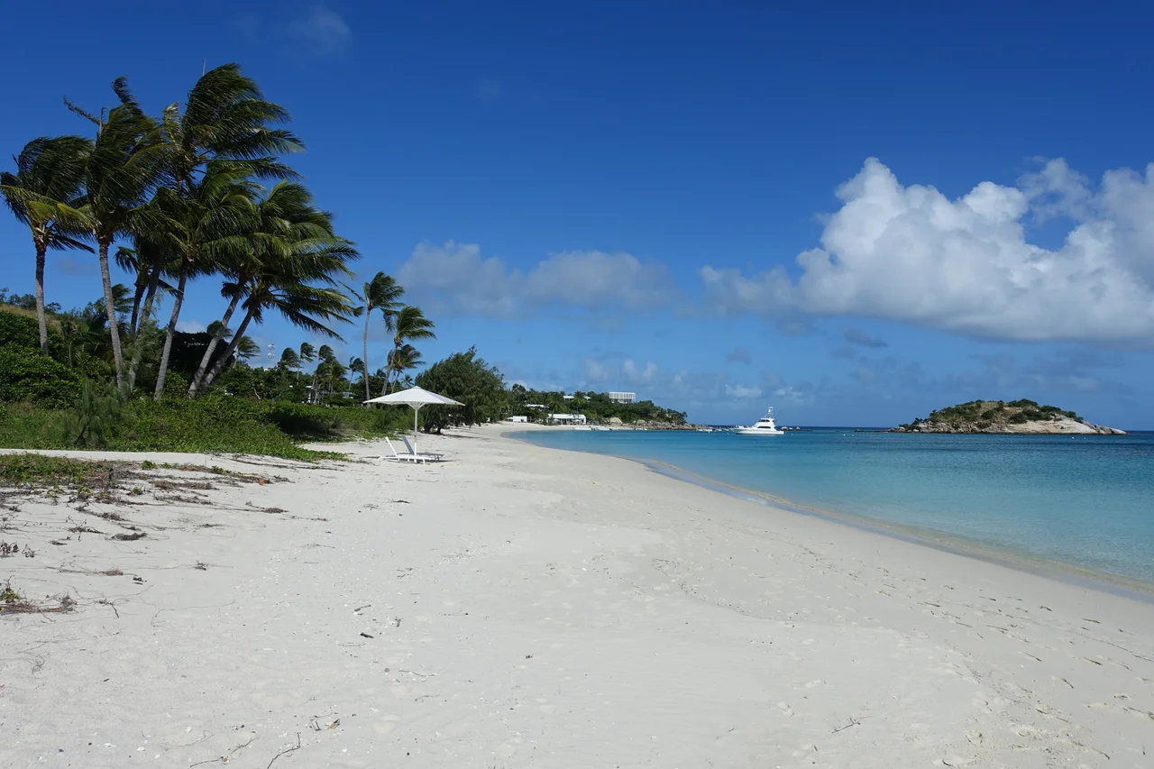

Lizard Island
To the Dingaal people, the island is the body of a stingray. North Direction and South Direction Islands form the tail; the whole formation, laid across the blue of the northern Great Barrier Reef, is a creature from a creation story older than any map. They call this place Jiigurru. The English called it Lizard Island, because James Cook, scrambling up its peak in 1770, noticed the monitor lizards basking in the grass. Two names, two ways of seeing, fixed to one high granite island, set the tone for everything that has happened here since.
Jiigurru, Body of the Stingray
Long before Europeans arrived, this was Dingaal country, and it was sacred. Jiigurru served as a place for ceremony and trade, and for the initiation of young Dingaal men into adulthood. The connection runs astonishingly deep. Excavations have shown people occupying the island as far back as roughly 6,500 years ago, making it the earliest offshore island settled on the northern reef. A 2024 study went further, revealing that the Aboriginal people here built ocean-going vessels and navigated the open sea, and that they made pottery, a discovery that overturned a long-held assumption that Aboriginal Australians never did. The senior elder of the Dingaal today is Gordon Charlie, and his people, alongside the Guugu Yimithirr, have held custody of this water and stone for thousands of years.
Cook's Look
In August 1770, James Cook arrived in trouble. HMS Endeavour had been holed on the reef and patched at the river mouth that is now Cooktown, and Cook needed a way out through the labyrinth of coral that hemmed him in. He landed on the island, noted the lizards, and climbed its highest granite peak, scanning the breakers for a gap to open water. From the summit he found his passage. That peak has been called Cook's Look ever since. It is a punishing climb of about 360 metres, but the reward is the same panorama that decided the fate of his voyage: reef and channel and sea spread out in every shade of blue, the whole puzzle visible at a glance.
The Watsons and a Sacred Ground
In 1879 a beche-de-mer station was set up on the island's northern bay to boil sea slugs for the Chinese market. Robert Watson ran it with his young wife Mary and two Chinese workers, Ah Sam and Ah Leong. What the newcomers did not grasp, or did not heed, was that their operation sat on sacred initiation ground. In late 1881, while Robert was away, Dingaal men came to the island. As the elder Gordon Charlie has explained, the intent was not to murder but to drive the intruders from a holy place. In the violence that followed, Ah Leong was killed and Ah Sam was speared. Mary fled with her baby and the wounded Ah Sam in a cut-down iron boiling tank, and the three died of thirst on a waterless island days later. Her diary survives in the State Library of Queensland.
Retribution and Memory
Mary Watson's death stirred deep public grief, and grief on the frontier too often curdled into vengeance. A punitive expedition went out, and many Aboriginal people were killed in retribution, including people who had nothing to do with what happened on the island. It is the cruellest part of the story: innocents punished for a defence of their own sacred country. The island holds both tragedies at once now. The Dingaal regard Mary's ruined cottage as a symbol of the violation of their sacred sites and the end of their traditional ways, while the wider memory long honoured Mary as a heroine. Both are true. Neither cancels the other.
Research Station and Resort
Today Jiigurru wears two more identities. On its westernmost point sits the Lizard Island Research Station, run by the Australian Museum, where scientists study coral, fish, and the health of a reef under stress from warming seas and bleaching. On the northwestern shore stands an ultra-luxury resort, reachable mostly by light aircraft, where guests pay handsomely for white sand and turquoise water. Around it all spreads the national park, gazetted in 1939, where monitor lizards still bask exactly as they did when Cook named the place. Sacred ground, scientific outpost, exclusive retreat, and the setting of a frontier tragedy: few small islands carry so many stories on so little granite.
From the Air
Lizard Island lies at about 14.663 degrees south, 145.464 degrees east, in the northern Great Barrier Reef, roughly 90 km north-northeast of Cooktown and about 30 km off the mainland near Cape Flattery. It is a high, rugged granite island, easy to identify by its grassy peak (Cook's Look, the highest point) and pale beaches ringed by reef in vivid blues and greens; North Direction and South Direction Islands sit nearby. Recommended viewing altitude is 3,000 to 6,000 feet for the island, its fringing reef, and the surrounding shoals together. Lizard Island Airport (ICAO YLZI) is on the island itself; Cooktown Airport (YCKN) is about 90 km south-southwest. Dry-season months (May to October) give the clearest water colour and calmest air; the summer wet season brings haze, storms, and cyclone risk.
Nearby Stories
- Cape Melville 47 km away
- Aboriginal Shire of Hope Vale 48 km away
- Old Laura Homestead 61 km away
- Bathurst Bay 69 km away
- Green Island (Queensland) 202 km away
- Coen, Queensland 240 km away
- HMS Mermaid (1817) 284 km away
- Kapa Kapa Trail 542 km away