
Coen, Queensland
There is a pub in the middle of Cape York whose sign tells a joke that has lasted half a century. It was built as the Exchange Hotel. Then, the story goes, sometime around 1976, a few drunk plumbers turned up in the dead of night with a spare letter 'S' and bolted it to the front. The publican took it down. They put it back. Eventually he gave up - and Coen has been home to the 'Sexchange Hotel' ever since, the name now cheerfully painted on signs up and down the peninsula because, as a later owner put it, it brings the crowds in. That mischief is pure Coen: a tiny, remote, fiercely characterful town near the dead centre of Cape York, where almost everyone driving to the top of Australia has to stop.
The Town in the Middle
Coen sits inland on the Peninsula Developmental Road, the long, mostly unsealed spine of Cape York, and geography has made it indispensable. Push north toward the tip of the continent and you funnel through Coen; there is simply no way around it. In the dry season the town swells with travellers, and the modest strip of buildings does the work of a regional capital: a general store and fuel outlet, a medical clinic, a police station, a post office, a public library, a ranger base, and of course the pub. The population is small - around 320 people, of whom roughly three-quarters identify as Indigenous - but its importance is out of all proportion to its size. For the long, dusty road to Weipa and the far north, Coen is the last real supply point that feels like a town.
Gold in the Creeks
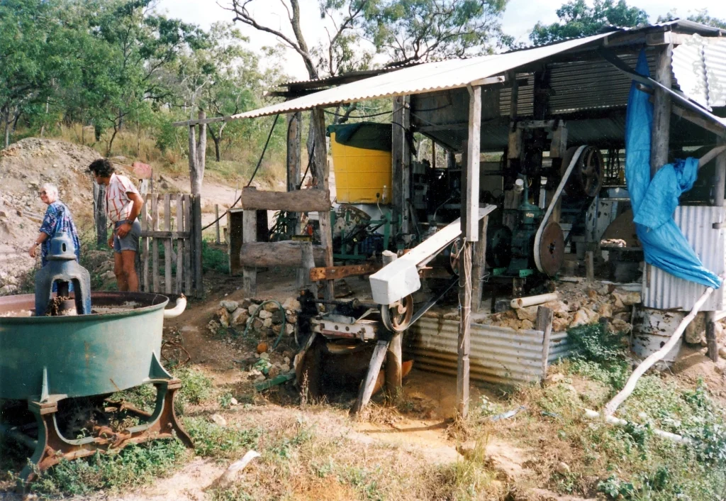
Coen was born of gold. Alluvial gold was found on the Coen River as early as 1876, in the wake of the great rush on the nearby Palmer River, and by July 1878 more than five hundred miners had cut a track in and were working the field. The first boom faded, then revived in 1886, and by 1889 Coen was a one-street township of tents and bark huts. The Coen Goldfield was proclaimed in 1892, and the Great Northern Mine became the district's mainstay. Threaded through all of it was the overland telegraph, strung up the peninsula in the 1880s, which gave this isolated outpost a thin copper lifeline to the rest of the world. Gold drew people here; the wire kept them connected. Both shaped the small town that survived after the rush moved on.
Removal and Return
This is Kaanju country, and the deeper history of Coen is the history of how Aboriginal people held on to it. Under the Aboriginals Protection and Restriction of the Sale of Opium Act of 1897, more than 300 Aboriginal people were forcibly removed from the Coen district to distant reserves; nearly half were sent to Palm Island, far to the south. Among them were the Lama Lama people of the Stewart River, dispossessed as pastoral stations spread into their country. In 1961, when Lama Lama families refused to work on Silver Plains Station for less than award wages, the station owner falsely accused them of harassing stock, and they were tricked aboard a vehicle on the pretext of a medical check-up and removed again. Some walked back. Over the years, the majority resettled themselves at Coen. The story of this town is, in the end, a story of people who kept coming home.
Birds, Heat, and the Wet
Coen rewards those who linger. Set near where rainforest, monsoon forest, and coastal woodland meet, it is a celebrated spot for birdwatchers, with a fauna drawn from all three habitats. The climate runs to extremes typical of the tropical savanna: daytime temperatures sit above 30 degrees for much of the year, dropping below 10 on the coolest dry-season nights and climbing past 35 in the pre-monsoon build-up. Then, from December to March, the wet arrives - torrential downpours, heavy humidity, and the threat of cyclones sweeping in off the Coral Sea. The road turns to mud, the rivers rise, and the steady stream of travellers thins to nothing. Coen, for a few quiet months, belongs to itself again.
From the Air
Coen lies near the geographic centre of Cape York Peninsula at 13.94°S, 143.20°E, in a valley on the Coen River along the Peninsula Developmental Road. From the air, look for the thin sealed-then-unsealed ribbon of the PDR threading the savanna, the town clustered on the river, and the rainforested McIlwraith Range rising to the east. Coen Airport (ICAO: YCOE, IATA: CUQ) sits about 22 km northwest of town and handles scheduled services to Cairns and Lockhart River. Oyala Thumotang National Park lies a short distance west between the Coen and Archer rivers. Best flown at 3,000-6,000 ft in the dry season (May-October) for clear air; the wet season (December-March) brings monsoon storms, low cloud, and possible cyclones.
Nearby Stories
- Princess Charlotte Bay 30 km away
- Musgrave Telegraph Station 65 km away
- Bathurst Bay 70 km away
- Wenlock Goldfield 77 km away
- Shire of Aurukun 116 km away
- Archer River 129 km away
- Aboriginal Shire of Pormpuraaw 141 km away
- Raine Island 237 km away