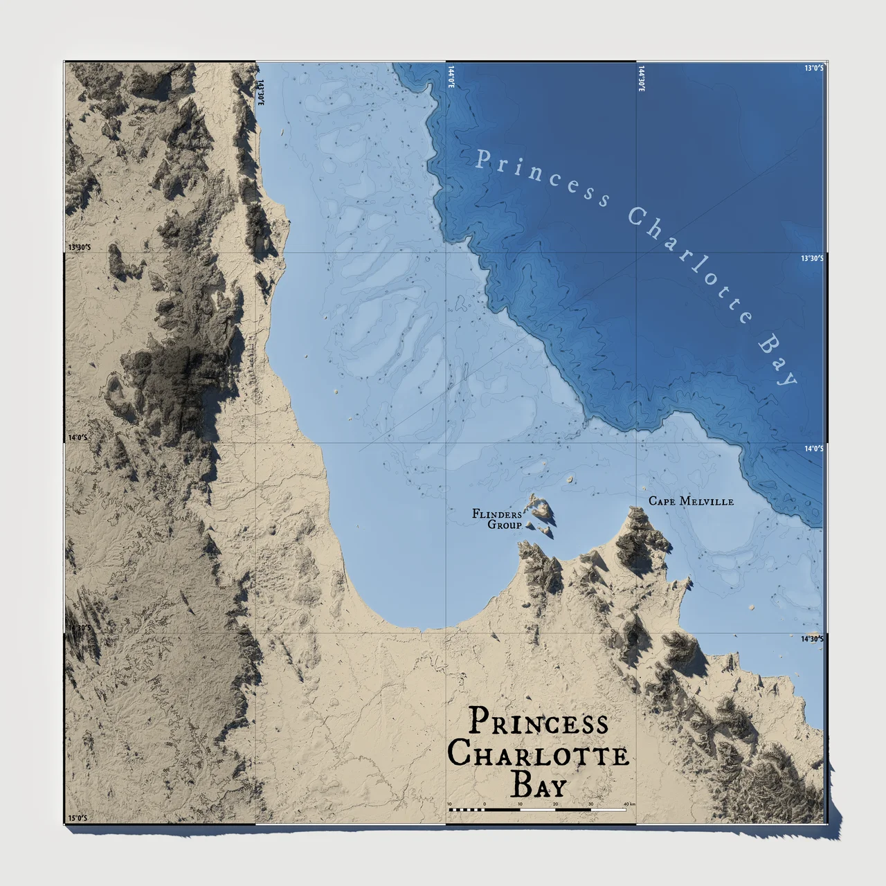

Princess Charlotte Bay
From the air it reads as one immense, pale curve of water, so shallow and so still that the seafloor seems to glow through it. Princess Charlotte Bay spreads across the base of Cape York Peninsula, 350 kilometres north-northwest of Cairns, where the Queensland coast finally surrenders the road and the towns and gives itself over to mangrove, tidal flat and reef. There is no resort here, no marina, almost no one. What there is, beneath that luminous shallow water, is a meadow - mile upon mile of seagrass, and the gentle, vanishing animals that depend on it.
The Underwater Pasture
Seagrass is easy to overlook. It is not coral, and it makes no postcards. But the beds carpeting the floor of Princess Charlotte Bay are among the most important habitat on this stretch of the Great Barrier Reef. Tidal flats of sand and mud rim the bay; out past them, the grass runs in dim green pastures that catch the light at low tide. This is grazing country. The bay and neighbouring Bathurst Bay together hold some of the highest densities of dugong anywhere in Queensland - the shy, slow-moving sea cows that crop the grass blade by blade, surfacing to breathe with a soft exhalation and sinking again. A dugong can live sixty or seventy years and may travel hundreds of kilometres in search of healthy meadows, which makes a place like this, with its grass intact, something close to irreplaceable. Green turtles feed alongside them. To protect this gathering, a Special Management Area limits net fishing across the bay, an unusual concession to creatures most people will never see.
Sea Country
This is the saltwater country of the Lama Lama and their neighbours, peoples whose connection to this coast reaches back through countless generations and continues today. The land and waters behind the bay are jointly cared for under formal agreements between Traditional Owners and the state, including arrangements that recognise Indigenous rights to manage the sea itself - the dugong, the turtles, the fish - as relatives and responsibilities rather than resources. For the families connected to Princess Charlotte Bay, the meadows are not wilderness in the empty sense. They are an inheritance, named and known, looked after for the generations still to come.
Reef and River
Princess Charlotte Bay belongs to the Great Barrier Reef Marine Park, and its reefs have been described as pristine - a word that means more here than marketing, because so little has disturbed them. The bay's most easterly point is the granite headland of Cape Melville; its most westerly is Claremont Point. Between them, freshwater bleeds in from the Rinyirru wetlands behind the coast, mixing salt and sweet in the mangroves where barramundi spawn. The bay is also home to the Bizant river shark, a rare and little-understood species of the brackish margins, named for one of the bay's rivers and almost never seen by anyone. Mud crabs, tiger prawns, queenfish and grunter move through the same tidal margins, in a system still working much as it always has.
The Quiet at the End of the Road
What makes Princess Charlotte Bay remarkable is partly what it lacks. There is no skyline, no breakwater, no tour fleet. The remoteness that once made it hard to settle has become the thing that keeps it whole. Anglers reach it across long dirt tracks through Rinyirru; the wetlands flood and dry with the monsoon, and the road closes when the rain comes. The reward for the journey is a coast that feels genuinely unfinished by people - a place where the tide goes out over a glowing meadow and a dugong rises, breathes, and is gone.
From the Air
Princess Charlotte Bay lies at approximately 14.42°S, 144.00°E, a broad shallow embayment at the base of Cape York Peninsula. From altitude the bay reads as a luminous pale-green shelf rimmed by extensive sand and mud tidal flats, with the granite mass of Cape Melville marking its eastern point and Claremont Point the western. The Flinders Group islands sit to the northeast. Recommended viewing altitude 7,000-12,000 ft for the full sweep of the bay and seagrass shallows; clarity is best in the dry season (roughly May-October), as monsoon runoff clouds the water and weather closes in from December to March. Nearest airfields: Cooktown (YCKN) to the south and Coen (YCOE) inland to the west; Cairns (YBCS / IATA CNS) is the major gateway 350 km south-southeast. No controlled airspace; remote terrain with minimal services - carry full reserves.
Nearby Stories
- Coen, Queensland 42 km away
- Musgrave Telegraph Station 52 km away
- Cape York Peninsula 54 km away
- Cape Melville 57 km away
- Coen Carrier Station 68 km away
- Guugu Yimithirr language 89 km away
- Mrs Watson's Cottage 106 km away
- Japanese submarine Ro-33 589 km away