
Aboriginal Shire of Mapoon
In November 1963, the people of Mapoon watched their houses burn. Police had come up the coast on a government boat, rounded up families under armed guard, and shipped them away to make room for one of the largest bauxite deposits on Earth. The buildings were set alight and bulldozed; the community was scattered as far as Palm Island and the New South Wales border. The Queensland government meant for Mapoon to cease to exist. It did not. This windswept point on the Gulf of Carpentaria is famous in Australia not because it was destroyed, but because its people came back — and that act of return, against everything stacked against them, is one of the great stories of Aboriginal resistance.
Country of the Tjungundji
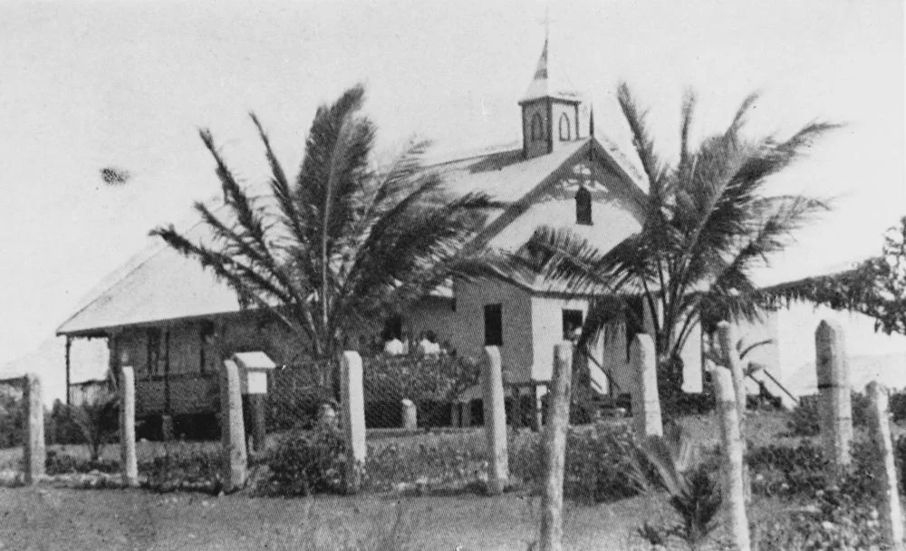
Long before any of this, there was the land and the people who belonged to it. Mapoon sits at Cullen Point, on the traditional homelands of the Tjungundji — pronounced Choong-un-gee — alongside other Western Cape peoples. The name itself comes from a Tjungundji word, often rendered as "place where people fight on the sandhills," rooting the place name in the country's own language and memory. In 1891 the site became a mission: German-born Moravian missionaries James Gibson Ward and the Reverend Nicholas Hey established it under the Presbyterian Church, on what had until then been called the Batavia River. Mission life reshaped the community profoundly, but it never severed the people's deep belonging to this stretch of coast — a belonging that would prove impossible to bulldoze away.
The Burning
By the early 1960s, the Western Cape held something the world wanted: bauxite, the ore of aluminium, in enormous quantity. Mapoon stood in the way. In November 1963, on orders from the Queensland authorities, police boarded families onto a boat at gunpoint and removed them north to a place near Bamaga that the government named "New Mapoon." Then the old village was burned and flattened. When Comalco's mining lease was extended in 1965 to cover the very ground where homes had stood, the intent was complete. Officials framed it as progress and assimilation. It was dispossession — the oldest story on this continent, repeated with diesel and matches. Families were torn from their country and from each other, and for a time it looked as though Mapoon was gone.
The Long Way Home
But the people never accepted that the land was no longer theirs. Through the 1960s and into the 1970s they organised, lobbied, and waited — none more tirelessly than Andruana Ann Jean Jimmy, a Mapoon leader, land-rights activist, councillor, and poet who carried the community's case to conference after conference and refused to let it be forgotten. On 19 September 1974, with help from the Aboriginal legal service and Indigenous activists, families began moving back to Cullen Point. Seven families had returned by 1975. They rebuilt by hand — houses, a community, a future — on the ashes of what the state had destroyed. Their fight became a landmark in the Australian movement for Aboriginal land rights, proof that removal was not the same as erasure.
Mapoon Today
The return was vindicated in law. In 1989, the land was formally transferred to the Mapoon Land Trust under a Deed of Grant in Trust, and in 2000 the community gained its own elected council — taking full control of its own affairs as an Aboriginal Shire, governing the country it had never stopped claiming. Around 430 people live here now, a living rebuke to the boats and bulldozers of 1963. The descendants of those who were driven out walk the same sandhills their ancestors named, run their own council, and tell their own history on their own terms. Mapoon is not a monument to suffering. It is a homecoming made permanent — a community that the full weight of a state government tried to extinguish, and that chose, instead, to endure.
From the Air
Mapoon sits at Cullen Point, 11.35°S, 142.33°E, on the western coast of Cape York Peninsula where it meets the Gulf of Carpentaria. The nearest major airport is Weipa (YBWP) to the south, with RAAF Base Scherger (YBSG) nearby; Mapoon itself has a small airstrip serving the community. From the air this is striking country — pale beaches and red dunes meeting the milky-green shallows of the Gulf, fringed by mangroves and savanna woodland. Best viewed in the dry season (May–October) for clear air and calm seas; the wet season brings storms, flooding, and reduced visibility. Fly 2,000–4,000 ft AGL along the coast to take in Cullen Point and the river mouths that frame the community.
Nearby Stories
- Jardine River 18 km away
- Janszoon Voyage of 1605–1606 86 km away
- Duyfken Point 108 km away
- Yam Island 131 km away
- Kutini-Payamu (Iron Range) National Park 135 km away
- HMS Pandora (1779) 136 km away
- Australia–Indonesia Border 272 km away
- Indonesia–Papua New Guinea Border 276 km away