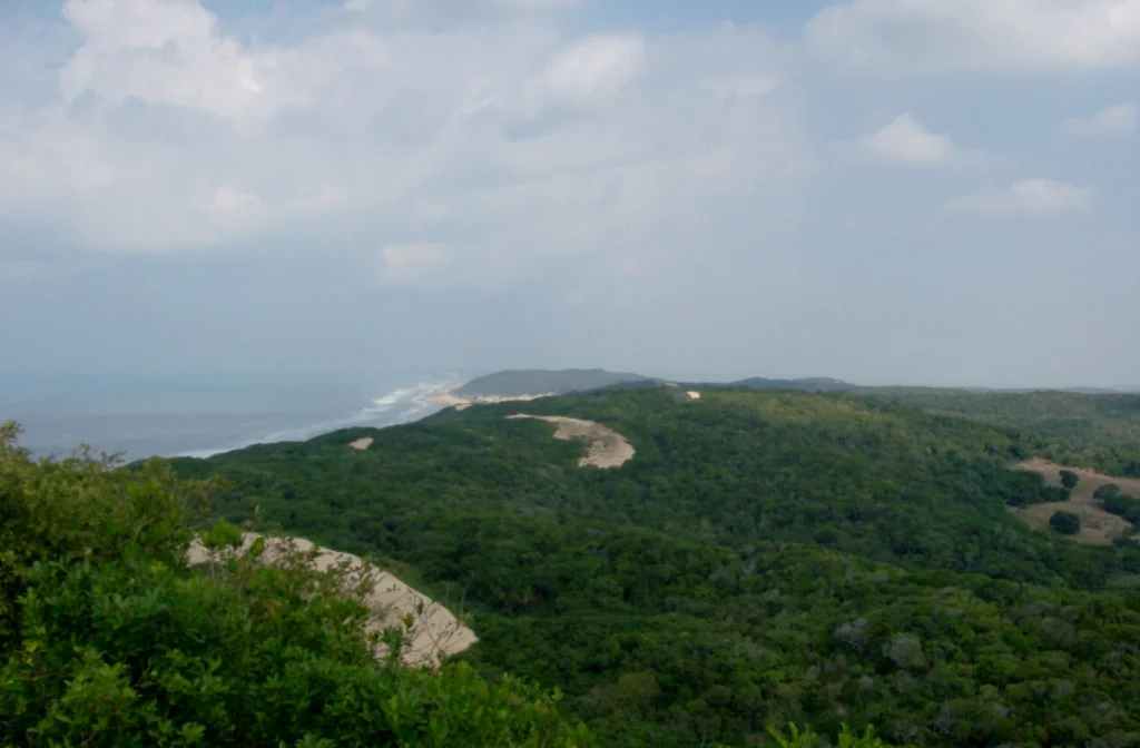

Inhaca Island
Inhaca is the island that makes Maputo Bay a bay. Lying off the southern Mozambican coast, this low green crescent stands between the open Indian Ocean and the sheltered water behind it, and that geography has shaped everything about the place - the lighthouse that has warned ships since 1894, the reefs in its lee, the research station where scientists have studied tropical seas since 1951. Locals also know it as Kanyaka. To the lodges on its northwest shore it is a beach escape forty kilometres from the capital. To a biologist it is one of the best-studied stretches of coastline in southern Africa.
An Island Between Two Waters
Roughly twelve kilometres top to bottom and seven across, Inhaca covers about 52 square kilometres of forest, plain, and cultivated field. Its eastern shore takes the full swell of the Indian Ocean; its western and southern flats fall away into wide mudflats at low tide, fringed with mangroves. At the island's southeastern tip, Ponta Torres, the land reaches toward the mainland Machangulo peninsula, leaving only a 500-metre channel where the tide races through. The highest ground is Mount Inhaca, a forested dune of just 104 metres on the northeastern shore - modest in numbers, but enough to give the island its spine and its commanding view of the ocean.
The Slave Coast and the Treaty
Inhaca sat at a crossroads of empire. Though it lay just off the harbor of a Portuguese colony, the British occupied the island from 1823, using it - as they used many islands around Africa - as a base to patrol and suppress the slave trade in the region. Behind that anti-slaving mission lay hard imperial interest, too: control of an island this close to Maputo's harbor meant influence over one of the coast's best natural ports. The arrangement held for more than half a century, an awkward British foothold in Portuguese waters, until the dispute was put to international arbitration. France's Marshal MacMahon ruled in Portugal's favor, and the MacMahon Treaty of 24 July 1875 confirmed Portuguese sovereignty over the bay and its islands. Inhaca would remain part of Portuguese Mozambique until the country's independence in 1975. The island's quiet shores carry a heavier history than their beauty suggests.
A Living Laboratory
Few small islands have been studied so closely. A lighthouse has guided ships toward Maputo from the island's high ground since 1894, and in 1951 a marine biological station was built here - now run by Eduardo Mondlane University - drawing researchers to one of the richest patches of sea on the coast. The waters hold some 160 species of coral, from branching staghorn to flat plate forms, and reef fish that read like a diver's wish list: barracuda, giant trevally, potato bass, parrotfish, the curious Inhaca fringelip. Whale sharks and manta rays glide through in summer. Two dolphin species live here year-round, including humpback dolphins that gather in unusually large groups for the region. Even a few dugongs survive in these shallows, along with nesting loggerhead and critically endangered leatherback turtles. Not all the history is gentle - southern right whales, once abundant here, were driven to rarity by hunting that included illegal Soviet and Japanese catches in the 1960s and 1970s.
Wings Over the Mudflats
For birds, Inhaca is a destination in its own right - around 300 species, resident and migratory, working the mangroves and tidal flats. Among them are specialties that draw birdwatchers from far away: the southern banded snake eagle, the mangrove kingfisher, the spotted ground thrush, the crab plover stalking the exposed sand. The southerly swamps and Saco Bay shelter the sooty falcon. The diversity is no accident. Mangroves, dune forest hung with grey-green usnea lichen, grassy plains, reefs, and mudflats are packed onto one small island, and each habitat carries its own community. About 6,000 people share it, most living inland, fishing the waters their parents fished - though the catch, like so much here, is not what it once was.
From the Air
Inhaca Island lies at roughly 26.02 degrees south, 32.95 degrees east, at the eastern edge of Maputo Bay. From the air it is a clear, distinct landmass - a green island ringed by pale shallows and mudflats, separated from the Machangulo peninsula to its south by a narrow channel, making it an excellent waypoint for coastal navigation. The island has its own airstrip, Inhaca Airport, near the main village; light aircraft reach it from Maputo International (ICAO: FQMA) in about fifteen minutes. The lighthouse on high ground marks the island's role guarding the bay entrance. Best viewed in the dry season (May to October) when skies are clearest over the coast.
Nearby Stories
- 1986 Mozambican Tu-134 Crash 44 km away
- Ponta d'Ouro 54 km away
- Border Cave 81 km away
- Sabi Sand Game Reserve 132 km away
- Sudwala Caves 224 km away
- Zavora 234 km away
- MS Africa Shell 253 km away
- Ngilgi Cave 7699 km away