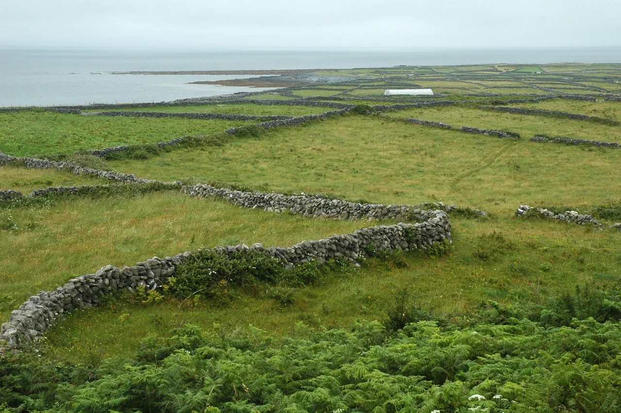

Inis Mór
Eight hundred and twenty people live on Inis Mór now - down from over three thousand in the famine-era 19th century, and dispersed across a strip of limestone twelve kilometres long and rarely more than three wide. There are no taxis, no car rentals, and no scheduled buses on the island. There never have been. Most visitors arrive on the 40-minute ferry from Rossaveel, walk past the harbour at Kilronan, and hire a bicycle or climb into a pony trap. The island runs on its own terms, and those terms haven't changed all that much.
Three Roads West
From Kilronan, three roads thread westward across the island toward the village of Kilmurvey. The Main Road carries most of the traffic; the Low Road dawdles along the north coast with views back to Connemara; the Back Road meanders south through fields walled in by stones the islanders pried out generation after generation. The limestone here is bare karst - the same pavement that surfaces across the Burren in County Clare - scraped clean by Pleistocene glaciers and stitched together since by walls and patches of hand-built soil. The speed limit is 50 km/h and cars are exempt from roadworthiness testing. There is essentially nowhere to drive that an islander could not walk in an hour.
The Cliff Fortress
Dún Aonghasa anchors the south coast of Inis Mór and draws nearly every visitor to its semicircular ramparts. The fort is genuinely old - the inner stone walls were raised in the Bronze and Iron Ages, and the site was used from around 1100 BC - and genuinely strange. Its open side is a 100-metre vertical cliff into the Atlantic, with no railing then or now. Concentric walls of limestone curve inward to a citadel about 50 metres across, where a flat stone platform sits within four-metre-thick masonry. Outside the inner walls is the chevaux-de-frise: a band of jagged stones planted upright in the ground, intended (as one theory has it) to stop cavalry or to terrify whoever tried to approach on foot. It still works.
The Holes the Sea Breathes
Near the eastern tip of Inis Mór, the limestone has been undermined from below until the roof of a sea cave collapses, leaving a vertical shaft - a poll seideáin, or blow-hole. There are several on the island; the two best are near Killeany. In calm weather the sea gloops and sploshes deep below. In a winter storm, the wave action hurls spray, sand, and ribbons of torn seaweed straight up out of the rock. They are unfenced. The locals warn visitors to keep their distance. Farther west, near Kilmurvey, lies Poll na bPéist - the "Worm Hole" - a perfectly rectangular pool 15 metres deep, fed by an underwater passage from the sea. The shape looks human-made and chisel marks suggest a natural feature was enlarged at some unknown date, but the pool itself is the work of dissolving limestone. The Red Bull Cliff Diving Series has been held above it since 2012.
Saints, Stones, and the Sun of the West
Enda of Aran founded Ireland's first true monastery near Killeany around AD 490, and what is now a fragment of a 9th-century church is reputedly his burial site at Teaghlach Einne. From this small island, monks fanned out across Ireland - Ciarán of Clonmacnoise studied here, and Saint Brendan was blessed for his Atlantic voyages on Aran. The Seven Churches at Na Seacht dTeampaill date from the 8th to the 15th centuries, though only two of the buildings are actually churches; the rest are monks' cells and outbuildings. Teampall Bheanáin, the oratory of St. Benen of Armagh, is sometimes called the smallest church in the world - and it points north-south rather than east-west, defying a convention already standard by the 11th century when it was built. The Cromwellian soldiers who flattened most of the monasteries in 1651 spared the saint's tomb-shrine. The 122-metre-high Inishmore Lighthouse, built 1818, was so often shrouded in fog that captains complained they had to find the rocks first in order to find the light. It was decommissioned in 1857.
The Twentieth Century's Edge
Father Ted festival-goers descend on Inis Mór every March in honour of the 1995-1998 sitcom Father Ted, set on a fictional Craggy Island. The shipwrecked steam trawler MV Plassy that opens the show's title sequence still sits rusting on the shore of Inis Oírr next door, but most Ted devotees end up on Inis Mór because that is where the ferries run year-round and where the pubs - Tigh Joe Mac, Madigan's, the Aran Islands Hotel bar - are open most reliably. The island has been the setting for The Banshees of Inisherin (2022), Leap Year (2010), and Dermot Kennedy's 2019 music video "For Island Fires and Family." Liam O'Flaherty, the novelist, was born at Gort na gCapall in 1896. The poet Máirtín Ó Direáin came from here too. The cliffs are still on the edge of Europe; everything else has had to come the long way around.
From the Air
Coordinates 53.12°N, 9.73°W. The island measures roughly 12 km east-to-west and is the westernmost of the three Aran Islands. Inis Mór Aerodrome (Inishmore Airfield, EIIM) sits near Killeany at the eastern tip, served by Aer Arann Islands' 9-seat Britten-Norman Islanders from Connemara Airport (EICA) at Inverin, 31 km east. The flight takes 10 minutes. Shannon Airport (EINN) is 75 km southeast. Best viewing is from 1,500-3,000 ft AGL in late spring; the 100-metre southwestern cliffs of Dún Aonghasa, Dún Eochla on the central ridge at 122 m, and the rectangular Worm Hole near Kilmurvey are all visible from low altitude.
Nearby Stories
- Headford 4.2 km away
- Connemara Railway 8.8 km away
- Island Eddy 10 km away
- Ardoileán 13 km away
- Ennis 13 km away
- Rineen Ambush 18 km away
- RMS Carinthia (1925) 32 km away
- Ballynavenooragh 76 km away