
Inishmore
The name on the map is younger than the island's oldest stone walls. "Inishmore" was an Anglicization concocted by the Ordnance Survey in 1839, and there is no documentary evidence of anyone using it before then. The island had always simply been Árainn or Inis Mór - the big island - and under the Official Languages Act of 2003, Árainn is again the only legal placename. The remapping took the better part of two centuries to undo. The walls and the fortresses, meanwhile, have not budged.
The Geological Outlier
At 31 square kilometres, Inishmore is the second-largest island off the Irish coast - behind only Achill - and the most populated of the Aran group, with 820 residents recorded in 2016. Geologically it is not really an island at all. It is a continuation of the Burren of County Clare: the same Viséan-stage Carboniferous limestone, deposited 330 to 350 million years ago in a shallow tropical sea, compressed into strata flecked with fossil corals, crinoids, and sea urchins. The Midlandian glaciation of the last ice age scraped the surface clean. Solutional weathering since then - just ten thousand years or so - has cracked the pavement into the grikes and clints that give the Aran limestone its corduroy texture. Walk it long enough and you stop noticing the fissures. Stumble in one once and you remember them forever.
The Most Magnificent Barbaric Monument
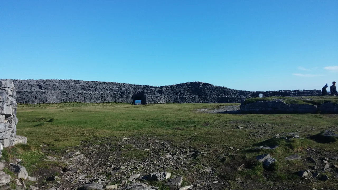
George Petrie, writing in the 19th century, picked his words deliberately. Calling Dún Aonghasa "the most magnificent barbaric monument in Europe" was not condescension but classification: barbaric in the original Greek sense, of something from outside the literate Mediterranean world. The fort begins around 1100 BC, was modified in the Iron Age, and clings to a 100-metre vertical drop on Inishmore's south coast. Its concentric stone walls - the innermost a citadel about 50 metres across with four-metre-thick masonry - enclose half a circle. The sea took the other half over centuries of erosion. Outside the walls lies a chevaux-de-frise of limestone slabs jammed upright into the karst, a defensive belt that would have made a frontal approach by anything with legs an ordeal. No one knows for certain what Dún Aonghasa was for. The fact that an answer has eluded scholars for two hundred years is part of why it still draws people in.
The Prison Island
Inishmore's stone walls did double duty during the Cromwellian conquest of Ireland. The Commonwealth of England had decreed in 1653 that all Roman Catholic priests be banished, and clergy who continued their ministry in defiance were arrested. Inishmore and Inishbofin became prison camps run by the New Model Army - islands convenient because escape was hard and supervision easy. The priests held on Inishmore had not taken up arms; their offence was nonviolent persistence in performing the sacraments. They were not released until the Stuart Restoration in 1662, nine years after the original decree. Two centuries earlier, similar stones, same coast: in the year 1015 the Annals of Inisfallen record that Viking raiders with seven ships plundered the islands and carried off 150 captives. The next year a battle at Port Ciaráin killed Ua Lochlainn, the royal heir of Corcu Modruad. The next year after that, a colic pestilence swept the island and many died. Aran's isolation has rarely been gentle.
Saints and Salvages
Enda of Aran, the founding saint, died around AD 530. The Annals record his successors: Nem Moccu Birn in 654, Colmán mac Comán in 751, Egnech bishop and anchorite in 916. The monastic line continued century after century. By the time the Friary system flourished, Inishmore had a dozen monasteries; saints from Brendan to Columba called it the "Sun of the West." Cromwell's soldiers ended the last of that. The Tempull Breccain - the Seven Churches of Aran - dates from the 5th to the 13th century and was once a major pilgrimage destination. The Lawrence Collection photographs of the 1890s show the same ivy-mantled stones that are there today, give or take a winter's weather. Tim Robinson, the cartographer, spent decades walking and mapping the island in detail unsurpassed by anyone before him. His two-volume Stones of Aran - Pilgrimage (1986) and Labyrinth (1995) - is the closest thing the island has to a definitive book.
Sweaters and Cameras
The Aran sweater - cream-white, cabled, knitted from undyed wool - became a global garment in the 20th century, although many of the sweaters now sold to tourists in Kilronan are made elsewhere in Ireland. Robert Flaherty's 1934 docu-fiction Man of Aran turned the island into an international image of stoic island life, although the film stylised what was already a harsh existence. Inishmore has continued to draw filmmakers. Martin McDonagh's play The Lieutenant of Inishmore (2001) and his Oscar-nominated The Banshees of Inisherin (2022) both reference or were filmed here. Liam O'Flaherty was born at Gort na gCapall in 1896. The poet Máirtín Ó Direáin came from Inishmore too. John Ford's mother, Barbara Feeney, was born in Kilronan. Bridget Dirrane, the centenarian nurse and memoirist, lived from 1894 to 2003 - one woman's life spanning the island's whole modern history.
From the Air
Coordinates 53.12°N, 9.73°W. Inishmore is the westernmost of the three Aran Islands, 12 km long oriented roughly east-southeast to west-northwest. Inishmore Aerodrome (EIIM) sits near Killeany on the eastern tip; flights operate from Connemara Airport (EICA) at Inverin via Aer Arann Islands' 9-seat Britten-Norman Islanders, 10 minutes' flying time. Shannon Airport (EINN) lies 75 km southeast. At 122 metres, the central ridge near the old signal tower is the island's highest point. The southwestern cliff face containing Dún Aonghasa stands 100 metres above the Atlantic and is best seen from 1,500-2,000 ft AGL on the approach from Galway Bay.
Nearby Stories
- Headford 4.2 km away
- Connemara Railway 8.8 km away
- Island Eddy 10 km away
- Ardoileán 13 km away
- Ennis 13 km away
- Rineen Ambush 18 km away
- RMS Carinthia (1925) 32 km away
- Ballynavenooragh 76 km away