Iquitos Varzea
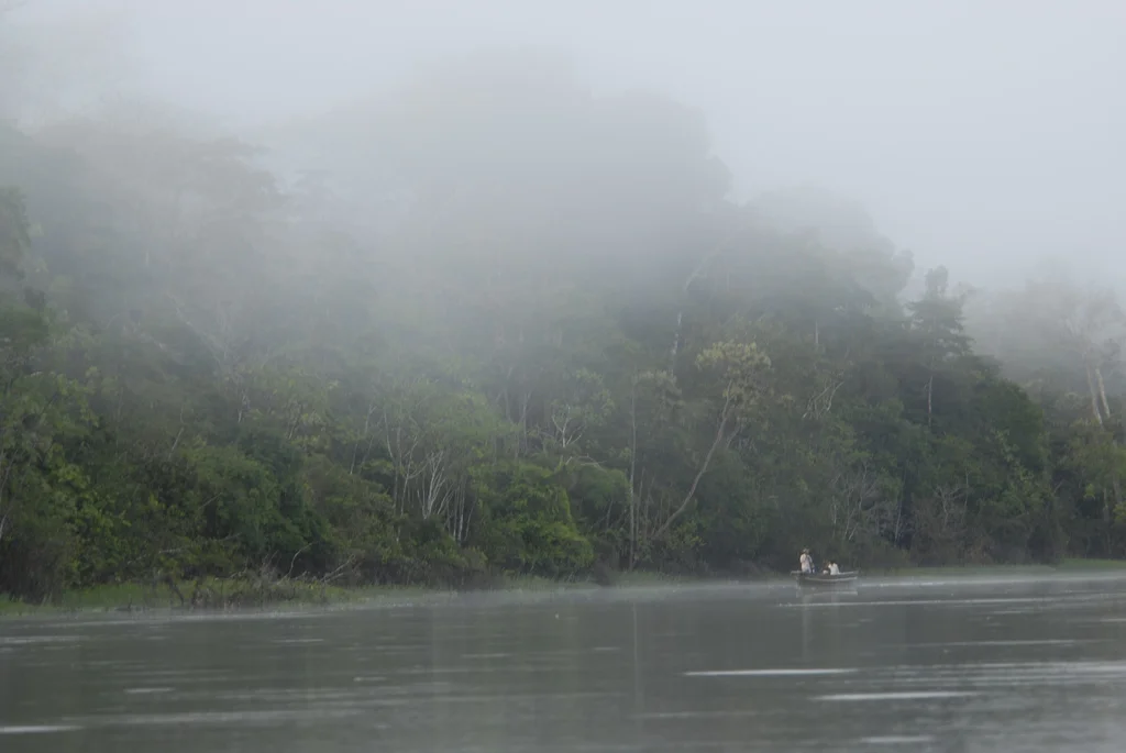
Twice a year near the Peruvian city of Iquitos, the Amazon rises until its waters push six meters deep into the surrounding forest, stretching nineteen kilometers wide in places. The rainforest does not die. It continues breathing underwater. Large fish swim between tree trunks searching for fruit. Tambaqui with molars specifically designed for cracking tough palm seeds arrive from the open river. Pirarucu, one of the largest freshwater fish on Earth at up to three meters long, join them. The flood stays for up to ten months. When it finally retreats, the fish disperse the seeds they swallowed, and the next generation of trees takes root in whatever mud the river has rearranged.
A Forest Built by Sediment
The Iquitos varzea covers about 11.5 million hectares across northwestern Brazil, northeastern Peru, and northern Bolivia - roughly the size of Pennsylvania plus New Jersey. It is defined by water chemistry as much as geography. Whitewater rivers carry nutrient-rich sediment down from the Andes and deposit it across the floodplains every flood cycle, producing some of the most fertile soil in the Amazon basin. The soil itself is young - Holocene alluvial and fluvial deposits laid down in the last ten thousand years, still settling. The rivers meander across this flat landscape, and sometimes, between one flood and the next, they simply abandon their channels and cut new ones. Oxbow lakes, swales, levees, point bars, short-lived islands, and forests at every stage of regrowth form a mosaic that no map can hold steady for long.
Life in Three Dimensions
Count the mammals and the numbers climb quickly: 227 species documented in the ecoregion. Jaguars and ocelots hunt the terra firme edges. South American tapirs push through the understory. Capybaras graze the grassy shores. Kinkajous move through the canopy at night. The primates are extraordinary - spider monkeys, Venezuelan red howlers, common squirrel monkeys, bald uakaris with their fire-red faces, and Goeldi's marmoset, a species rarely found outside this ecoregion. In the rivers themselves, Amazon river dolphins - pink, blind from birth in clear water conditions, reliant on echolocation - hunt alongside smaller tucuxi and Amazonian manatees. Among the 624 bird species are wattled curassows, an endangered ground-dwelling bird that requires exactly this kind of flooded forest. Black caimans up to four meters long share the shallows with yellow-spotted river turtles and green anacondas.
The Aquarium That Built Aquariums
The Iquitos varzea is the landscape most tropical fish in the world's aquariums trace back to. Angelfish, blue discus, neon tetras, cichlids, characins, and dozens of catfish families originated here. The ornamental fish trade still pulls millions of specimens from these waters every year. The larger fish are food. Pacu, tambaqui, pirarucu, dusky narrow hatchetfish, and piranhas all enter the forest during the floods to eat falling fruit. Pirarucu require air-breathing at the surface - they gulp atmospheric oxygen because their rivers periodically run low in dissolved oxygen during the flood season. Indigenous communities have fished them for centuries. Overfishing has reduced populations significantly, and Peru now restricts harvest.
What the Ecoregion Is Losing
The World Wildlife Fund classifies the Iquitos varzea as Vulnerable. Because navigable rivers run through it, humans have always been able to reach it easily - and extract from it easily. Ranchers clear and burn the forest to plant pasture grasses for cattle, which eliminates the fruit trees fish depend on. Logging pulls out valuable hardwoods like Cedrela odorata (Spanish cedar) and Calycophyllum spruceanum. Gold mining contaminates rivers with mercury. Commercial fishing operates at a scale the system cannot sustain. In the worst-hit areas, tapirs and several primate species have simply disappeared from local hunting. Two protected areas offer partial shelter: Peru's Pacaya-Samiria National Reserve covers 20,000 square kilometers of this ecoregion, and the smaller Tambopata National Reserve protects a portion further south. The forest adapts to flooding as it has for millennia. What it has no evolutionary answer for is bulldozers.
The Rhythm of the Water
The climate is equatorial and fully humid, Koppen classification Af - the kind of climate that produces rain on nearly 300 days a year. Temperatures hold steady between 22 and 32 degrees Celsius, with a mean of 27. July is slightly cooler, December slightly warmer, and neither difference is enough to matter. Annual rainfall runs from about 2,250 to 3,000 millimeters. March receives the most - about 263 millimeters. July receives the least - about 80. The rhythm of flooding matches the rain, but the flood peak arrives months after the downpour as water collects and moves downstream through the vast Amazon drainage. By the time the water reaches Iquitos, it has traveled from the Andean slopes and gathered from a hundred tributaries. The forest has learned to wait for it. So have the fish.
From the Air
Centered near 5.17 degrees S, 74.75 degrees W along the Amazon River near Iquitos, Peru. The Iquitos varzea extends along the Amazon and its upper tributaries across northeastern Peru, northwestern Brazil, and northern Bolivia. Coronel FAP Francisco Secada Vignetta International Airport (SPQT) in Iquitos is the main regional access point - no roads connect Iquitos to the rest of Peru. Viewing altitude 3,000-5,000 ft reveals the meandering river channels and oxbow lakes most clearly. During peak flood (March through May), forest appears drowned; during low water (August through November), river channels run deep between exposed banks. Expect heavy rain nearly 300 days a year. Best flying in July, the driest month.
Nearby Stories
- Huallaga River 41 km away
- Peruvian Amazonia 54 km away
- Nauta 81 km away
- Matsés National Reserve 94 km away
- Department of Loreto 111 km away
- 2005 Northern Peru Earthquake 131 km away
- Tamshiyacu Tahuayo Regional Conservation Area 144 km away
- 2021 Northern Peru Earthquake 185 km away