Itajuba
On the morning of March 18, 1819, a priest and about eighty families walked down off a mountainside in southeastern Minas Gerais and started a new village on the Sapucai River. The old settlement was too remote, Father Lourenco da Costa Moreira had decided, too far from water, too deep in the woods of the Serra da Mantiqueira for anyone to make a living there. So they moved. They carried the religious images from the old church. The next day Moreira said the first mass in the new location. The new settlement took the name Itajuba, which in Tupi means water that falls on the rock, a reference to the small waterfalls scattered through the surrounding hills.
A Priest Who Read the Land Correctly
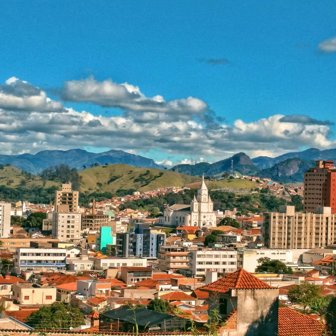
The Puri-Coroados people had lived in this stretch of the Mantiqueira foothills for generations before the Portuguese arrived. When Father Moreira came to the parish of Delfim Moreira in January 1819, what he found was a nearly abandoned outpost called Soledade de Itajuba, isolated and without a reliable water supply. He told the residents that the terrain was not suited to the settlement they wanted, and suggested moving down the mountain to a flatter place near the Sapucai River, where the ground was workable and the water was dependable. Eighty families agreed. They did not all agree on everything afterward. Part of the population decided to build a new church at the new site, and when that happened, Moreira and his followers carried the paintings and statues from the old building to the new one. The process was half city planning, half religious procession. Today Itajuba is a town of more than 97,000 people that sits in a broad Sapucai valley with the Mantiqueira peaks rising to nearly 1,500 meters on the surrounding slopes.
The Engineering University That Defined a City
In 1913, the town took a step that would shape its future more than anyone could have anticipated. The Federal University of Itajuba, UNIFEI, was founded as an engineering school. More than a century later, it remains one of the most respected technical universities in Brazil, particularly in electrical and mechanical engineering. A full ten percent of the town's residents are students or academic staff, and the university's presence ripples outward into the economy. Three other regionally important institutions operate in the city too: Universitas, the College of Medicine, and FACESM, the social sciences college. Itajuba runs on a skilled labor force in a way that most Brazilian cities of similar size do not. The town supports two weekly newspapers, six radio stations including a university station, and a local TV affiliate. A place of roughly 100,000 people should probably not support that much independent media. Itajuba does.
The Helicopters
On the industrial side, Itajuba manufactures things that fly and things that shoot. Helibras, Brazil's only helicopter manufacturer, operates here. A subsidiary of Airbus Helicopters, the Itajuba plant assembles rotorcraft for the Brazilian armed forces and civilian customers across Latin America. Founded in 1978, the company moved to Itajubá in 1980 and has operated here ever since. Every Brazilian Army helicopter, every Brazilian Navy shipboard helicopter, every police search-and-rescue machine across a huge sweep of South America is likely to have been assembled in this valley town. The engineers who certify the rotor systems often trained at UNIFEI, which is how the industrial and academic sides of Itajuba feed each other. A helicopter factory needs engineers. A university produces them. The factory locates where the engineers are. The cycle, once started, tends to reinforce itself.
The Rifles and the Knives
The other strategic industry in town is IMBEL, the Industria de Material Belico do Brasil, the state-owned Brazilian Warfare Material Industry. The Itajuba plant manufactures a Brazilian-licensed version of the FN FAL assault rifle, which for decades was the standard rifle of the Brazilian Army. It also produces the military-issue knives that come standard with those rifles. The plant's presence in Itajuba dates from the 1930s, when the Brazilian government was investing in domestic armaments capacity, and it has remained here through every subsequent policy regime. The combination is unusual: a university town that is also a helicopter town that is also a rifle town, all set in a scenic mountain valley surrounded by coffee farms.
What the Mantiqueira Grows
Around the industrial and academic core, a traditional agricultural region continues to produce coffee, bananas, and potatoes, centered on the cooler country around the nearby city of Maria da Fe. The climate at these elevations runs wet in summer and dry in winter, with morning fog common in the valleys. Itajuba itself sits at 827 meters at the valley floor, but the mountain slopes surrounding it rise to 1,500 meters, which means weather can change dramatically across a ten-minute drive. Coffee grown in the Mantiqueira foothills commands some of the higher prices in the Brazilian arabica market, because the slow ripening produced by these altitudes tends to develop the chocolate and nut notes that specialty buyers favor. The agricultural layer does not compete with the industrial layer. They simply occupy different parts of the same landscape.
From Above
From cruising altitude, Itajuba sits in a classic Mantiqueira valley configuration: a green agricultural basin between folded mountain ridges, with the Sapucai River running through the middle and the town itself a compact urban grid in the broader of the valley floors. The Helibras factory and the IMBEL complex are visible on the edges of the urban area, large industrial facilities with their own access roads. The UNIFEI campus occupies a distinct block nearer the center. The Mantiqueira ranges climb away on every side, their ridgelines forested and their slopes covered with coffee plantations interrupted by stands of eucalyptus.
From the Air
Coordinates: 22.43 degrees south, 45.45 degrees west. Recommended viewing altitude 5,000 to 8,000 feet above the valley floor (surface elevation 827 meters / 2,713 feet, surrounding peaks to 1,500 meters / 4,921 feet). The nearest airport is Pouso Alegre (PPY / SNPQ) about 40 km northwest. Larger fields within reach are Sao Jose dos Campos (SJK / SBSJ) 160 km east and Belo Horizonte Confins (CNF / SBCF) 400 km north. Mountain valley weather can shift quickly: morning fog is common year-round and afternoon buildups can be severe in summer.
Nearby Stories
- Campos do Jordao 9.7 km away
- Serra da Mantiqueira 15 km away
- Cambuquira 40 km away
- Poços de Caldas 66 km away
- Itapira 79 km away
- Suzano Massacre 99 km away
- Our Lady of the Rosary Church, Lavras 101 km away
- Christ the Redeemer: The Statue Built from Soapstone Carried Up a Mountain 186 km away