Kafue River
In February 2025, the Kafue River turned blue. Not the metaphorical blue of a clean current running under a morning sky, but the blue of fifty million liters of acidic mining waste dumped into its headwaters when a tailings dam at the Sino-Metals Leach Zambia copper operation collapsed. The color traveled with the current. Downstream in Kitwe, the municipal water supply shut off. A river that had survived colonial logging, commercial sugar estates, and four decades of hydroelectric re-engineering suffered a wound that activists and scientists are still measuring. The Kafue is not a river that strangers know. For more than half of Zambia's population, it is the river.
A Country's Own River
At 1,576 kilometers long, the Kafue is the longest river that lies entirely within a single country in south-central Africa. It begins in the Copperbelt, crosses the heart of Zambia, and empties into the Zambezi near the town of Chirundu on the Zimbabwe border. No other principal Zambian river is so central or so urban. More than 50 percent of the country's population lives in the Kafue basin, and around 65 percent of those residents live in cities and towns. That single fact changes how you read the river. It is water, but it is also drinking supply, irrigation, electricity, and economy, all bent into the same channel.
Through the Copperbelt
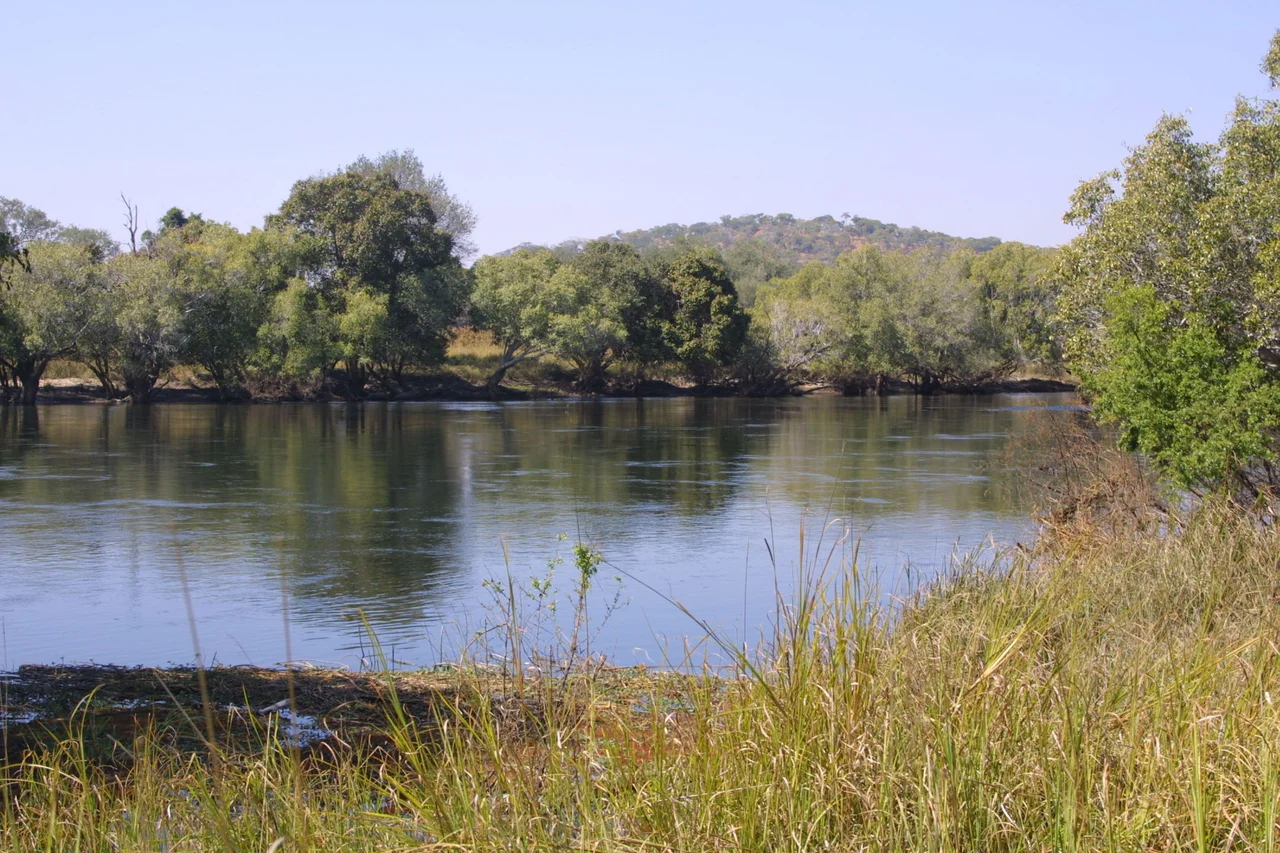
The river flows past the Copperbelt towns of Chililabombwe, Chingola, and Mufulira, and skirts Kitwe. North of Chingola, a pool known as Hippo Pool is so beloved by locals that it is now protected as a national monument, a picnic spot where families have gathered for generations. Beyond the mines, the channel narrows to 30 to 40 meters, meanders less, and runs in a shallow valley only slightly lower than the surrounding plateau. Water is drawn here for small farms and market gardens. At Kitwe the river turns sharply southwest, flowing through forest and flat rock country that floods every wet season, then contracts in the dry to a fifty-meter ribbon. For all its abuse, studies in the early 2000s found that the natural wetlands of the Copperbelt were astonishingly good at filtering mining pollutants. Downstream from the Copperbelt, the Kafue was running clean. Until it was not.
Lukanga Swamp and the Old Road South
South of the Copperbelt, the river relaxes into a maze of meanders, oxbow lakes, and floodplain channels, with the Lukanga Swamp twenty kilometers to the east. In the rainy season, the combined wetland exceeds 6,000 square kilometers. Geologically, the Kafue once flowed much farther south than it does today, joining the Okavango and the ancient courses of the upper Zambezi to fill Lake Makgadikgadi in what is now northern Botswana, before continuing to the Limpopo. Then the land uplifted. A rift valley opened east of the present Kafue National Park, and the river, redirected, carved a new exit. The slot it carved is the Itezhi-Tezhi Gap, where the 1977 dam now stands and where a 500-square-kilometer reservoir has replaced what used to be forested hills.
Too Many Users, One River
The Itezhi-Tezhi Dam and the Kafue Gorge Dam downstream are the river's twin hydroelectric hearts, and they have had major negative effects on the ecosystems that evolved around the river's natural rhythm. On the Kafue Flats, excess phosphates from fertilizer runoff and from the Nakambala Sugar Estate trigger algal blooms that reduce fish populations. The Nakambala estate alone draws over 720,000 cubic meters a day to irrigate 134 square kilometers of sugar cane. Mining effluent containing cadmium, lead, and mercury has damaged water quality for decades. In 1999, the World Wildlife Fund opened dialogue between the Zambian government, the state utility ZESCO, and local communities, pushing for more natural flow patterns from the dam. The conversation helped shape Zambia's revised National Water Policy in February 2010, which aims at integrated, decentralized water management. The policy is a framework. The river is a negotiation that never ends.
The Day the River Died
On 18 February 2025, the tailings dam at the Sino-Metals Leach Zambia copper mine collapsed in Copperbelt Province. Fifty million liters of waste containing concentrated acid, dissolved solids, and heavy metals surged into a tributary of the Kafue. Fish died in numbers that locals compared to an overnight apocalypse. The city of Kitwe suspended its water supply. News reports called the river "dead," although rivers, like communities, rarely die all at once. The contamination moved downstream with the current, and at each bend scientists, fishing families, and municipal engineers measured what the water was carrying. The 2025 disaster concentrated in a single dramatic event what the Kafue's long history has taught in slower chapters. A river is only as healthy as the decisions made upstream of it. The Kafue runs for more than fifteen hundred kilometers, and every bend of it belongs to someone.
From the Air
The Kafue River arcs across Zambia, with a representative waypoint at 11.63 degrees South, 27.19 degrees East in the Copperbelt reaches. From 4,000 to 8,000 feet above ground the river is visible as a dark, sinuous line broken by the broad reflective sheets of the Lukanga Swamp, the Itezhi-Tezhi Reservoir, and the Kafue Flats. Nearest major airports along its course include Ndola (FLND) in the Copperbelt, Kenneth Kaunda International (FLKK) at Lusaka, and Livingstone (FLLI) near the Zambezi confluence region. Clear air and visibility is typical from May through October.
Nearby Stories
- Katanga 35 km away
- Shinkolobwe 45 km away
- Copperbelt 52 km away
- Nchanga Copper Mine 91 km away
- Chingola 96 km away
- Deziwa mine 143 km away
- Ntumbachushi Falls 216 km away
- North-Western Province, Zambia 220 km away