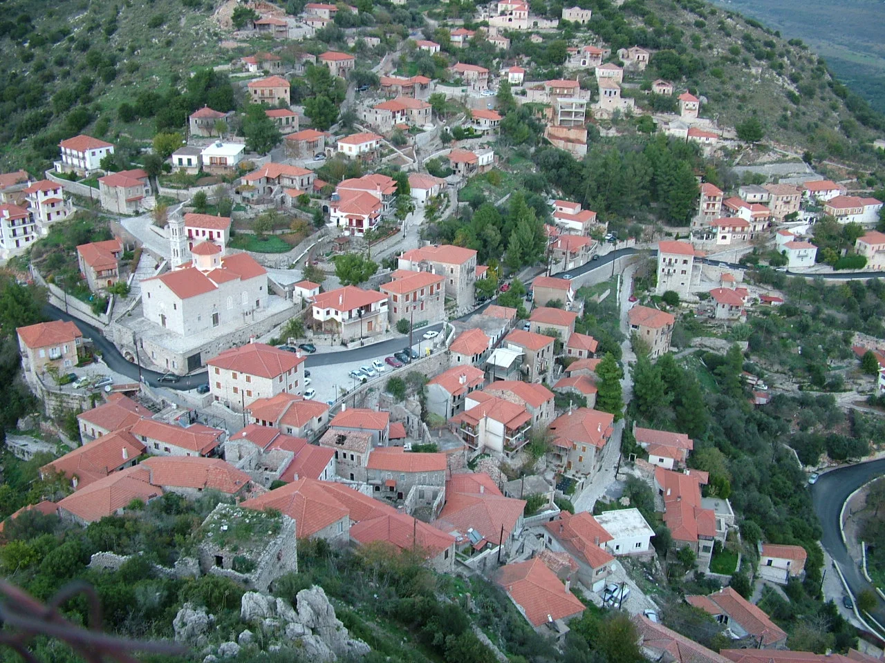

Karytaina
The castle at Karytaina has controlled this gorge for nearly eight hundred years, watching over a sequence of rulers who came and went beneath it: Frankish barons, Byzantine generals, Venetian governors, Ottoman administrators, and finally a Greek revolutionary general who repaired its walls and built a small church inside them. Each group left something behind and took something away, until the village below became one of the most layered settlements in the Peloponnese — a place where the etymology of its own name remains genuinely uncertain, variously traced to a Slavic root, a corruption of the ancient Gortyna, the Greek word for walnut, or a woman's name, Karitaina.
The Gorge and the Ridge
Karytaina stands on the slopes of the hill of Achreiovouni at about 550 meters above sea level, on the right bank of the Alpheios near its confluence with the Lousios. The position was not accidental. Whoever held this ridge controlled the ravine of the Alpheios valley — the main route connecting the high Arcadian plateau with the coastal plains of Elis to the west. It also commanded the southern part of the mountainous Skorta region. The village is 54 kilometers from Tripoli, 20 from Megalopoli, and 17 from Stemnitsa. At the turn of the 18th century, the French traveler François Pouqueville recorded that the surrounding district comprised 130 villages with 28,170 inhabitants, of which about 3,000 lived in Karytaina itself.
The Franks Build, the Byzantines Reclaim
The Crusader conquest of the Morea around 1205 brought Karytaina into the orbit of the Frankish Principality of Achaea, which divided its new territory into secular baronies. Karytaina's barony — one of the largest — passed to the Briel or Bruyères family. The third baron, Geoffrey of Briel, built the castle in the mid-13th century on a steep rocky outcrop above the village. Geoffrey was a forceful figure who played a prominent role in the affairs of Frankish Greece, at one point openly defying the Prince William II of Villehardouin. After Geoffrey's death in 1275 the barony reverted gradually to the princely domain; it later passed to Isabella of Villehardouin and her daughter Margaret of Savoy. Pressure from Byzantine Greeks based at Mystras had been mounting for decades, and in 1320 Karytaina finally fell to them. The castle lost strategic importance thereafter, passed briefly to Venice from 1687 to 1715, and under the second period of Ottoman rule after 1715 was abandoned and fell into ruin.
Kolokotronis and the War of Independence
By the time the Greek War of Independence broke out in 1821, Karytaina's residents were among the first in the Peloponnese to join the uprising. The general Theodoros Kolokotronis — the most celebrated commander of the revolution — chose the ruined Frankish castle as his stronghold, particularly during a critical period in 1826 when the war's momentum had stalled. He repaired the walls, erected a small church inside dedicated to the Virgin Mary, and built his house just outside. The castle's triangular circuit wall, more than 110 meters on the long sides and about 40 meters at its base, with a central structure that once served as the barons' residence built above a cistern, gave him both shelter and a commanding view of the approaches through the gorge. The village's fame during this period was such that Karytaina's image later appeared on the 5,000-drachma banknote before Greece adopted the euro.
Stone Village, Living Memory
Today Karytaina is a protected traditional settlement, and the medieval and Ottoman layers of its history are preserved alongside the Frankish castle at the top of the hill. A 12th-century church may exist inside the castle walls, according to the Greek archaeologist N.K. Moutsopoulos — though the pre-Frankish history of the site is sparse. A bell tower stands in the village below, framed by the castle silhouette above it, an image that has become emblematic of the Arcadian highlands. The town's population, which stood at over 1,000 in the 1920s, has declined substantially over the decades as people have moved to the cities. But the stone structures remain, and the castle keeps its watch over the gorge, as it has since Geoffrey of Briel's masons cut it from the rock in the 1200s.
From the Air
Karytaina is located at 37.485°N, 22.042°E in the Gortynia region of Arcadia, at approximately 550 meters elevation. The Frankish castle on its rocky outcrop is visible from altitude as a distinctive promontory above the deep Alpheios gorge. The confluence of the Alpheios and Lousios rivers is visible nearby — two river gorges meeting in a landscape of sharp ridges and deeply cut valleys. The nearest major airport is LGKL (Kalamata International), approximately 70 km to the south-southwest. The gorge topography creates localized wind conditions; approaching from the south over the Megalopolis plain provides the clearest view of the village and its castle against the ridge.
Nearby Stories
- Battle of Meligalas 5 km away
- Battle of Picotin 13 km away
- Kastanitsa 13 km away
- Phlius 14 km away
- Cleitor 16 km away
- Pyramid of Hellinikon 16 km away
- Agios Andreas, Katakolo 19 km away
- Strofades 39 km away