.jpg)
People From the Top of the Land
In July 2016, about three hundred people gathered on a windy bluff above the Sonoma coast to watch Kashaya Pomo dancers move through tall grass for the first time in more than a century. The sound of clappers and bone whistles carried over the Pacific. A tribal leader called it the most powerful moment the Kashaya had experienced in a hundred years - to hear the wind through the feathers of their dancers on land that had been taken from them and, after five years of negotiation, returned. The Kashia Band of Pomo Indians of the Stewarts Point Rancheria is a small federally recognized tribe in northern Sonoma County. Their formal name is bureaucratic, but their name for themselves is not. Kashaya means "expert gamblers," and wina-ma bakhe ya translates as "People From the Top of the Land" - a reference to the coastal ridges where they have lived for thousands of years, watching the Pacific from above.
A Territory Measured in Seasons
Before European contact, an estimated 1,500 Kashaya Pomo inhabited a territory stretching from the Gualala River in the north to Duncan's Point south of the Russian River, and from the Pacific coast over coastal mountain ranges to the confluence of Dry Creek, roughly thirty miles inland. They moved with the seasons - to the coast for abalone and seaweed, to the valleys for acorns and game, to the ridges for berries and medicinal plants. When the Russian-American Company established Fort Ross on the Kashaya village site of Metini in 1812, the relationship that followed was complicated but not catastrophic. Kashaya workers labored alongside Russian managers and Aleut hunters. Kashaya women married Russian men. The 1817 treaty between the company and Kashaya chiefs was the first formal agreement with a Native people in California. The Kashaya are the only California tribe never removed from their ancestral territory - a distinction that required extraordinary endurance across two centuries of colonization.
Forty-One Acres Inland
By 1870, only three Kashaya villages remained. The devastation came not from a single forced march but from the slow accumulation of dispossession - ranchers fencing land, timber companies clearing forests, diseases thinning the population. In 1914, the federal government began taking land into trust, establishing Stewarts Point Rancheria the following year on 41.5 acres of inland hills along Skaggs Springs Road, far from the coast their ancestors had fished for millennia. The rancheria sits in rural northern Sonoma County, its nearest neighbor the planned community of Sea Ranch along the Pacific. As of the 2010 census, 78 people lived on the now 550-acre reservation, 72 of them Native American. The tribe conducts business from two offices, one at the rancheria and one in Santa Rosa.
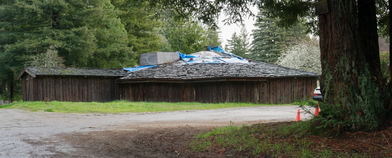
The Dreamer Who Opened the Roundhouse
Essie Pinola Parrish, born in 1902 at the Haupt Ranch, was recognized as a shaman by the Kashaya at age six. Her Indian name was Pewoya, the Stirrer. When her predecessor Annie Jarvis died in 1943, Parrish became the tribe's yomta - its official spiritual leader. She was a masterful basket weaver whose work is held in museum collections, but her deeper legacy was cultural preservation during decades when assimilation pressures threatened to erase Kashaya traditions entirely. Working with Berkeley linguist Robert Oswalt, she helped compile a Kashaya Pomo dictionary. She collaborated on more than twenty anthropological films documenting Pomo ceremonies and daily life. In a break with tradition that proved transformative, Parrish opened the tribe's ceremonial roundhouse to outsiders for the annual White Deer Dance and Strawberry Festival, drawing hundreds of visitors. She died in 1979, and upon her death the roundhouse was locked, awaiting another dreamer to take her place.
The Coast Returned
For a hundred years, the Kashaya lived inland while other people owned the coastline their ancestors had walked. Then, in 2010, a coalition began working to change that. The Richardson family had ranched 688 acres of coastal bluff and grassland since 1925. When family members Bill Richardson, Anna Richardson Granneman, and Mary Richardson Zern decided to sell, The Trust for Public Land stepped in. Five years of fundraising followed - Sonoma County contributed two million dollars, foundations raised six million more. In October 2015, the deal closed. The land became the Kashia Coastal Reserve, restoring Kashaya access to the Pacific for the first time since they were pushed inland. Out of respect for a relationship spanning nearly a century, Bill Richardson was allowed to live out his life on the property he helped return. The reserve is being restored to a condition as close as possible to what existed before Western contact - native grasses replacing cattle pasture, traditional burning practices resuming, the land healing.
A Language on the Edge
The Kashaya language, also known as Southwestern Pomo, belongs to the Pomoan language family of Northern California. Several dozen elders still speak it fluently, and younger tribal members are working to sustain it - but the window is narrowing. The language carries a way of understanding the Sonoma coast that English cannot replicate: words for specific fog patterns, for the behavior of abalone at particular tides, for plants with no common English name. Language revitalization programs are part of a broader effort to ensure the culture Essie Parrish fought to preserve does not fade with the generation that knew her. Lorin Smith, born in 1935, serves as the tribe's current spiritual leader and medicine man. He has continued Parrish's practice of welcoming non-Indians to the roundhouse, keeping the door open as the community works to hold onto what makes it distinct.
From the Air
Located at 38.66°N, 123.34°W in rural northern Sonoma County. Stewarts Point Rancheria is inland from the coast along Skaggs Springs Road, not easily distinguished from the air. The Kashia Coastal Reserve occupies 688 acres of coastal bluff visible along Highway 1 between Sea Ranch and Salt Point State Park. Fort Ross is approximately 10 miles south along the coast. Nearest airports: Charles M. Schulz-Sonoma County Airport (KSTS) approximately 35 nm southeast; Little River Airport (KLLR) approximately 35 nm north. Coastal fog common, especially summer mornings.
Nearby Stories
- Where the Sheep Rancher Planted Stars 4.4 km away
- The Petrified Forest 5.8 km away
- The Brewery That Couldn't Behave 6 km away
- The Clayton Fire 9.5 km away
- Bodega Head: Where Two Plates Meet 14 km away
- Pixieland 687 km away
- Neskowin Ghost Forest 725 km away
- ʻAkaka Falls State Park 3649 km away