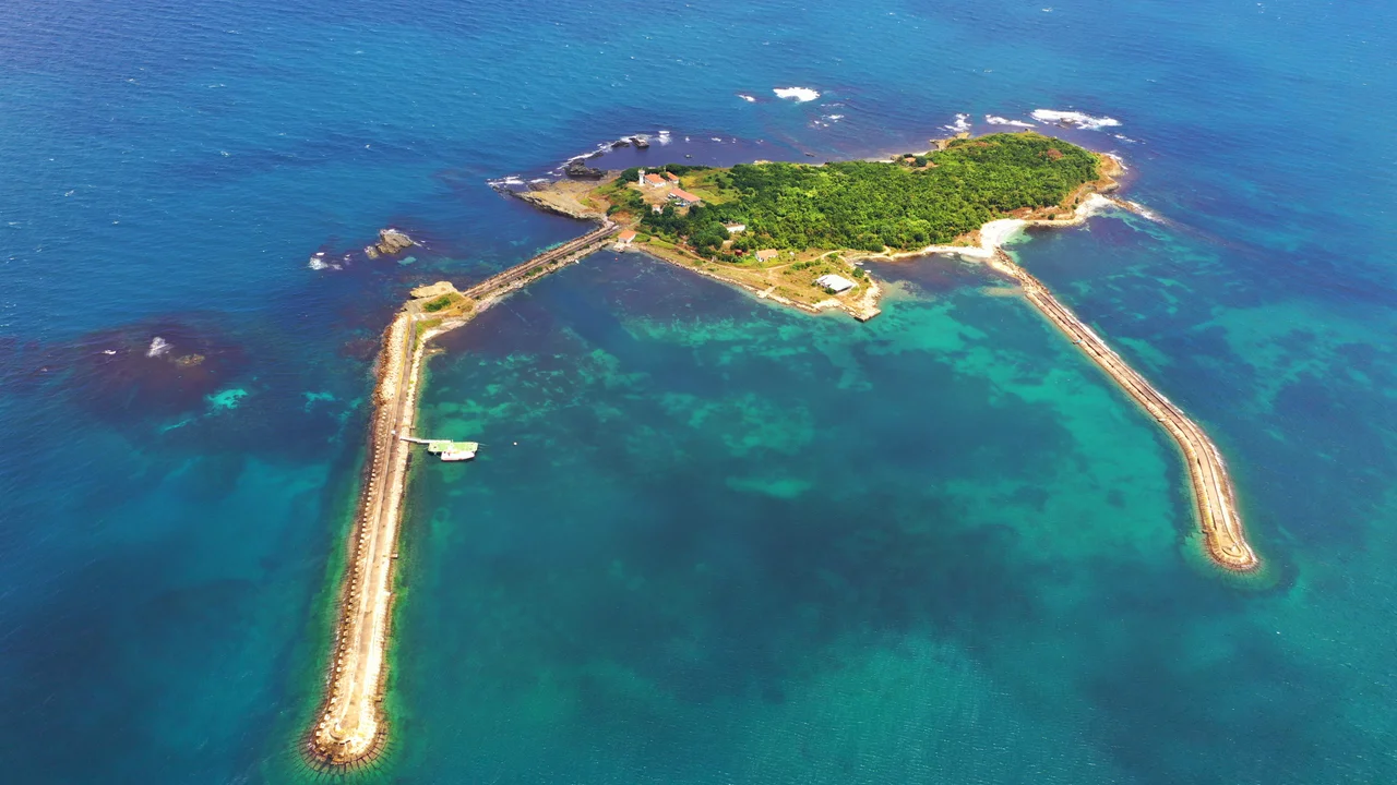

Kefken Island
The island has been called many things. Daphnusia. Apollonia. Thynias. Thyni. Thynis. The catalogue of names attached to this 21-hectare fragment of rock and scrub off the Black Sea coast of Turkey reflects the succession of civilisations that sailed past it, fished near it, fortified it, and named it after whatever mattered most to them at the time. Ptolemy recorded it. Pliny the Elder noted it. Strabo mentioned it. Ancient writers did not waste words on places of no consequence, and Kefken Island — the name it carries today — was never of no consequence.
An Island of Many Names
The oldest surviving name, Thynias, may derive from the ancient Greek word for tuna — thynos — suggesting that the waters around the island were fishing grounds before they were anything else. The name may also connect to the Thynii, a tribe of Thracian origin who settled coastal Bithynia in antiquity. Daphnusia, another ancient name, appears in both Ptolemy's Geography and in other classical sources. Apollonia links it to the cult of Apollo, a naming pattern common across Greek colonial sites in the Black Sea region. The island lies roughly four times as long as it is broad — an elongated shape that would have been recognisable to mariners navigating the southern Black Sea coast, a useful landmark for ships moving between the Bosphorus and the ports of eastern Pontus.
A Bishopric on the Margins
During the Byzantine period, the island's settlement — never large enough to be called a city — was elevated to the rank of bishopric, making it a recognised ecclesiastical centre. The timing was late: the settlement does not appear in the Synecdemus, the sixth-century administrative register of Byzantine cities and bishoprics, suggesting it gained that status after that document was compiled. The bishopric of Daphnusia, as it was known, was not a great diocese of the eastern church. It was a peripheral see on a small island. Today the Catholic Church lists Daphnusia as a titular see — a formal designation preserved for historical continuity long after the actual episcopal community ceased to exist. The ruins that remain on the island include walls from the Hellenistic and Genoese periods, along with cisterns and wells that once supported whatever population the island sustained.
The Moment Constantinople Changed
Kefken Island's most historically significant moment came not from anything that happened on the island itself, but from what happened elsewhere while the island happened to be the focus of military attention. In 1261, the Latin Empire — the crusader state installed in Constantinople after the Fourth Crusade of 1204 — was besieging the island. The Latin fleet was engaged in that operation when, in one of the most consequential political shifts of the medieval world, Michael VIII Palaeologus, the Greek Emperor of Nicaea, reconquered Constantinople. The Latin Empire collapsed. The Byzantine Empire, in a recovered form, resumed control of its ancient capital. The Latin fleet, occupied with a small Black Sea island, was in the wrong place at the decisive moment. Kefken Island was not the cause of that strategic failure, but it was where the Latin ships were when history moved on without them.
Fortress Walls and the Lighthouse
Visitors to Kefken Island today can still see the remnants of its fortified past — walls from the Hellenistic period and later from the Genoese era, when Genoa controlled much of the Black Sea trade and maintained fortifications at key points along the coast. The Genoese presence here, as at Galata in Constantinople and at Caffa in Crimea, was commercial rather than territorial in the Byzantine sense: they wanted access to trade routes, and the island was a waypoint and anchorage on the coastal passage. A lighthouse now marks the island's presence for modern shipping, maintaining its ancient function as a navigational reference on a coast that has always been important to those who sail the Black Sea. The mainland village of Cebeci, in the Kandıra district of Kocaeli Province, is the departure point for the short boat ride to the island.
From the Air
Kefken Island lies at approximately 41.216°N, 30.261°E, off the Black Sea coast of Kocaeli Province. From the air it appears as a distinct elongated landmass separated from the mainland by a narrow strait — a clear visual waypoint for coastal navigation. The forested Kocaeli hills rise behind the mainland shore. LTFJ (Sabiha Gökçen International Airport) is approximately 80 km to the southwest. LTBQ (Cengiz Topel Airport, near İzmit) lies roughly 60 km to the south. At 3,000–5,000 feet, the island is clearly visible against the open Black Sea, with the Bosphorus entrance visible further west on clear days.
Nearby Stories
- Ağva 10 km away
- Optimatoi 13 km away
- Hereke 28 km away
- Tottenham (1802 Indiaman) 35 km away
- 2025 Kartalkaya Hotel Fire 84 km away
- Battle of Constantinople (922) 100 km away
- Soviet Destroyer Dzerzhinsky 358 km away
- Mevlâna Museum 396 km away