
Kenting National Park
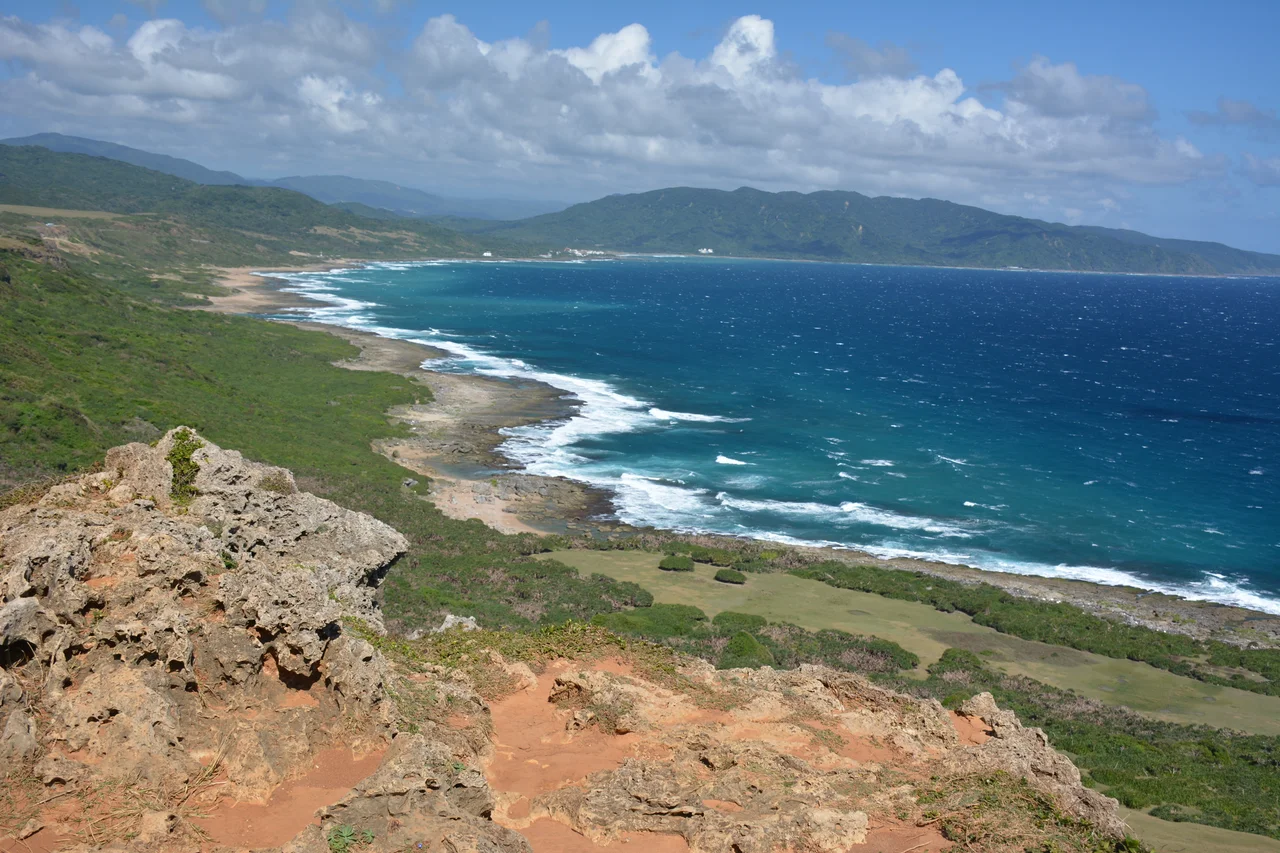
Ten million years ago, the ground beneath Kenting was ocean floor — coral reefs, foraminifers, and shellfish building up layer by layer in warm shallow water. Tectonic forces eventually shoved that seafloor upward into the light. Rain and erosion got to work, carving the raised limestone into cliffs, caverns, stalactites, and sinkholes draped in tropical vines. Today that ancient seabed is one of Taiwan's most popular national parks, a peninsula where the Taiwan Strait meets the Philippine Sea and where the forest holds more than 1,200 species of ornamental and conserved plants in an area of roughly 467 hectares.
Stone That Grew in the Sea
The coral limestone that defines Kenting's landscape is everywhere you look: rising in jagged pinnacles above the forest canopy, forming the walls of caves that visitors walk through on wooden boardwalks, and jutting into the surf as dramatic headlands. Stalactites and stalagmites inside the park's cave systems grow at roughly one centimeter every thirty years — meaning the columns that hang from ceilings in the Silver Dragon Cave and other formations represent millions of years of patient mineral accumulation. The Kenting National Forest Recreation Area, which covers the elevated interior of the peninsula between 150 and 300 meters above sea level, preserves this geology alongside a layered forest: tall Moraceae and lauraceae trees forming a canopy, understory palms filling the middle, and low grasses and climbing plants covering the ground. A 300-year-old Chinese pistache tree stands near the entrance trail, one of many old-growth specimens that survived the clearing of much of southern Taiwan's lowland forest.
Where Raptors Congregate
Each autumn, Kenting becomes one of Asia's most important raptor migration corridors. The peninsula acts as a funnel: birds moving south from mainland China and the rest of Taiwan narrow toward the tip and concentrate in the forest above the limestone cliffs. Chinese goshawks, oriental honey-buzzards, gray-faced buzzards, brown shrikes, and falco subbuteos all pass through in significant numbers, joined by cattle egrets and other waterbirds working the wetlands. Birdwatchers set up spotting scopes on the hillsides above the coast road, and on peak days the sky above the park can fill with circling raptors riding thermals before pushing south across the Bashi Channel. In the understory, Formosan macaques — Taiwan's only native monkey — move through the canopy in noisy groups, and butterflies drift through the clearings in spectacular variety. The park's claim as the only tropical botanical garden in Taiwan is matched by its role as a critical stopover for wildlife moving up and down the western Pacific flyway.
Beaches and the Blue Water Beyond
Most visitors come for the coastline, and Kenting delivers. Nanwan, tucked between Hengchun and the resort strip of Kenting proper, has become the center of the area's growing surf scene. Jialeshui, on the more exposed east coast, draws experienced surfers and divers to rockier, less crowded waters. The coral offshore supports an array of marine life accessible to snorkelers willing to wade in from the beach. Two public beaches operate under park management; numerous private pay beaches line the main coastal road. During typhoon season — roughly May through October, overlapping with peak tourism — swells can close all beaches with little warning, the same waters that glitter on a calm morning turning gray and violent within hours.
Kenting After Dark
The national park closes much earlier than the town it shares a name with. Most park facilities wind down around 22:00, but the main commercial strip through Kenting township transforms each evening into something closer to a night market than a beach resort: food stalls, souvenir vendors, games, and the kind of low-key street energy that attracts both backpackers and Taiwanese families on weekend escape. Thai food became fashionable here some years ago and has never quite left — you can find pad thai a few steps from the seafood grills and the fresh fruit trucks that cruise the streets in the evening. The accommodation ranges from camping inside the park itself, where permits are available through the park authority, to modern resort hotels that have replaced older guesthouses along the beachfront. The newer hotels are generally nicer; the construction of new ones seems to be a permanent condition.
Getting to the End of the Island
Kenting sits far enough south from the rest of Taiwan that getting there is a small adventure in itself. The High Speed Rail brings passengers from Taipei to Zuoying, Kaohsiung, in roughly 1.5 to 2 hours; from there, the Kenting Express bus (Route 9189) connects to the park with service running approximately 8am to 7:30pm, making a day trip by HSR a reasonable option for those who plan ahead. Buses also run directly along the coast road through Fangliao and Fangshan, connecting with Eastern Taiwan. Once there, most people rent a scooter — the roads around the peninsula are well-suited to it, and the distance between coastal viewpoints makes walking impractical. The electric scooters available in Kenting have a range of roughly 80 to 100 kilometers; the fuel-powered options, easier to find in Hengchun, tend to suit longer explorations of the peninsula.
From the Air
Kenting National Park occupies the extreme southern tip of Taiwan at approximately 21.98°N, 120.80°E. The peninsula narrows dramatically here, with ocean visible on both the western (Taiwan Strait) and eastern (Philippine Sea) sides. The Eluanbi Lighthouse at the very tip is a clear visual landmark — a white tower on a forested promontory that has guided ships for over a century. The coral limestone formations in the Forest Recreation Area show as pale rock outcroppings on the elevated central spine of the peninsula. Nearest major airport: RCKH (Kaohsiung International), approximately 70 kilometers north. Recommended viewing altitude: 4,000–6,000 feet to see the full peninsula shape and the convergence of the two seas at Cape Eluanbi.
Nearby Stories
- Fangliao 18 km away
- Orchid Island 25 km away
- Zhaori Hot Spring 41 km away
- Ten Drum Rende Creative Park 69 km away
- Barclay Memorial Park 102 km away
- Mavulis Island 102 km away
- 1991 Eruption of Mount Pinatubo 741 km away
- Scarborough Shoal 780 km away