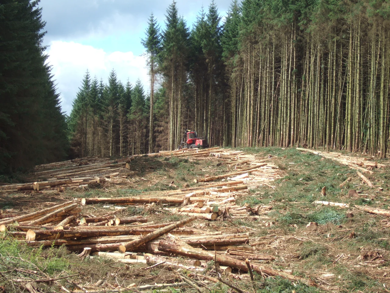

Kielder Forest
In the early 1930s, men from the closed shipyards of Tyneside and the silent mines of Durham boarded trains north into Northumberland and were put to work planting trees. They lived in hutted camps run by the Ministry of Labour, one of 38 Instructional Centres scattered across Britain to keep the unemployed busy and useful. The land they planted had been grouse moor and sheep run for centuries, treeless and windswept. The men were not foresters. They were shipwrights and pitmen learning to dig holes in peat. Their camp eventually disappeared underneath Kielder Water when the reservoir was filled in the 1970s. The trees they planted now cover 250 square miles, the largest man-made forest in England, and roughly half of all England's red squirrels live among them.
A Strategic Reserve of Timber
The Forestry Commission was founded in 1919 to address a crisis the First World War had laid bare: Britain had almost no domestic timber. Trenches, pit props, railway sleepers, every kind of military and industrial need had been met by imports that submarines could cut off in weeks. The Commission's brief was to plant a strategic reserve. Kielder, vast and remote and cheap, was an obvious place to start. First plantings began in the 1920s. Through the Depression, the Ministry of Labour provided men. Purpose-built villages went up for the workers' families, including Stonehaugh, which still exists. By the time the trees were tall enough to harvest, the strategic justification had evaporated, and Kielder had become something else: a working multi-purpose forest, a recreation landscape, and a wildlife refuge.
A Sea of Sitka Spruce
Sitka spruce, Picea sitchensis, covers seventy-five per cent of the planted area. It is a North American species, native to the Pacific coast from Alaska to California, that thrives in the damp gloom of northern Britain in a way few native conifers can. Norway spruce and lodgepole pine cover nine per cent each. The remainder is a mix of Scots pine, larch, Douglas fir, and broadleaves: birch, rowan, cherry, oak, beech, willow. Around 475,000 cubic metres of timber are harvested every year for sawmills, chipboard, pulp, and wood fuel. Clear-felled areas are replanted with a more diverse mix than the original monocultures, and increasing amounts of open space and riparian habitat are being created to support wildlife. The forest is certified under the Forest Stewardship Council scheme, the global standard for sustainable timber.
Squirrels, Ospreys, and a Possible Lynx
Kielder is the last great English stronghold of the red squirrel. Around half of England's red squirrel population lives in the forest, sheltered from the grey squirrels that have displaced them almost everywhere else by virtue of Kielder's vast scale and the active management of grey squirrel populations. There is a squirrel hide at Kielder Waterside for visitors hoping to catch a glimpse. In 2009, a pair of ospreys nested successfully in the forest, the first English breeding ospreys in this part of the country in modern times. A second pair joined them in 2011. By 2016 four pairs were fledging eleven young between them. The forest is also being considered as a reintroduction site for the Eurasian lynx, extinct in Britain for 1,300 years. Low human population, scarce roads, and a stable roe deer population make Kielder one of the few places in England where a lynx could plausibly survive. Whether one ever will is a political question more than an ecological one.
Killer Kielder
Among rally drivers, the forest has another name. The gravel tracks that the foresters use to extract timber make some of the most demanding rally stages in Britain. Long fast straights tempt drivers into speeds they cannot hold; the corners are deceptive; the ditches beside the road are deep and unforgiving; the surface itself is often rough. For decades the World Rally Championship's RAC Rally included Kielder stages, often called 'Killer Kielder' by commentators, because so many cars retired from accidents or mechanical failures over the forest's roads. National rallies and the British Rally Championship still use the forest. Outside the rally calendar, the tracks belong to walkers, mountain bikers, and the occasional roe deer. The Kielder Marathon, inaugurated in 2010 by the British distance runner Steve Cram, circles the reservoir, taking in the surrounding gentle contours.
Castle, Skyspace, Dark Sky
Kielder Castle Visitor Centre is an eighteenth-century hunting lodge built by the Duke of Northumberland at the head of the North Tyne valley. A great football match between the men of Tynedale and Redesdale is reported to have taken place at the castle in 1790, presumably without modern rules of any kind. Today the castle is a hub for cycling, walking, and forest drives. Scattered through the forest are art installations: a Skyspace by James Turrell, a camera obscura called Wave Chamber in a stone cairn by Chris Drury. And above it all, the sky. The local authorities reduced late-night street lighting in the 2010s to enhance the dark skies, which are now among the darkest in mainland Britain. Sighty Crag, deep inside the forest, is the furthest hill in England from a public road, four miles from the nearest tarmac in any direction. In a country where so much has been built and lit, Kielder is a deliberate piece of unlit nowhere.
From the Air
Coordinates: 55.208°N, 2.528°W (forest centre). Recommended viewing altitude 4,000-8,000 ft AGL for the dramatic scale of the planted forest and the silver expanse of Kielder Water reservoir. The forest covers roughly 250 square miles north-west of Hexham, running up to the Anglo-Scottish border. Peel Fell, 602 m, is the highest point. Northumberland International Dark Sky Park airspace. Nearest airports: Newcastle (EGNT) approximately 38 nm east-southeast, Carlisle Lake District (EGNC) approximately 26 nm south-west.
Nearby Stories
- Dryburgh Abbey 3.3 km away
- Battle of Homildon Hill 3.9 km away
- Hexham Abbey 5.4 km away
- Simonside Hills 9.3 km away
- Peebles 12 km away
- Ruthwell Cross 16 km away
- Once Brewed 16 km away
- Lockerbie 22 km away