
Once Brewed
Drive into the village from the east and the sign reads Once Brewed. Drive in from the west and the sign reads Twice Brewed. There is only one place, only one cluster of buildings on the Military Road south of Hadrian's Wall, but it has insisted on two names for the better part of a century. The villagers shrug. The youth hostel, opened in the 1930s, declared that since the inn down the road was already called the Twice Brewed, the hostel would call itself Once Brewed. Both names stuck. Walkers stagger in off the Pennine Way looking for both, and find the same beer in the same glass either way.
On the Military Road
The village sits on the B6318, the road laid down in the years after the 1745 Jacobite rising — planned to move troops quickly between Newcastle and Carlisle after General Wade's forces were badly hampered by the lack of roads during the '45 campaign. Wade was building over older bones. Hadrian's Wall ran along the Whin Sill ridge that rises immediately north of the village, and the Vallum, the great Roman earthwork that marked the southern boundary of the military zone, runs directly past Once Brewed, partially overlain by Wade's road. The Roman fort of Vindolanda is about two miles to the south-east. Every track in this landscape is layered: Roman earthwork beneath Georgian road beneath modern tarmac, all converging on the same dip in the hills where it has always made sense to cross.
The Battle of the Brews
Several stories explain the inn's name. The most romantic involves the night before the Battle of Hexham in 1464, during the Wars of the Roses. Yorkist foot soldiers stationed near the inn supposedly demanded their beer be brewed again because it lacked its usual fighting strength. The landlord obliged. Strengthened by the rebrewed ale, the troops routed the Lancastrians the next morning. A more prosaic explanation: eighteenth-century farmers tended to brew weak ale for everyday drinking, and a 'twice brewed' inn was simply one that sold the stronger stuff. A third theory takes the view that Hadrian's Wall here crosses the brows, or 'brews,' of two hills, where drovers' roads also met. The name may be older than anyone alive can verify, which is part of the point. The Twice Brewed Inn still serves walkers and cyclists from a 1934 building on the same site, run by the same family since 2012.
The Sill Rises
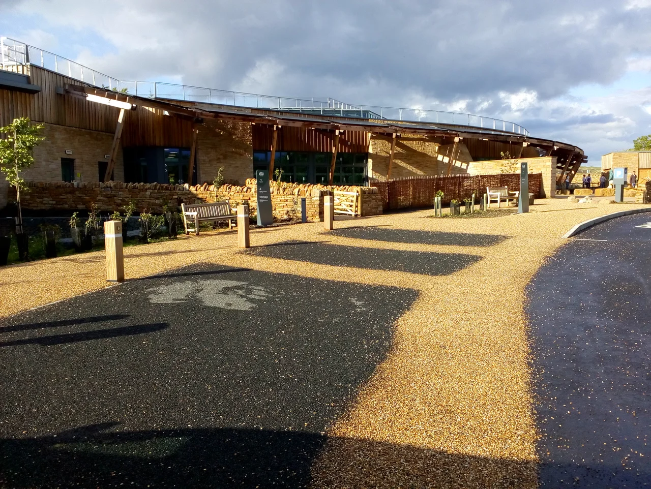
For decades the YHA youth hostel at Once Brewed was a low, modest building that did its job and not much more. In 2015 it closed for demolition. In 2017 it reopened as The Sill, a striking modern building with a turf roof that slopes seamlessly into the surrounding moorland, designed to echo the Whin Sill geology that gives the place its name. Prince Charles, now King Charles III, opened it officially in 2018. The Sill is part visitor centre for Northumberland National Park, part youth hostel, part café, part exhibition space. The grass roof has become an attraction in itself, a kind of building-as-landscape. Walkers on the Hadrian's Wall Path and the Pennine Way still sleep here, as walkers have for nearly a century, but they wake now under solar panels and timber rather than under corrugated tin.
Vanished Villages
Eighteenth-century maps of Northumberland show two other settlements that have since disappeared. Iverton appears in probate records as late as the 1830s and was probably either coextensive with Twice Brewed or right next to it. The historian R. G. Collingwood, writing in 1921, identified it with a 'ruined farm half a mile west of Chesterholm,' which would put it on or near Once Brewed itself. Forsten, another lost village, sat just across Bradley Burn. Both names dissolved gradually into the older landscape; Once Brewed and Twice Brewed somehow held on, perhaps because the inn refused to let its name die. In a country where so many small places have vanished into the maps, the persistence of a settlement named entirely for its beer is a small triumph of marketing.
From the Air
Coordinates: 55.001°N, 2.385°W. Recommended viewing altitude 2,000-4,000 ft AGL for the dramatic ridge views. The Whin Sill cliff line carrying Hadrian's Wall runs immediately to the north; the B6318 Military Road threads east-west through the village. The Sill visitor centre with its distinctive sloping turf roof is the obvious landmark. Northumberland National Park airspace. Nearest airports: Newcastle (EGNT) approximately 24 nm east-southeast, Carlisle Lake District (EGNC) approximately 24 nm west-southwest.
Nearby Stories
- Bishop Auckland 5.1 km away
- Battle of Newburn 5.8 km away
- Battle of Otterburn 7.4 km away
- Siege of Carlisle (1315) 8.8 km away
- Ullswater 12 km away
- Cresswell Lifeboat Station 15 km away
- Brough, Cumbria 16 km away
- Battle of Philiphaugh 39 km away