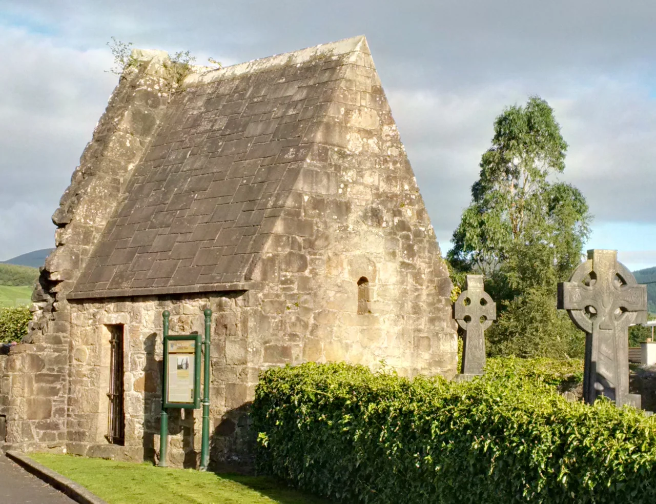
,_St._Molua%27s_Church_(3).jpg)
Killaloe
The bridge has thirteen arches and no place for two cars to pass. Traffic between Killaloe in County Clare and Ballina across the river in County Tipperary moves under signal control, one direction at a time, the way it has since 1825. Floods used to take the bridges here in every generation. This one has held. Below, the River Shannon slides slow and dark out of Lough Derg toward the Atlantic, three hundred kilometres south. Above, on the Clare bank, the road climbs past the cathedral toward a low earthwork mound that is, by local tradition, the birthplace of the High King who broke the Vikings at Clontarf.
Brian Boru's River
Brian Boru was born here in 941, give or take. He rose through the dynasties of Munster, took the High Kingship of Ireland in 1002, and spent the rest of his life at war with one province or another. At the Battle of Clontarf in 1014 his Munster forces broke the alliance of Leinster and the Dublin Vikings - Brian was killed in the fighting, but his O'Brien dynasty went on to dominate Ireland for centuries. The earthwork fort above Killaloe is a Neolithic mound that the O'Briens reinforced in the eleventh century. Until the Shannon's level rose in 1930, cattle could be forded across at this point, and a toll - boruma - was charged on every crossing. That toll, some say, gave Brian his nickname.
The Shannon's Stubborn Drop
Above Killaloe the Shannon runs almost flat through three great lakes - Lough Allen, Lough Ree, and the long sprawl of Lough Derg. Below the village, the river turns serious: thirty metres of fall in twenty kilometres, with waterfalls, all the way to the tidal estuary at Limerick. That drop was the missing link in Ireland's inland navigation. The Grand and Royal Canals had been cut at huge expense from Dublin all the way to the upper Shannon by the early 1800s, but boats stopped at Killaloe-Ballina until 1799, when a canal and lock system finally opened the lower stretch. The twin towns became river ports. Trade boomed for half a century, then died abruptly when the railways arrived in the 1850s. The lower river was dammed in 1930 to feed the Ardnacrusha hydroelectric station near Limerick - an engineering project that brought electricity to rural Ireland and rewrote the river forever.
Cromwell at Ballina
The Shannon has always been a barrier as much as a road. In 1650 Cromwell's army was held up at Ballina for ten days, casting about for a way across to take Limerick. The cathedrals on the Killaloe side, the Catholic St Flannan's and the older Church of Ireland building, both date to the cusp of medieval and modern Ireland. Tuamgraney, upstream, has St Cronan's - Ireland's oldest church in continuous use, its tenth-century walls still standing where its round tower no longer does. Two kilometres east of the village a remnant of the primordial oak forest of Suidain survives. Brian Boru's Oak Tree, the locals call one of the older specimens, and it may genuinely be a thousand years old. The writer Edna O'Brien was born in Tuamgraney in 1930. Her early novels were denounced from the pulpit so vigorously that her career was practically sponsored by the controversy.
Between the Waters
The canal runs parallel to the Shannon on the western side here, and the narrow island of land caught between them carries the name Between the Waters - a farmer's market every Sunday, walking paths, the slow rituals of small-town Ireland. Boat trips into Lough Derg sail out of Killaloe between April and September. The Lough Derg Way, sixty-four kilometres long, traces the river up from Limerick through O'Brien's Bridge, past Killaloe and Ballina, then north along the lake's eastern bank to Dromineer. East of the water rises Tountinna, at 532 metres the highest point in County Clare and a contender for Ireland's boggiest hilltop - the path is now laid with shale shards, which is what passes for civilisation on a Clare summit. In December 2024 a new bridge opened a kilometre south to take pressure off the old thirteen-arch span. Both still stand. The old one carries the photographs.
From the Air
Killaloe sits at 52.80 N, 8.45 W on the west bank of the River Shannon at the southern outflow of Lough Derg, in County Clare. Shannon Airport (EINN) lies about 25 km south-west, Limerick city about 20 km south. Approaching from the east, the long silver thread of Lough Derg is the unmistakable visual landmark - around twenty-five kilometres long, narrowing to a point at Killaloe. The thirteen-arch bridge connects to Ballina on the Tipperary bank. Best viewed in oblique afternoon light when the river catches the sun and the wooded hills above the lake throw shadow. Atlantic weather systems track in from the west; visibility windows are often short.
Nearby Stories
- 2003 Derrybrien Landslide 0.8 km away
- Croom Castle 8.6 km away
- The Burren 9.7 km away
- Birr Castle 11 km away
- Bansha 12 km away
- Cloughjordan 14 km away
- Ennistymon 17 km away
- Abbeyfeale 23 km away