.jpg)
Kilmainham
Dig anywhere in Kilmainham and you hit history. In the nineteenth and twentieth centuries, when navvies cut railway lines through the slopes above the Liffey, when gravel quarries opened, when the Irish National War Memorial Gardens were graded for planting, the spades came up with bones. Dozens of pagan burials, each one wrapped around the personal grave goods a Viking warrior expected to need in the next world. Taken together with finds at Islandbridge across the river, this is the largest known Viking cemetery in western Europe outside Scandinavia. The dead have been there since the ninth century, waiting for someone to need a railway, or a war memorial, before introducing themselves.
St Maighneann's Church
The place takes its name from Cell Maignenn - in modern Irish, Cill Mhaighneann, meaning the church of Saint Maighneann - a Christian monastery established by the year 606 on the ridge of land where the River Camac meets the Liffey. By 795 the ecclesiastical site may still have been the only substantial structure along the Liffey's banks, a small community of monks praying on a low hill above the marshes. Around the same time someone in Kilmainham lost or buried a magnificent piece of jewellery: the Kilmainham Brooch, an early Celtic penannular brooch (so called because its ring is incomplete), unearthed in the area centuries later. The brooch and the bones are roughly contemporary, two strands of the same moment - native Christian gold and Viking pagan iron, sharing a few muddy acres above the river.
Sitric, Niall, and a Battle
The Vikings settled Dublin from 841, and Kilmainham was one of a string of villages that stretched up the riverbank to Clondalkin. They did not always remain peacefully. In 919 the Battle of Islandbridge was fought near here between Viking forces under Sitric Caech and Gaelic Irish forces led by the high king Niall Glundub. The high king lost. Niall was killed in the fighting and the Norse held their grip on Dublin for another century. In 1013 Murchad, son of Brian Boru, raided into Leinster as far as Kilmainham, a final flare-up of the wars that would climax the following year at Clontarf. The Norman invasion of the late twelfth century rewrote everything again: the lands along the Liffey were granted to the Knights Hospitaller (the Knights of St John of Jerusalem), and Strongbow built them a castle about two kilometres west of the old Danish wall of Dublin. The Knights held the land until the dissolution of the monasteries in the sixteenth century.
Royal Hospital, Old Soldiers' Home
Where the Knights Hospitaller had their priory, the Royal Hospital Kilmainham now stands - a vast classical building completed in 1684 on the model of Les Invalides in Paris, originally a retirement home for elderly and wounded soldiers of the British army in Ireland. The arched, pedestrianised avenue leading up to it ends at the Richmond Tower, marking the junction with the South Circular Road. The building survived the loss of empire by being given a new life: in 1991 it reopened as the Irish Museum of Modern Art (IMMA), and the long colonnaded courtyards, once the parade ground of veteran soldiers, now host contemporary exhibitions. Until the time of Queen Elizabeth, the Lord Lieutenants of Ireland often held court at the manor of Kilmainham, in the days before Dublin Castle became the seat of English power. In 1559 the Lord Lieutenant Thomas Radclyffe found the buildings here storm-damaged and had to hold court at the palace of St Sepulchre instead, and the following year the queen ordered Dublin Castle upgraded. Kilmainham slipped quietly out of fashion.
The Gaol
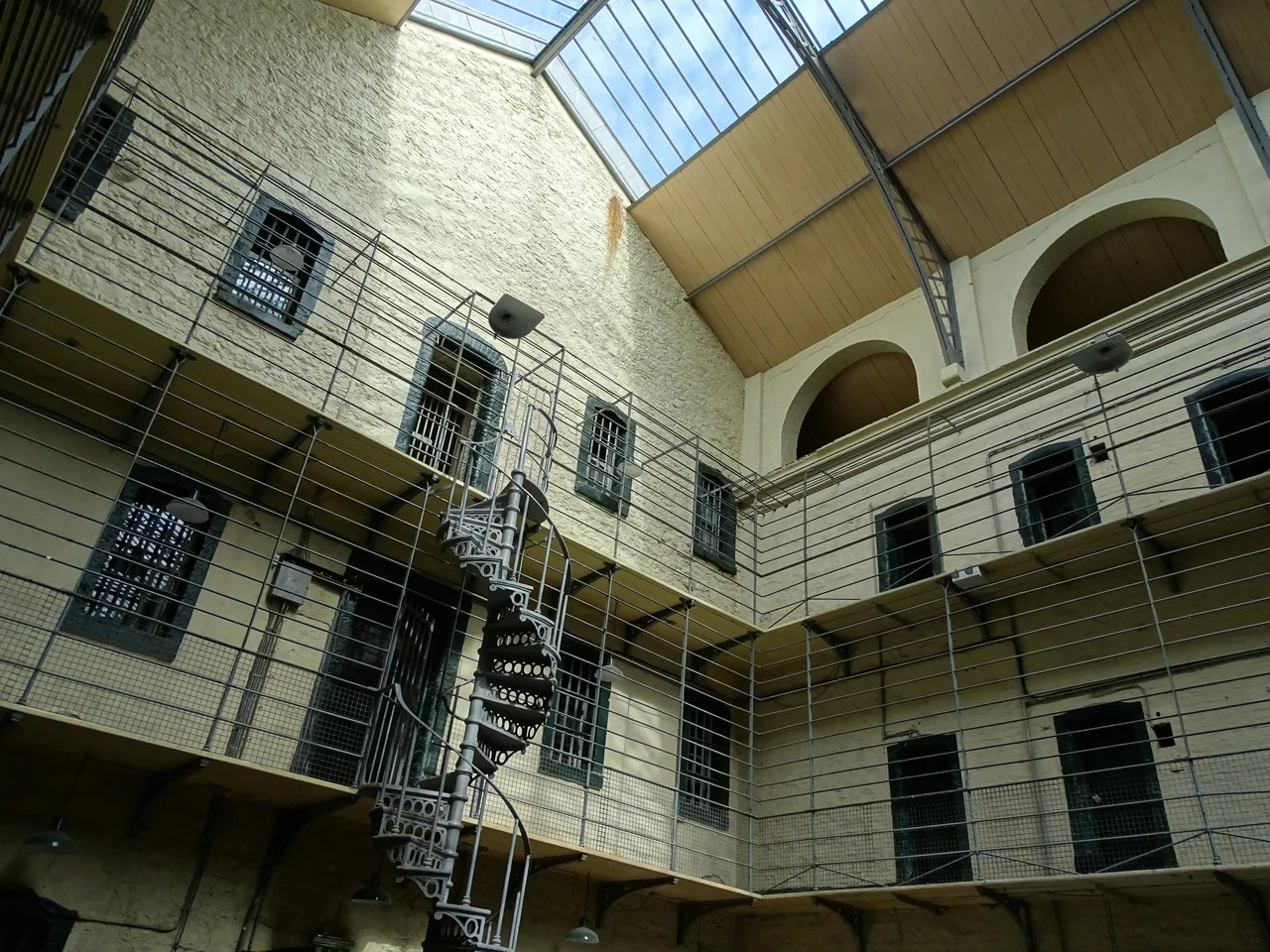
A short walk from the Royal Hospital stands Kilmainham Gaol, opened in 1796. Among its inmates over the years were Robert Emmet, the Young Irelanders, the Fenians, the Land League leaders, Charles Stewart Parnell, Eamon de Valera. The gaol is most associated with the executions that took place in its Stonebreakers Yard between 3 and 12 May 1916, when fourteen of the leaders of the Easter Rising were shot by firing squad: Patrick Pearse first, on the third; Thomas Clarke, Thomas MacDonagh on the same morning; Joseph Plunkett, who had married Grace Gifford by candlelight in the prison chapel the night before; Sean MacDermott; James Connolly, so badly wounded he was strapped into a chair to be shot. The executions transformed Irish public opinion almost overnight. The gaol closed in 1924 and was preserved as a museum. Walking through it today is one of the harder experiences a Dublin tourist can have, and a necessary one.
Memorial Gardens
Just along the riverbank from the gaol, where the gravel quarries once exposed Viking bones, the Irish National War Memorial Gardens commemorate the 49,400 Irish soldiers who died fighting in the British forces during the First World War. Designed by Edwin Lutyens - the same Lutyens who rebuilt Howth Castle - and completed in 1939, the gardens feature granite fountains, sunken rose gardens, and a great limestone altar inscribed simply with names. For decades after independence the site was politically inconvenient and quietly neglected. It was restored in the 1980s and reopened to the public, an acknowledgement that Irish history is not single-stranded. The River Camac still threads through Kilmainham, crossed by small bridges at the South Circular Road, Rowserstown Lane and Bow Lane. The dead share the soil with the living, the layers stacked one on the next like the strata of a city that has been here, in one form or another, since before the year 600.
From the Air
Kilmainham lies on the south bank of the Liffey at approximately 53.342 degrees N, 6.308 degrees W, immediately west of Dublin city centre. From altitude the precinct is identifiable as the large green block formed by the Phoenix Park to the north of the river, with the Royal Hospital Kilmainham and its long pedestrian avenue visible on the south bank. Dublin Heuston railway station sits at the eastern edge. Dublin Airport (EIDW) lies about 10 km north-east; Weston (EIWT) sits a few kilometres west. The Liffey makes the most useful navigation line.
Nearby Stories
- Wicklow Mountains 12 km away
- Mornington 14 km away
- German submarine U-1051 16 km away
- Abbey of Kells 18 km away
- Irish Military Intelligence Service 20 km away
- HMS Manners (K568) 37 km away
- Templemore 42 km away
- Irish Sea Bridge 43 km away