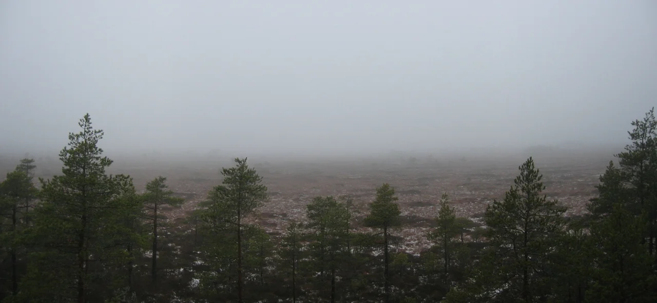

Kurjenrahka National Park
A raised bog is a landscape that has climbed out of reach of its own water supply. Sphagnum moss keeps growing on top of its own dead layers, the peat thickens to several metres, and eventually the whole dome stands high enough above the surrounding land that nothing reaches it except rain. Rain carries almost no nutrients. That is the trick: the bog engineers itself into poverty, and then a very specific set of species moves into the poverty and thrives. Kurjenrahka, the bog at the centre of this national park thirty-five kilometres north of Turku, is named for the birds that patrol it. Kurki is a crane, and rahka is the bog itself.
How a Bog Builds Itself
The dome does not rise evenly, which is the interesting part. As the moss creates its own conditions, wetter and drier patches feed back on each other, and the surface differentiates into hummocks and hollows and pools, each supporting a different set of plants. Much of Kurjenrahka is forested bog, with a transitional fringe of thin, stunted trees where the ground turns wetter; step onto the open expanse and the trees give up entirely. Around the edges, where water runs off the neighbouring hills and into the margin, there is a wetland of an entirely different character, fed by mineral-rich ground water rather than rain, and carrying a flora that has nothing in common with the dome above it. The park holds two lakes of its own and several bogs besides Kurjenrahka: Lammenrahka, Vajosuo, Laidassuo, Lakjärvenrahka.
Where Eight Parishes Met
This land emerged from the Ancylus Lake stage of the Baltic roughly seven thousand years ago, and people have left traces on it ever since; there are finds at Saksala from the Stone, Bronze and Iron Ages. The place that gathers the human history is a boundary marker called Kuhankuono, which first appears in a document of 1381, listed in a catalogue of border points between the parishes of Masku and Nousiainen. It marked the meeting point of parish edges, eight of them in the old arrangement, and the modern park still straddles seven municipalities. What all those boundaries met at was commons: shared land, used by everyone whose farm bordered it, and much of the forest around the park is still administered as common land today. Permanent farms appeared from the eighteenth century. Forestry happened here, but mildly, because getting timber out of a bog country was more trouble than it was worth.
Slow to Save
Protection came in instalments, and never quickly. In 1958 a decision was taken to leave Pukkipalo as old-growth forest, and it survives as the most impressive ancient woodland in the province, thick with big trees and with the standing and fallen deadwood that a working forest never accumulates. A decision to establish a national park followed in 1976, but buying the land from its many owners took two decades. The law finally passed on 19 December 1997, and the park came into being at the start of 1998, roughly thirty square kilometres assembled largely out of former common land. In 2024 it drew 66,800 visitors, which for a park with no staffed visitor centre is a substantial number. The information hut at Kurjenpesä is unmanned and open from eight in the morning until eight at night, and the arrangement works.
Duckboards, Towers and Cloudberries
Walking a bog means walking on planks. Duckboards carry the trails across the wet ground, and in spring, when the snow goes, some of them disappear under standing water. The Kuhankuono network and the Suokulla route together offer around 300 kilometres of marked trail, ranging from the wheelchair-accessible Karpalopolku loop of 1.7 kilometres to multi-day circuits of fifty kilometres and more. Bird towers at Vajosuo and at Koivusaari on the eastern edge of Kurjenrahka put you above the open bog without putting you on it. Savojärvi, 124 hectares of dark water with 64 of them inside the park, has swimming jetties and a wood-fired self-service sauna at Rantapiha. Berry season runs long: bilberries in July, lingonberries into September, and out on the peat the two prizes, cloudberries turning yellow in August and cranberries best after the first hard frost has taken the sharpness out of them.
The Seasons Nobody Books
Restricted zones close parts of the park to off-trail travel while the birds are nesting, from mid-April to mid-July, and Lammenrahka from mid-January. This inconveniences almost nobody, since crossing an open bog in summer is exhausting work at the best of times. Winter inverts the whole place. Snow lies from late December into March, considerably longer than in Turku just down the road, and ski tracks are cut straight across the frozen bogs, turning the hardest ground in the park into the easiest. Wolves and bears live in this landscape, and you would be fortunate to find even a footprint; no attack on a person has been recorded here. The animal you will actually meet, in numbers that make long sleeves a serious recommendation, is the mosquito.
From the Air
60.7206 N, 22.3836 E, about 35 km north of Turku in the interior of Finland Proper. From the air the park reads as a mosaic: pale open bog domes ringed by darker forested hills, with the dark water of Savojärvi and the smaller lakes giving the clearest fixes. Regional road 204 between Turku and Säkylä clips the eastern edge at the Kuhankuono entrance and makes a reliable run-in line. Turku Airport (EFTU) is roughly 30 km south-southwest; Pori Airport (EFPO) lies about 80 km to the northwest. A viewing altitude of 2,000 to 4,000 feet AGL shows the bog and forest pattern best. Late spring and autumn give the strongest colour contrast between peat and forest; in deep winter the bogs and the frozen lakes flatten into a single white sheet.
Nearby Stories
- University of Turku 2.7 km away
- Sarka (museum) 14 km away
- Sammallahdenmäki: Graves Built for a Shoreline That Left 14 km away
- Halikko Church 14 km away
- Köyliönjärvi 16 km away
- Valmet Automotive 21 km away
- Sastamala 39 km away
- Archipelago Sea 48 km away