The Laguna de Santa Rosa: Sonoma County's Hidden Sea
Do not eat the black bass. That advisory, issued by the California Office of Environmental Health Hazard Assessment, is perhaps the strangest introduction to a place the Ramsar Convention has designated a wetland of international importance. The Laguna de Santa Rosa is both things at once -- a 22-mile ribbon of marshes, floodplains, and vernal pools that drains a 254-square-mile watershed across the Santa Rosa Plain, and the most impaired water body on California's entire North Coast, listed under the Clean Water Act for six separate pollutants. More than 200 species of birds rest, feed, and nest here along the Pacific Flyway. Endangered coho salmon and steelhead trout still swim its tributaries to spawn. Bald eagles, golden eagles, and osprey hunt its waters. The Laguna is a paradox written in water: degraded and extraordinary, poisoned and teeming with life.
An Ocean's Memory
The land beneath the Laguna remembers a time when none of this was land at all. As recently as the Miocene period, the entire Santa Rosa Plain lay submerged beneath the Pacific Ocean. Around twelve million years ago, volcanic eruptions and tectonic uplift thrust the Mayacamas and Sonoma Mountains skyward to the east, draining the sea and establishing the broad, flat basin that exists today. Millions of years of erosion carved those mountains into the rich alluvial soils of the plain, while the western hills -- lower, gentler -- contributed far less sediment. The result is a landscape tilted toward a central depression where water collects naturally, flowing through dark gray Clear Lake clay soils that drain poorly and hold moisture like a sponge. The Laguna's topography is almost perfectly flat, with slopes of zero to two percent, which means that when winter rains arrive, water does not rush through. It spreads. The floodplain swells to resemble a chain of shallow lakes, storing over 80,000 acre-feet of stormwater before slowly releasing it into Mark West Creek.
A Century of Wounds
In 1833, the first Mexican land grant carved up the Laguna's watershed for ranching. By 1870, the railroad had arrived, bringing channelization and intensive agriculture. What followed was more than a century of ecological decline. The cities along the US-101 corridor -- Santa Rosa, Rohnert Park, Cotati, Sebastopol -- treated the Laguna as a convenient drain. For decades, it received untreated sewage from surrounding communities. Farms encroached on the floodplain, replacing riparian forest with pasture and row crops. By the 1960s, the vast eastern plain had been almost entirely converted, and the once-rich run of 1.6 million anadromous fish had virtually collapsed. By 1989, over 92 percent of the Laguna's historic riparian habitat had been lost. Water quality had reached critically poor levels. Mercury, PCBs, nitrogen, phosphorus, excess sediment, elevated temperatures, and depleted oxygen -- the Laguna carried them all, earning more Clean Water Act impairment listings than any other waterway on the North Coast.
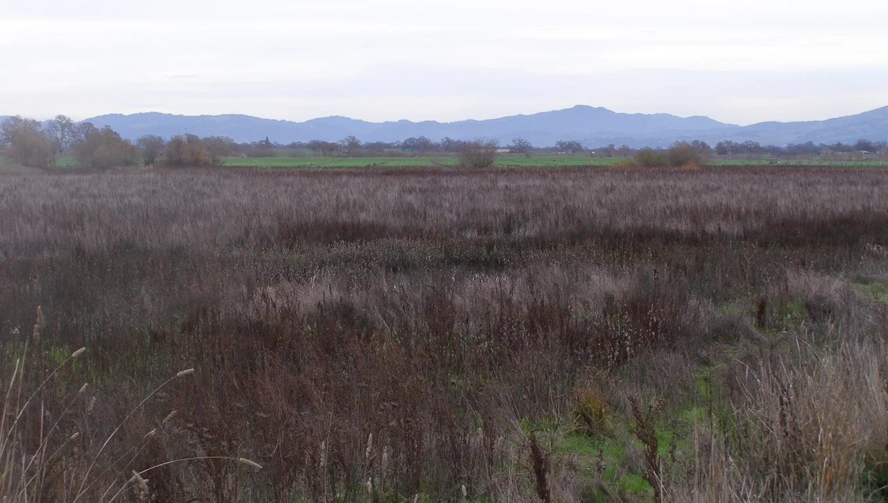
What Refuses to Disappear
Despite everything, the Laguna's biology is staggering. The wetland complex remains the most biologically diverse area in all of Sonoma County, a place scientists have called a 'national treasure.' California tiger salamanders breed in its vernal pools -- those ephemeral puddles that appear on the floodplain each winter and vanish by summer, supporting species found nowhere else. The California freshwater shrimp, a creature so rare it carries federal endangered status, lives here. Sebastopol meadowfoam, a small white flower endemic to this specific stretch of Sonoma County, grows in the wet grasslands and exists in no other place on Earth. Along the waterways, great blue herons stand motionless in the shallows while burrowing owls watch from the oak savanna above. Black-necked stilts pick through the mud on improbably long legs. In migration season, the sky fills with Canada geese, turkey vultures, and American kestrels. The Laguna sits on the Pacific Flyway, and the birds know it even when the water quality reports suggest they should not.
Turning the Current
The turnaround began in 1989 with the founding of the Laguna de Santa Rosa Foundation, a nonprofit that set out to reverse more than a century of neglect. Progress came slowly and from multiple directions. Santa Rosa upgraded its wastewater treatment to tertiary levels and began reusing treated effluent for hay farming rather than dumping it into the Laguna -- a system now considered one of the most progressive in the nation. The Foundation published a comprehensive restoration plan in 2006, funded by the California Coastal Conservancy and developed with hundreds of stakeholders. Ecological restoration projects rebuilt pockets of riparian habitat. Education programs brought schoolchildren to the water's edge. Then, on February 2, 2011, the recognition that mattered most arrived: the Ramsar Convention on Wetlands designated 3,894 acres of the Laguna as a wetland of international importance. The designation took effect on April 16, 2011, placing the Laguna in the company of the Everglades and the Danube Delta. For a waterway that had spent a century as a dumping ground, the recognition was less a trophy than a challenge -- an acknowledgment that what remains is worth fighting for, and that the fight is far from over.
From the Air
The Laguna de Santa Rosa is visible as a winding wetland corridor at approximately 38.47N, 122.84W, stretching roughly 22 miles through the Santa Rosa Plain in Sonoma County. From altitude, the Laguna appears as a sinuous green-brown ribbon paralleling US-101 between Cotati to the south and Forestville to the north. In winter, the floodplain expands dramatically and can resemble a chain of shallow lakes. The nearest airport is Charles M. Schulz - Sonoma County Airport (KSTS), approximately 5 nautical miles to the northeast. The Mayacamas and Sonoma Mountains are visible to the east. Best viewed at 2,000-5,000 feet AGL, when the wetland's serpentine course and surrounding agricultural mosaic are clearly distinguishable.
Nearby Stories
- The Bottle That Humbled France 1.8 km away
- The Bay on the Fault Line 2.9 km away
- Dry Creek Rancheria Band of Pomo Indians 3.6 km away
- The Sea Ranch 6.8 km away
- The Cipher at the Crosshairs 7.7 km away
- Yocha Dehe Wintun Nation 20 km away
- Gualala River 42 km away
- ʻAkaka Falls State Park 3668 km away