The Drowned City Beneath Bandung
The city floods every rainy season, and nobody can quite fix it. Bandung's southern suburbs sit in a bowl -- a broad, flat expanse of paddy fields, factories, and housing developments that fills with water when the Citarum River overwhelms its banks. Engineers have studied the problem for decades. But the explanation is not modern drainage or urban planning. It is geological, and it is ancient. Bandung was built on the floor of a lake. For over a hundred thousand years, from roughly 126,000 to 20,000 BCE, water covered this basin -- a vast inland sea created when the eruption of Mount Sunda blocked the river that drained it. The lake is gone. The evidence is everywhere.
When the Sea Became a Mountain
The story begins long before the lake, in the Miocene period, when northern Bandung lay beneath the ocean. Coral fossils embedded in the Rajamandala ridge prove it -- reefs that are now quarried as limestone and marble, ancient marine organisms locked in stone on a highland plateau. Between fourteen and two million years ago, tectonic forces pushed the seabed upward, transforming ocean floor into mountain range. Volcanic activity carved hills running north and south between present-day Bandung and Cimahi. Then, roughly two million years ago, the volcanism shifted northward and built Mount Sunda, an enormous stratovolcano estimated to have reached 3,000 meters -- far higher than anything in the area today. Its remnants survive as ridges and as the volatile Mount Tangkuban Perahu, whose name means "overturned boat" in Sundanese. When Mount Sunda erupted catastrophically, the debris blocked the Citarum River. Water backed up across the lowlands. The Bandung basin became a lake.
A Basin Shaped by Fire
The Bandung basin is an ellipse measuring sixty kilometers east to west and forty kilometers north to south, stretching from Padalarang in the west to Nagreg in the east. Mount Tangkuban Perahu forms its northern wall; Mount Malabar anchors the south. Volcanic domes from the Quaternary period ring most of the perimeter, with only the western portions dating to the older Neogene. The basin floor, where roughly three million people now live, consists of deep sedimentary deposits laid down over millennia of lake accumulation. Researchers have drilled into these deposits at two sites -- sixty meters deep at Bojongsoang and one hundred four meters at Sukamanah -- and used carbon-14 and uranium-thorium dating to confirm their age. The sediment layers tell a story of alternating wet and dry periods, of a lake that grew and shrank with the climate, and of a basin that was, for geological stretches of time, entirely submerged.
Stone Tools at the Waterline
People lived around the lake. Archaeological surveys around Padalarang have uncovered obsidian stone tools -- sharp, volcanic glass implements that early humans fashioned for cutting and scraping. Every one of these tools was found at elevations above 700 meters, which suggests a crucial detail: the lake's surface once reached approximately that height. Below 700 meters, no tools. Above it, the lakeshore communities left their mark. The obsidian itself likely came from the volcanic terrain surrounding the basin, readily available material for people who lived by water rich in fish and surrounded by forests that provided game. The tools are not precisely dated, but their distribution paints a picture of sustained habitation along a stable shoreline -- communities that thrived on the edge of a body of water large enough to shape their entire world.
Sangkuriang's Overturned Boat
The Sundanese people remember the lake, though they remember it as legend. The story of Sangkuriang is one of the most enduring myths in West Java. In it, a young man falls in love with a woman who turns out to be his own mother. She sets him an impossible task to prevent the marriage: dam the Citarum River and build a boat, both before dawn. Sangkuriang nearly succeeds through supernatural means, but his mother tricks him by creating the illusion of sunrise. In his rage, he kicks the unfinished boat upside down, and it becomes Mount Tangkuban Perahu -- the overturned boat. The dammed river, in the myth, is the origin of the lake. Scholars have noted that the legend may encode a collective memory of real geological events: the volcanic eruption that blocked the Citarum, the lake that formed behind the natural dam, and the mountain whose shape genuinely resembles an inverted hull. Oral traditions preserved in the Pantun Sunda -- Sundanese narrative poetry passed down through generations of performers -- kept the memory of the lake alive long after it drained, long after anyone could have known what lay beneath the rice paddies and the city streets.
From the Air
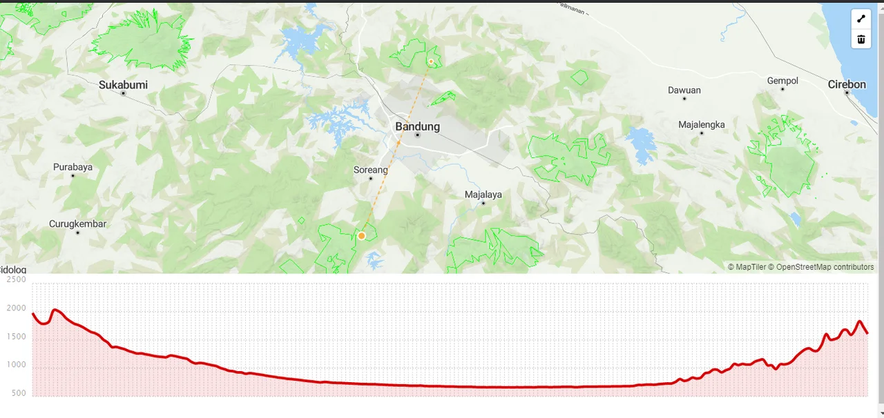
The former Lake Bandung occupies the Bandung basin at approximately 6.924S, 107.606E, a broad elliptical lowland roughly 60 km east-west and 40 km north-south. From the air, the basin is clearly visible as a flat urban and agricultural expanse surrounded by volcanic peaks -- Mount Tangkuban Perahu (2,084 m) to the north and Mount Malabar (2,343 m) to the south. The basin floor sits at approximately 700 meters elevation. Nearest airport is Husein Sastranegara International Airport (WICC) in western Bandung. Kertajati International Airport (WIIA) is approximately 70 km east.
Nearby Stories
- Citarum River 11 km away
- The Double Life of Cirahong Bridge 15 km away
- Gunung Padang: Java's Stairway to the Ancient World 20 km away
- Battle of Kalijati 20 km away
- Kraton Kacirebonan 40 km away
- The Inscribed Stone of Pakuan 47 km away
- The Islands That Vanished from Sight 253 km away
- SIEV X 347 km away