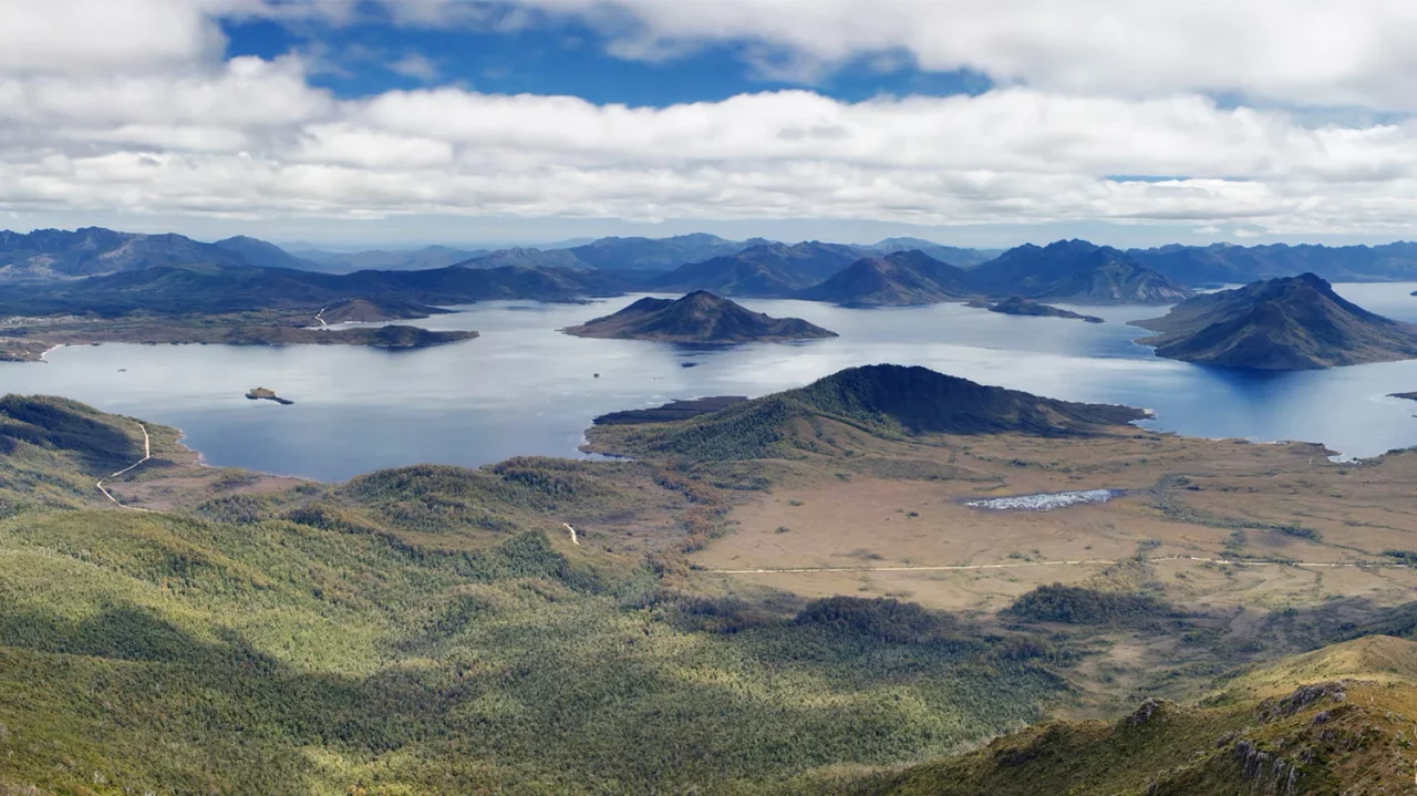

Lake Pedder
The beach was pink. A wide curve of quartzite sand, nearly a kilometre across and three kilometres long, glowed rose-coloured at the heart of the Tasmanian wilderness, ringed by jagged mountains and reachable only on foot or by small plane. That was the old Lake Pedder, a glacial lake unlike anywhere else on the island. In 1972 it vanished. The Hydro-Electric Commission dammed two rivers, and the rising water swallowed the lake, the beach, and a stretch of wild country whole. What floods the valley today is far larger, and it is not the same place at all.
The Lake That Was
Nothing about the original Lake Pedder was ordinary. It was a glacial outwash lake of about ten square kilometres in the remote southwest, named in the early twentieth century for John Pedder, the first chief justice of Tasmania. Its defining feature was that astonishing beach, a sheet of bright pink quartzite sand sitting some 300 metres above sea level, a splash of warm colour against the grey peaks and dark moorland of one of the most rugged landscapes in Australia. People came to walk it. Light aircraft landed on the firm sand. To those who saw it, the beach was not scenery but something closer to a wonder, and the memory of it would outlast the lake itself.
Electric Eric and the Blank Cheque
The decision to drown it was a political brawl. In 1967 the Tasmanian government stripped away the national park status that had protected the lake since 1955, clearing the way for the dams. Premier Eric Reece backed the Hydro-Electric Commission so fiercely that he earned the nickname "Electric Eric," and he would not be moved. When Prime Minister Gough Whitlam offered a blank cheque from the federal government to save the lake, Reece refused it outright, declaring he would not have Canberra interfering with the sovereign rights of Tasmania. Three dams went up, the Serpentine and Scotts Peak among them, and in 1972 the flooding proceeded over the objections of a determined and growing protest movement.
A Cause Worth Dying For
The fight to save Pedder cost lives and gave a movement its shape. The nature photographer Olegas Truchanas had captured the lake in colour slides, and when they were shown in Hobart set to the music of Sibelius, people are said to have wept and left the hall in tears. In 1972 the Christian activist Brenda Hean and the pilot Max Price flew a Tiger Moth biplane toward Canberra to skywrite a plea for the lake; they were never seen again, and it was alleged that someone had broken into the hangar and put sugar in a fuel tank. Out of this grief came the United Tasmania Group, now recognised as the world's first green party, and the activism that would later save the Franklin River.
What the Water Took
Some losses cannot be undone. When the lake filled, it carried species into extinction. The Lake Pedder earthworm, known from a single specimen gathered on that pink beach in 1971, was never found again and now sits on the IUCN's list of extinct species. The Pedder galaxias, a small native fish, vanished from its only wild home and survives today only in captivity and in two transplanted populations elsewhere in Tasmania. To some who fought for the lake, the official name itself is a wound; they refuse to call the reservoir Lake Pedder at all, preferring the Huon-Serpentine Impoundment, while bushwalkers mutter a blunter name, "Fake Pedder." A restoration committee still dreams of draining the dam and letting the pink beach surface again.
From the Air
Lake Pedder lies in the remote southwest of Tasmania at approximately 42.93°S, 146.13°E, within the Tasmanian Wilderness World Heritage Area. From the air the modern impoundment is a large, irregular expanse of dark water set among rugged, sparsely vegetated ranges, with the Frankland Range to the north and the dam walls at Scotts Peak and Serpentine marking its edges; the surrounding country is wild and almost roadless. Recommended viewing altitude is FL100 to FL180, weather permitting, though this region is notorious for fast-changing oceanic conditions, low cloud, and strong westerly winds straight off the Southern Ocean. The nearest sizeable airport is Hobart International (ICAO YMHB) to the east. There is no nearby controlled airfield over the wilderness itself; pilots should treat the area as remote terrain. Clear flying days are uncommon, and the lake's dark water against pale ranges makes a strong navigation reference when visibility allows.
Nearby Stories
- Macquarie Harbour Penal Station 37 km away
- Mount Field National Park 43 km away
- Mount Wellington (Tasmania) 52 km away
- Bruny Island 57 km away
- Macquarie Harbour 78 km away
- Van Diemen's Land 86 km away
- 2003 Fiordland Earthquake 1671 km away
- Chatham Islands 3037 km away