
Macquarie Harbour
Here is a harbour where the tide does not answer to the moon. Macquarie Harbour is so vast and so nearly sealed off from the ocean, fed by rivers pouring down from the mountains and pinched at its mouth into a channel barely wide enough for a ship, that its water level rises and falls with the weather instead. When rain hammers the ranges, the harbour swells. When the pressure lifts and the rain eases, it drops. Scientists call them barometric tides, and they belong almost nowhere else on Earth. This is the strange, brooding heart of Tasmania's west coast: a shallow fjord of some 315 square kilometres, stained the colour of strong tea, where almost everything that has ever happened on this coast eventually passed through.
Hell's Gates
The only way in from the Southern Ocean is a channel so narrow and so violent that the convicts who were shipped through it called it Hell's Gates, and the name has never been improved upon. The harbour drowns an enormous volume of fresh water, gathered from the King and Gordon Rivers and the wild country of the West Coast Range, and forces it all out through this single slot. The result is hazardous tidal currents and a bar that has wrecked ships and tested every sailor who attempted it. A man-made rock wall now hugs the outside of the channel's curve, holding the passage deep and narrow rather than letting it silt up wide and shallow. Beyond the gates lie Macquarie Heads and, at the westernmost edge, Cape Sorell, where the swell of the open ocean finally meets the land.
The Whale-Road
In December 1815, the sealer and explorer James Kelly is said to have rowed a small five-oared whaleboat out of Hobart and become one of the first Europeans to find this harbour, though the records argue over the exact date. He named it for Lachlan Macquarie, the Scottish-born governor of New South Wales. Two centuries later, the harbour wrote its saddest modern chapter. In September 2020, more than 450 long-finned pilot whales stranded on the sandbars and shallows near the entrance, the worst mass stranding in Australian history. Rescuers worked for days in the cold water and freed around 110 of the animals. Around 350 did not survive. The harbour that had swallowed convict ships now drew the whales into water they could not read, and the people who came to help could save only a fraction.
A Harbour Put to Work
Macquarie Harbour has rarely been left alone. Its first European settlement was the penal station on Sarah Island, chosen for an isolation so complete it amounted to a sentence in itself. Later the small port of Strahan rose on its northern shore to serve the mines inland, and a second port and the town of Pillinger flickered briefly to life at Kelly Basin before fading back into the bush. The harbour paid for this industry. For most of the twentieth century the Mount Lyell copper mine flushed its waste into the King and Queen Rivers, and an estimated hundred million tonnes of tailings poured downstream before the mine closed in 1994. Cleanup programs followed, and the rivers slowly began to recover, but the harbour still carries the memory of what was put into it.
Salmon, Skates, and the Future
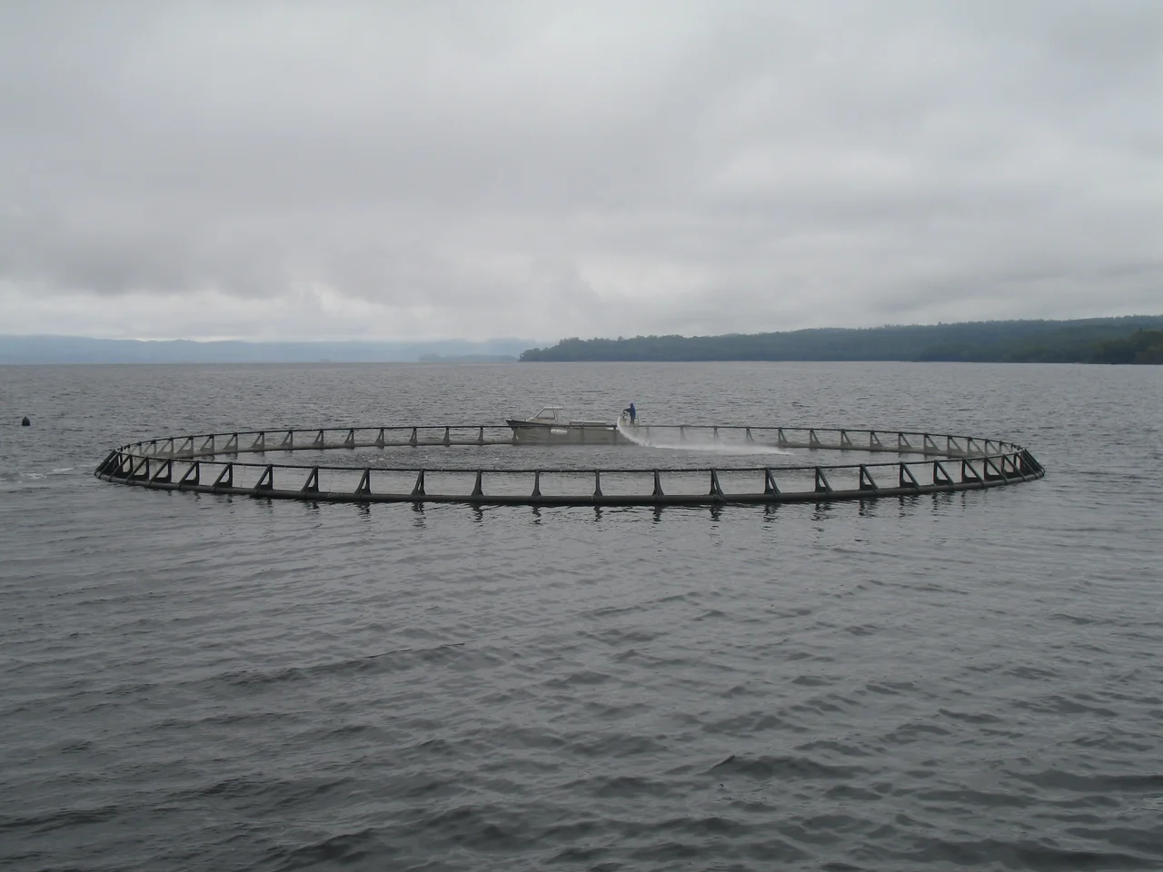
The newest pressure swims in pens. Salmon farming arrived in the 1980s and expanded fast in the new century, until the crowded pens stripped oxygen from the deep water and created dead zones on the harbour floor, and mass fish kills forced regulators to cut back stocking. The stakes are higher than they look, because hidden in these dark depths lives the Maugean skate, an ancient ray-like fish found nowhere else on the planet, surviving on the dissolved oxygen the harbour's quirks allow it. Above the water, though, Macquarie Harbour has become Tasmania's gateway to wilderness. From Strahan, boats run out to Hell's Gates and Sarah Island and up the mirror-still lower reaches of the Gordon River, and float planes lift off to cross country few people will ever walk.
From the Air
Macquarie Harbour sits at roughly 42.29 degrees south, 145.36 degrees east, a large dark fjord dominating Tasmania's west coast. From altitude it is unmistakable: a broad inland sheet of tea-coloured water nearly closed off from the Southern Ocean, with the narrow break of Hell's Gates at its northwestern corner and the deltas of the Gordon and King Rivers feeding it from the south and east. Strahan and its airfield (ICAO YSRN) sit at the harbour's northern end and make the obvious local reference point; Hobart International (YMHB) lies about 150 nautical miles to the east. The west coast is one of the wettest, windiest places in Australia, so expect persistent cloud, rain, and strong westerlies; on a rare clear day, a viewing altitude of 3,000 to 5,000 feet reveals the full sweep of the harbour against the West Coast Range.
Nearby Stories
- Cradle Mountain-Lake St Clair National Park 20 km away
- Southwest National Park 39 km away
- Overland Track 64 km away
- Mount Field National Park 71 km away
- Lake Pedder 76 km away
- Cape Grim Massacre 149 km away
- Cataraqui 263 km away
- Chatham Islands 3113 km away