Lake Tulloch: From Miner's Ditch to Foothill Reservoir
It started with a ditch. In the 1880s, Charles H. Tulloch acquired a narrow channel of water in the Central Valley foothills -- a remnant of placer mining operations where prospectors had carved trenches to wash gravel for gold. Miners had moved on, but the water kept flowing, and local farmers recognized something the gold seekers had not: the ditch was more valuable for irrigation than it had ever been for mining. They widened it, and by the early 20th century, that modest channel was watering 6,000 acres of farmland in the Oakdale and South San Joaquin areas. What began as a miner's discard became the seed of a reservoir that today covers 1,260 acres of the Stanislaus River canyon.
Two Districts, One River
The transformation from irrigation ditch to engineered reservoir was driven by partnership. In July 1910, the Oakdale Irrigation District and the South San Joaquin Irrigation District jointly paid $650,000 to co-own the water rights Charles Tulloch had assembled along the Stanislaus River. It was a significant investment for two agricultural districts, but the Stanislaus was a reliable snowmelt river, and controlling its flow meant controlling the fate of thousands of acres of cropland downstream. The two districts eventually received their first federal license from the Federal Energy Regulatory Commission to begin the Tulloch Project, with a permit effective from January 1, 1955. When that permit expired in 2004, a new license issued in February 2006 extended operations through January 1, 2046.
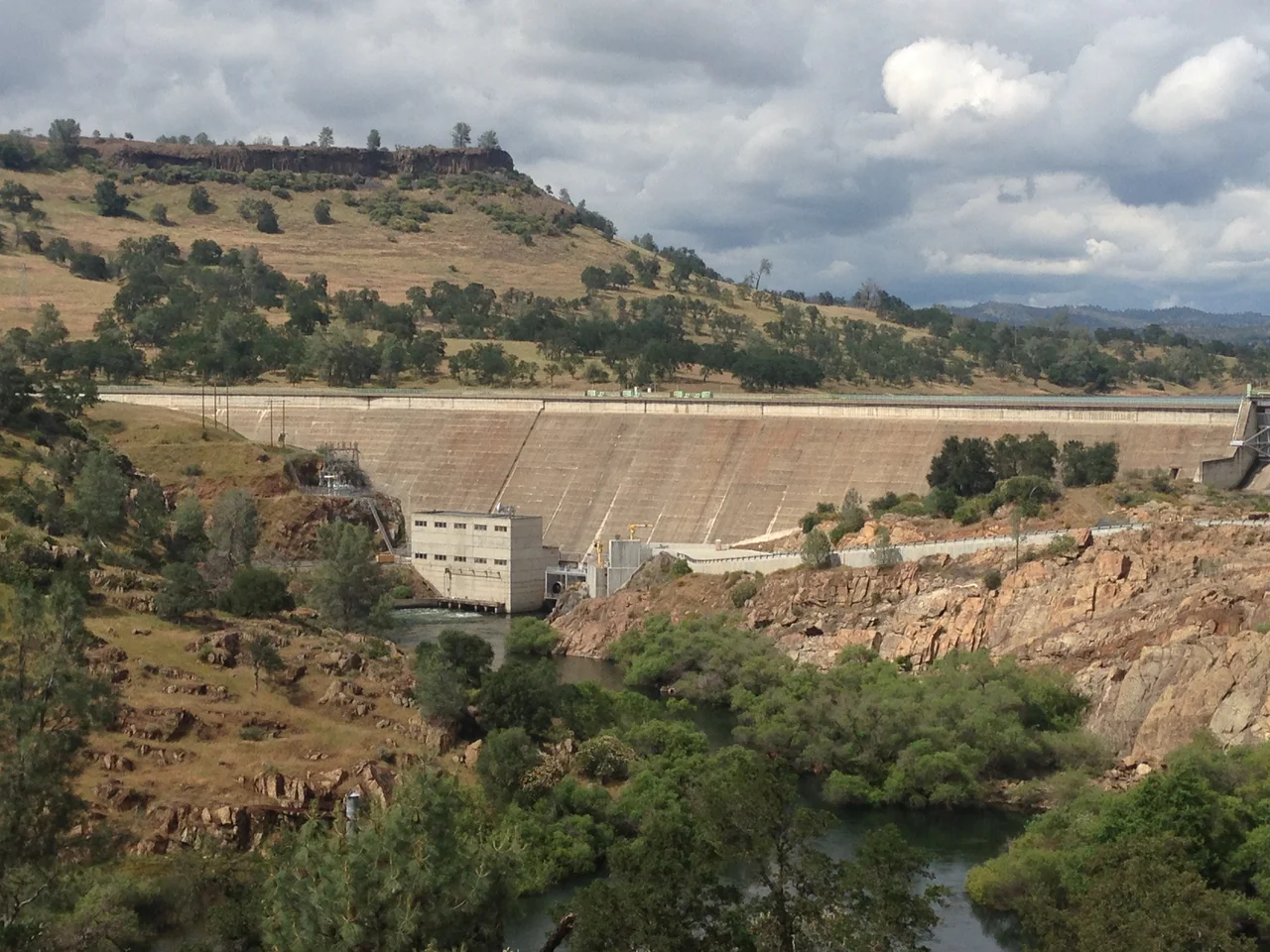
The Tri-Dam System
Lake Tulloch is the lowest link in a chain of three reservoirs along the Middle Fork of the Stanislaus River known as the Tri-Dam Project. Upstream, Donnells Dam and Beardsley Dam form the Upper Works, catching snowmelt high in the Sierra Nevada of Tuolumne County. Lake Tulloch, the Lower Works, sits at roughly 504 feet elevation where the foothills flatten toward the Central Valley. The entire system -- dams, tunnels, penstocks, and powerhouses -- was fully operational by 1957, just two years after the partnership was formally agreed upon. In the 1980s, small hydroelectric plants were added to each dam, converting the irrigation infrastructure into a dual-purpose system that generates electricity alongside its original mission of watering fields. The Turlock Irrigation District now controls these power plants, while the Tri-Dam Project's administrative offices operate from Strawberry, California, high in the Sierra.
Houses on the Water
Lake Tulloch holds a distinction unusual for California: private homes line its shores. In a state where most reservoir shorelines are publicly owned and development is prohibited, Tulloch's banks are dotted with houses whose backyards slope directly to the water. This anomaly reflects the lake's origins as a cooperative irrigation project rather than a state or federal water supply, which placed its shoreline under different development rules than reservoirs managed by agencies like the Bureau of Reclamation. The result is a community that feels more like a lakeside neighborhood than a typical reservoir recreation area, with docks, boathouses, and lawns reaching to the waterline. At 1,260 acres, the lake is large enough for serious boating but intimate enough that neighbors recognize each other on the water.
Bass, Trout, and Cold Water
The Stanislaus River feeds Lake Tulloch with water released from the dams above, and that water stays cold even through the dry heat of a Central Valley summer. The temperature makes Tulloch productive fishing water. Rainbow trout and brown trout thrive in the cooler depths, while largemouth and smallmouth bass hold in the warmer shallows and coves. Catfish, crappie, and bluegill round out the catch. The South Lake Tulloch RV Campground and Marina offers 130 waterfront sites ranging from lakefront cabins to tent sites with fire pits, along with a restaurant, general store, gas dock, and boat rentals. Boating, swimming, and camping draw visitors from the valley floor, many of whom are escaping the triple-digit temperatures that bake the lowlands from June through September. Up here in the foothills, the elevation provides a few degrees of relief and the water provides the rest.
From the Air
Lake Tulloch is located at 37.896N, 120.586W in the Sierra Nevada foothills near Copperopolis, California, at approximately 504 feet elevation. From the air, the reservoir is visible as a branching body of water in the Stanislaus River canyon, with Tulloch Dam at its western end. Private shoreline development distinguishes it from nearby reservoirs. The nearest airport is Columbia Airport (O22), roughly 15 nautical miles east in the Gold Country foothills. Modesto City-County Airport (KMOD) is approximately 30 nautical miles west. Clear conditions prevail most of the year, though summer haze from the Central Valley can reduce visibility at lower altitudes.
Nearby Stories
- Groveland and Big Oak Flat 4.6 km away
- Cleveland Elementary: The Shooting That Changed the Law 11 km away
- The River That Nobody Dammed 18 km away
- The Fifty-Dollar Ghost 19 km away
- Camanche Reservoir 23 km away
- Gold from the Sky Over Gold Country 23 km away
- Mount Hamilton (California) 44 km away
- Bodie Ghost Town 107 km away