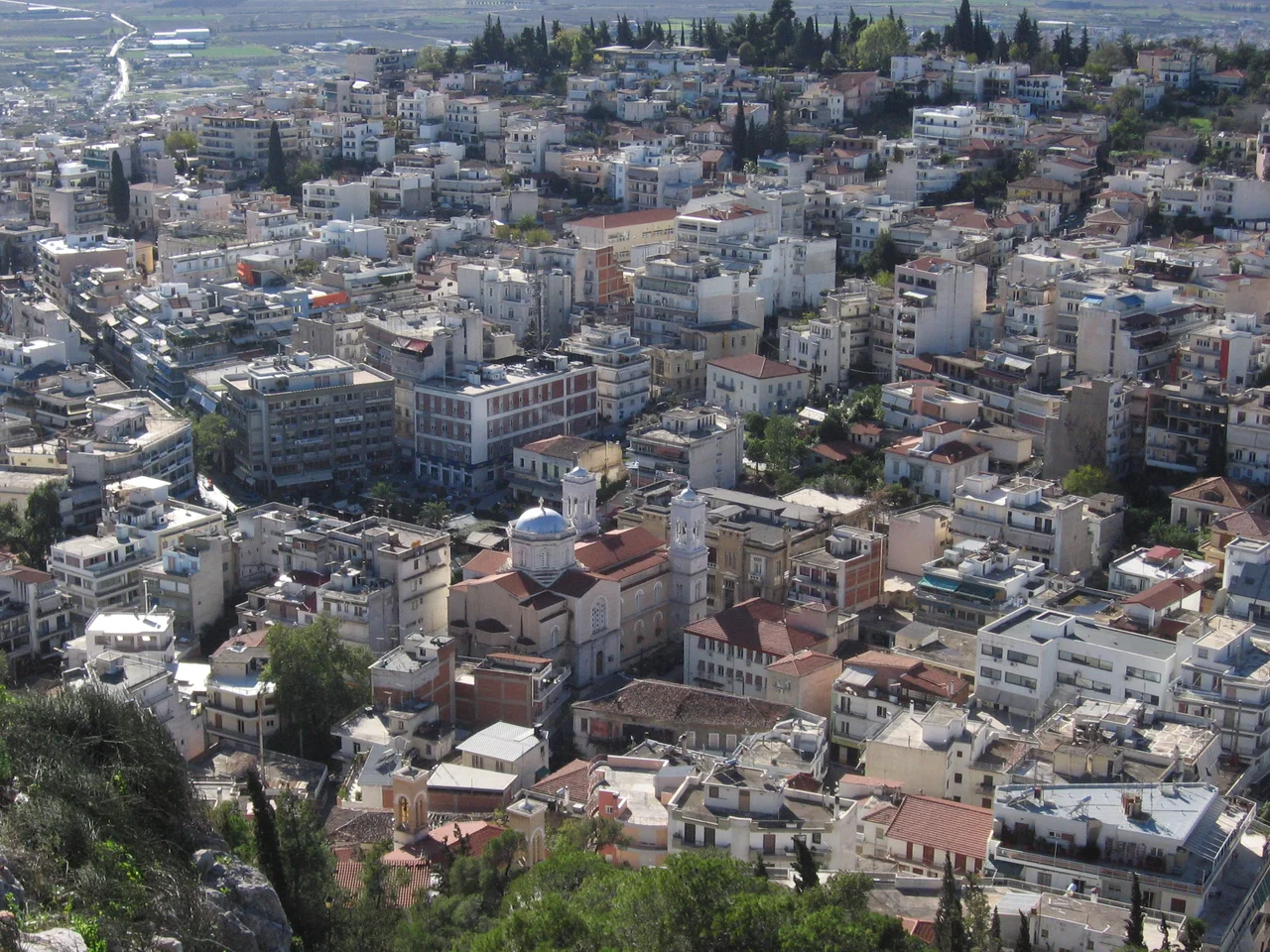

Lamia
The city has been called many things across thirty centuries. Zetounion to the Byzantines. Girton under the Franks. El Citó when Catalan mercenaries held it. İzdin to the Ottomans. Through every name change, the place itself never moved — clinging to the slopes of Mount Othrys, watching the narrow coastal plain below that connects southern Greece to Thessaly and, beyond that, to the whole of the Balkans. Control Lamia, the ancient strategists understood, and you control the passage. That is why the city's walls went up in the 5th century BC, and why so many armies fought over them.
The Keyhole of Greece
Lamia's strategic importance is easiest to grasp from the air or from the castle hill. Below stretches the Spercheios River valley, and just to the south lies Thermopylae — the famous 'Hot Gates' where geography has repeatedly forced armies into a chokepoint. Lamia itself sits at the northern end of that same constriction, commanding the last stretch of flat ground before the mountains close in. Archaeological excavations have found signs of human settlement here reaching back to the 3rd millennium BC, making this one of the oldest continuously inhabited places in central Greece. By the 5th century BC it had become a proper polis, with walls to match its ambitions. Macedonians, Thessalians, and Aetolians all contested it before Rome ended the argument in the early 2nd century BC. The city's name, according to one tradition, comes from the mythological Lamia, daughter of Poseidon and queen of the Trachineans who inhabited this region. Another view traces it simply to the Malians, the people of the surrounding countryside.
The War That Bears the City's Name
In 323 BC, Alexander the Great died in Babylon, and the Greek city-states seized the moment. Athens led a coalition of poleis in what became the Lamian War — a bold but ultimately doomed attempt to throw off Macedonian dominance. The Greek rebels besieged the Macedonian commander Antipater in this very city through a winter, forcing him to negotiate. The name Lamian War lives on in history books as shorthand for the last serious Greek challenge to Macedonian hegemony before Rome changed everything. The city's role in that confrontation gave it a permanent place in the historical record, out of all proportion to its modest size. Later, under Byzantine rule, the city became Zetounion — a name that first appears in documents from the 8th Ecumenical Council of 869. After the Fourth Crusade fractured the Byzantine world, it passed to Frankish lords, then to the remarkable Catalan Company of mercenaries, who held it under the name El Citó.
A Castle, a Square, and a Hero
The most visible landmark is Lamia Castle, the fortified acropolis that rises above the city and has been rebuilt and repurposed through every era of the city's long occupation. Walk the streets below it and the layers of history compress: Platia Eleftherias, Freedom Square, hosts the independence day parade and the cathedral, its café terraces busy in the evenings with the rhythm of Greek provincial life. A few streets away, Platia Diakou bears the statue of Athanasios Diakos, the military commander who died in Lamia in 1821 during the Greek War of Independence. His story is woven into the city's identity. So is that of Aris Velouchiotis — whose statue stands in Platia Laou — the World War II resistance leader who commanded ELAS guerrillas in the mountains around Lamia. The city also produced Niki Bakoyianni, the high jumper who won an Olympic silver medal at the 1996 Atlanta Games. Six departments of the University of Thessaly now fill the city with students, adding academic energy to an agricultural capital that has always punched above its weight.
Between the Mountain and the Plain
Lamia today is a city of about 47,500 people — compact enough to feel like a community, large enough to be the administrative capital of both the Phthiotis regional unit and the broader Central Greece region. It sits between Mount Othrys to the north and the Spercheios plain to the south, a position that determines its character as much as its history. The plain is fertile, and Lamia serves it as a market and service center: livestock and crops come through, students and civil servants stay. The Gorgopotamos Bridge nearby carries particular weight in modern memory — it was blown up by Greek resistance fighters and British Special Operations Executive agents in November 1942, one of the most celebrated acts of wartime sabotage in occupied Europe. Red taxis navigate the city's streets, and cycle paths thread between the squares. The sense of a place that has been perpetually between things — between north and south, between antiquity and modernity, between mountains and sea — runs through Lamia like a seam.
From the Air
Lamia sits at approximately 38.90°N, 22.43°E, on the slopes of Mount Othrys at around 165 meters elevation. The city is most recognizable from the air by its castle hill rising above the urban grid, with the Spercheios River valley visible to the south and the coastal plain stretching toward Thermopylae. Nearest major airport is Nea Anchialos (LGBL), about 60 km northeast near Volos; Athens Eleftherios Venizelos (LGAV) is roughly 200 km south. A military airfield (Lamia Airport) exists 2 km from the old Athens road but handles no commercial traffic. Approach from the south at 5,000–8,000 feet gives the clearest view of the castle and the Spercheios plain.
Nearby Stories
- Karpenisi 2.6 km away
- Duchy of Neopatras 2.7 km away
- Kalapodi 5.1 km away
- Farsala 11 km away
- Lake Plastiras 12 km away
- Thermos (Aetolia) 17 km away
- Demetrias 17 km away
- Free and Real 21 km away