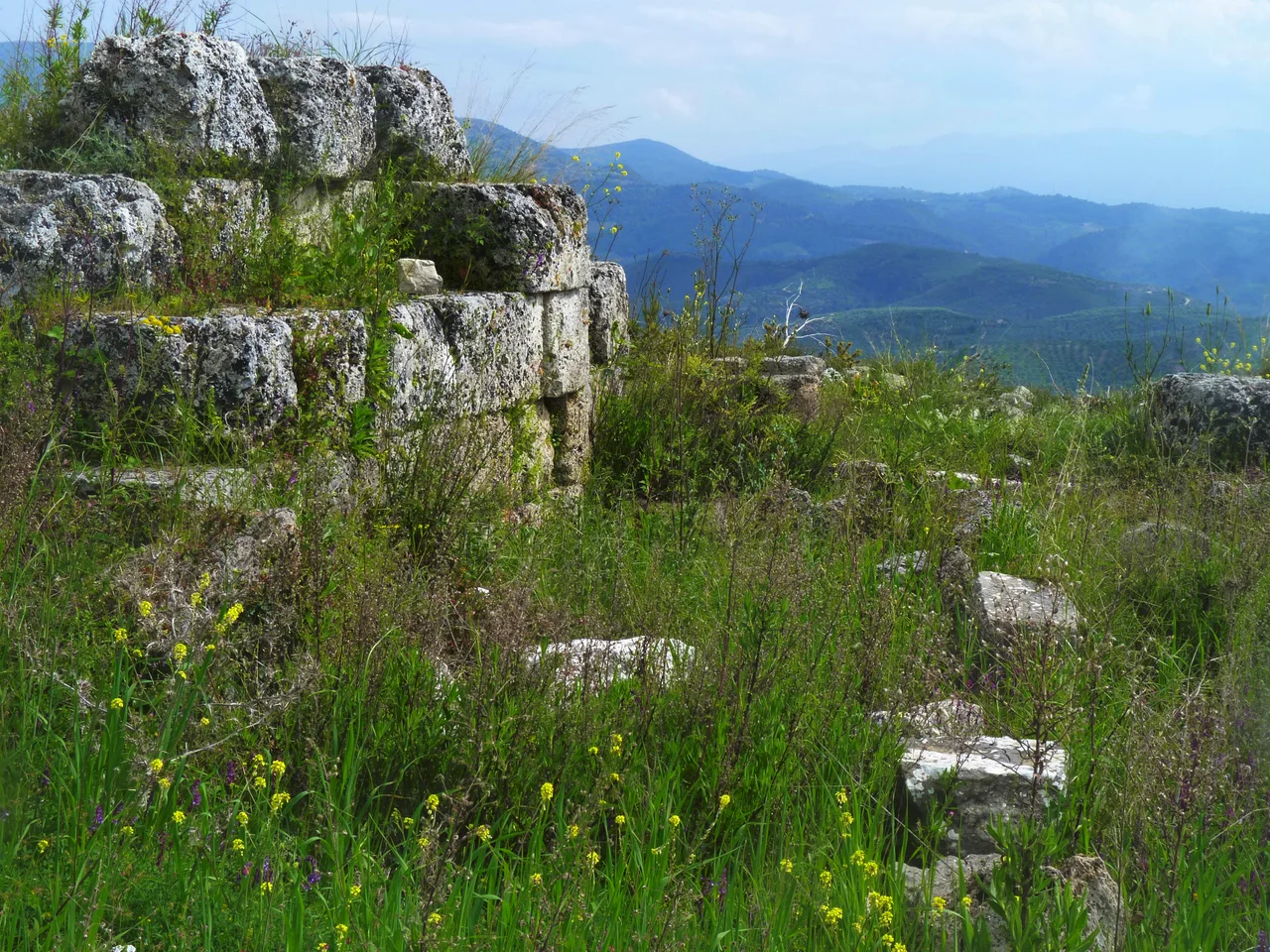

Lepreum
When Strabo traveled through the western Peloponnese in the first century BC, he called Lepreum's territory a "blessed country." It was a judgment based on what he observed: fertile fields, a mild climate moderated by surrounding mountains, and a location commanding the roads between Elis, Arcadia, and Messenia. The city had already passed its peak, but the memory of what it had been — the leading city of Triphylia, proud of its independence and willing to fight for it — was still vivid in the classical sources Strabo drew upon. Today, the ruins of ancient Lepreum lie scattered near the modern village of Lepreo, in the hills west of Mount Minthi, mute testimony to a city that refused for centuries to accept the role its powerful neighbor had assigned it.
The Stubborn City of Triphylia
Triphylia was a district wedged between Elis to the north, Arcadia to the east, and Messenia to the south — a border country, always contested. Lepreum was its chief city, built around two citadels set on defensible ridges, positioned about 40 stadia (roughly 7 kilometers) from the sea, at the western end of Mount Minthi. The surrounding land was rich. Easy access to the Neda River and the Ionian coast gave the city agricultural and commercial advantages, and the mountain backdrop provided protection. From the earliest period, Lepreum resisted absorption into its larger neighbors' spheres. The Caucones, the area's earliest known inhabitants, were displaced by the Minyans, who founded Lepreum along with five other cities in the region. The poet Callimachus called Lepreum the "fortified city of the Caucones," preserving the memory of that older people. Some classical scholars have even suggested that Lepreum is the mythical city of Aepy, mentioned by Homer in the Iliad but never otherwise identified.
The Fight Against Elis
After the First Messenian War, Elis extended its power over Triphylia and reduced Lepreum and its neighbors to subject status. The Triphylians bore the arrangement with resentment rather than resignation. Lepreum took the lead in repeated attempts to throw off Eleian supremacy — and the clearest measure of its standing is this: it was the only Triphylian city to send troops to fight at Plataea in 479 BC, when the Greek alliance broke the Persian land invasion. To be remembered for Plataea was to be counted among the serious Greek cities, not the subjects of someone else's empire. In 421 BC, Lepreum and the other Triphylian cities revolted with Spartan support. The conflict eventually settled in 400 BC when the Eleians formally accepted Triphylian independence. But the relief was short-lived. When Spartan power collapsed after the Battle of Leuctra in 371 BC, the Spartans attempted to reassert control over Triphylia, and Lepreum turned to the newly formed Arcadian League for protection — a strategic choice that led later writers, including Pliny the Elder, to call the city Arcadian.
Blessed Country, Fading City
The Classical and Hellenistic periods were Lepreum's height. As the de facto capital of Triphylia, it controlled fertile agricultural land and the critical road junction linking the three great regions of the southern Peloponnese. Strabo's description of a "blessed country" captures something real about the landscape: hills that break the summer wind, valleys that collect winter rain, soil that grows grain and olives and supports flocks. The city's buildings rose on limestone and porous bedrock foundations, with mud-brick walls oriented north-south — the doors facing north to avoid the powerful south winds that push up from the Ionian coast. By the time the geographer Pausanias visited around 170 AD, the city had lost its power but still held its title as Triphylian capital. The end came gradually: raids by pirates and various invaders between 800 and 1000 AD finally emptied the site. The stones were quarried for other purposes, the fields reverted, and Lepreum disappeared into the hills.
What the Excavations Found
The ruins near modern Lepreo include remains of a temple to Demeter, the earth goddess whose cult was widespread across the agricultural communities of the Peloponnese. Before that structure, the site held a sacred grove dedicated to Dione — a goddess whose very name, from the ancient Greek root for Dyeus (the sky father), suggests a worship stretching back to the earliest Indo-European religious traditions in the region. The Neolithic period left traces as well: evidence of habitation and of ties to the wider Aegean world, suggesting that the position commanding these inland roads was recognized and exploited for millennia before the Minyans gave the city its classical form. The architectural style of the earliest classical buildings — mud brick on limestone, doors sheltered from the south wind — suggests builders who understood their environment and worked with it rather than against it. Excavations near the present village continue to expand what is known.
An Identity That Shifted With the Wind
No other ancient city in the Peloponnese illustrates the fluidity of Greek regional identity as neatly as Lepreum. Its residents variously claimed to be Eleian, Arcadian, or simply Triphylian depending on which alliance offered the best protection in a given generation. Pausanias noted this with dry precision: the townsfolk in his time claimed to be Arcadians, though he knew perfectly well they had been Eleian subjects since ancient times, and that Aristophanes had called the city Eleian. The truth was that Lepreum's identity was tactical. It was a city that understood its precarious position at the junction of three regional powers, and it maneuvered accordingly — forming and reforming alliances, timing revolts, aligning with Sparta when useful and with the Arcadian League when that served better. What never changed was the insistence on self-determination. For Lepreum, independence was the constant; the labels shifted.
From the Air
Lepreum's ruins lie at approximately 37.44°N, 21.72°E, on the slopes west of Mount Minthi in the northern Triphylia district. From altitude, Mount Minthi (rising to about 1,210 meters) stands out as the dominant massif east of the Ionian coast in this part of the Peloponnese. The Neda River gorge, cutting dramatically through the limestone hills to the south, is a useful navigation reference. The nearest major airport is LGRX (Araxos Airport), approximately 85 km to the north along the Gulf of Patras coast. Flying at 6,000 feet on a clear day, the transition from the flat coastal plain of Elis to the broken hill country of Triphylia is visible as a distinct topographic change, with the limestone ridges casting sharp shadows in the afternoon light.
Nearby Stories
- Greek Baths in Ancient Olympia 2.4 km away
- Battle of Chora–Agorelitsa 8.5 km away
- 1986 Kalamata Earthquake 8.8 km away
- Strofades 13 km away
- Peloponnese 14 km away
- Orchomenus (Arcadia) 19 km away
- St. Mark's Roman Catholic Church 26 km away
- Valletta 603 km away