.jpg)
Liesjärvi National Park
Kyynäränharju is a narrow spine of gravel with a lake on either side. Walk it and the water is never more than a few steps away in either direction, which is disorienting in a country where lakes are usually things you come to the edge of rather than walk between. The ridge is an esker, and it was laid down by a river that ran in a tunnel underneath a kilometre of ice. When the glacier melted, the riverbed stayed - a long, sorted heap of sand and stone left standing where the water used to be. Liesjärvi National Park was drawn around that ridge and the lake country either side of it, and it has been protected, in one form or another, for more than a century.
What the Ice Left Behind
The Häme lake highlands are glacial leftovers almost everywhere you look, but eskers make the process unusually legible. Meltwater under the ice sheet carried gravel and sand along a fixed channel, sorting it by size as any river does, and dropped it when the flow slowed. Then the ice went and the sediment was suddenly a hill. Liesjärvi packs a remarkable amount of edge into a small area: a little over twenty square kilometres of park holds more than forty kilometres of shoreline, a ratio that comes from exactly this kind of terrain - ridges and hollows, water threading between them. Lake Liesjärvi itself is not formally inside the park boundary, but its islands are protected, which is how a national park ends up guarding the middle of a lake it does not own.
Korteniemi, Still Working
In 1878 a tenant farmer's holding on the shore became a forest ranger's station, with Kalle Lönngren as its first keeper. Rangers lived and farmed there for generations. Korteniemi is now the only forest ranger's homestead in southern Finland whose yard survives in its original arrangement - not a reconstruction but the actual buildings in their actual positions - and it has been restored to how it looked in the 1910s. It is also not a museum in the do-not-touch sense. Visitors are handed real work: hay to turn, animals to tend, the ordinary unglamorous labour that kept a household alive in a forest a long way from anywhere. The point is not nostalgia. It is that the landscape around Korteniemi was shaped by people doing precisely these things, and the park protects that as carefully as it protects the trees.
Trees Older Than the Park
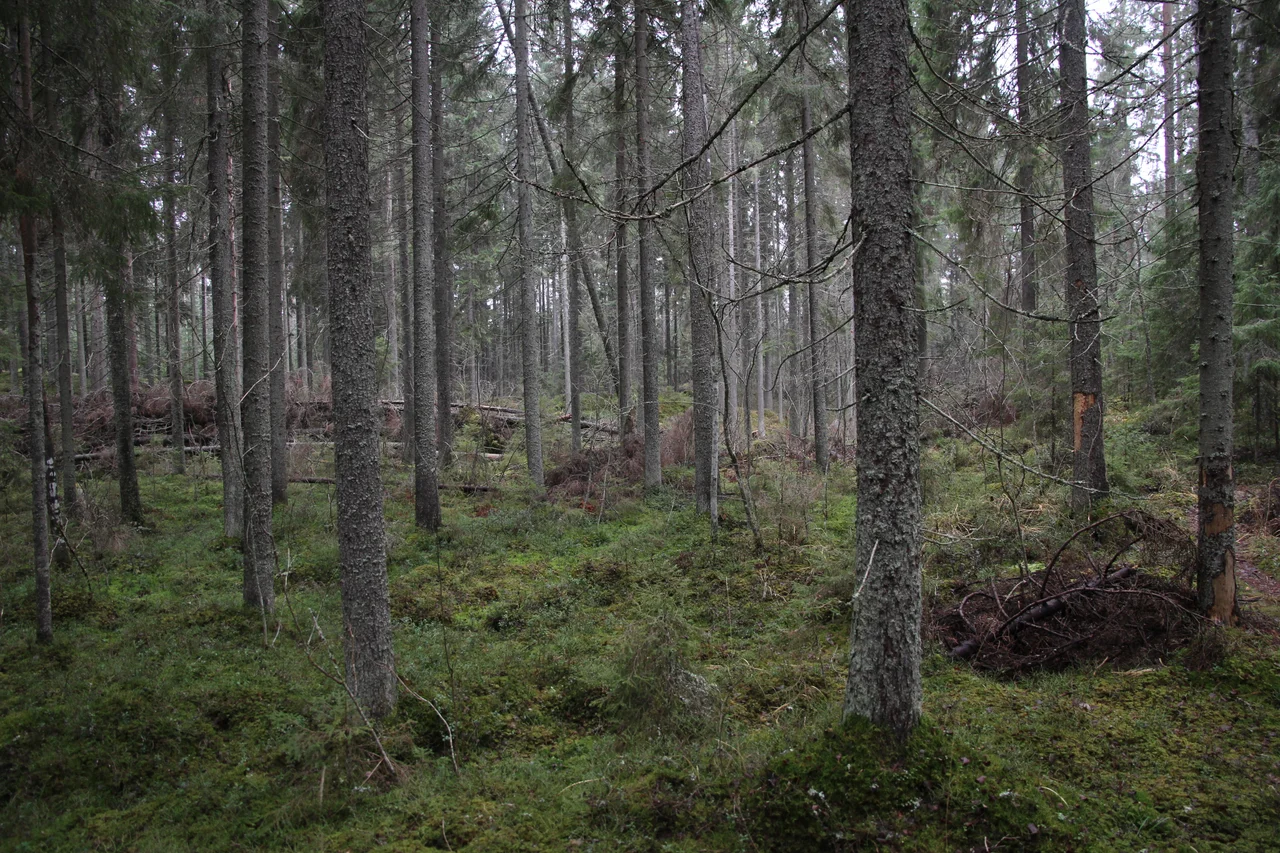
Some of the spruce here has been standing for around 180 years, which means it was already mature timber when Finland was still a Grand Duchy of the Russian Empire and Kalle Lönngren had not yet taken up his post. Walking the park's roughly thirty kilometres of marked trail takes you through dense, dark spruce stands where little light reaches the floor, out onto open heaths carpeted in lingonberry, across small peatlands, and up onto the dry pine-covered crests of the eskers. Each of those is a different soil, a different water table, a different set of species, and they can change over a distance of fifty metres. The whole park is best understood as a cross-section: a slice of the Häme lake highlands kept in something close to the condition the rest of the region has lost.
Protected in Instalments
Part of what is now the park was already set aside in 1920, a strikingly early date for nature protection in a country three years old. The national park itself followed in 1956, in the first significant wave of Finnish park designations, and it has been enlarged since - once in the 1980s and again in the 2000s. That piecemeal history is common in southern Finland, where land is privately held and protection has to be assembled parcel by parcel rather than declared across an empty map. Around fifty-seven thousand people visit each year, a substantial number for a park this size, and it is set up for them: marked routes, campfire sites, and pitches for both tents and caravans. Metsähallitus, the state forest service, runs it. Torronsuo, the great raised bog, lies about a dozen kilometres west - two entirely different landscapes within a morning's drive of each other.
From the Air
Liesjärvi National Park lies at 60.681 N, 23.858 E in Tammela, Kanta-Häme, about 20 km southeast of Forssa and roughly 90 km northwest of Helsinki. From the air the signature is the pairing of lakes Liesjärvi and Kyynäräjärvi with the thin wooded ridge of Kyynäränharju running between them - one of the clearest esker forms visible in southern Finland, appearing as a straight, narrow, forested causeway where none was built. Dark spruce forest dominates the surrounding land, broken by small peatlands and the pale sand crests of further eskers running roughly northwest to southeast. Recommended viewing altitude 2,000-3,500 ft. Nearest airfield is the light-aviation strip at Forssa; nearest commercial airports are Helsinki-Vantaa (EFHK) about 90 km east, Turku (EFTU) and Tampere-Pirkkala (EFTP). Torronsuo National Park sits about 13 km west and makes a natural pairing on any low-level route. Lake fog is common on still autumn mornings; the ridge often stands clear above it.
Nearby Stories
- Salo 10 km away
- The Artillery Museum of Finland 11 km away
- Nummi Church 12 km away
- Urjala 14 km away
- Sarka (museum) 16 km away
- Hakoinen Castle 24 km away
- Huittinen 34 km away
- National Museum of Finland 49 km away