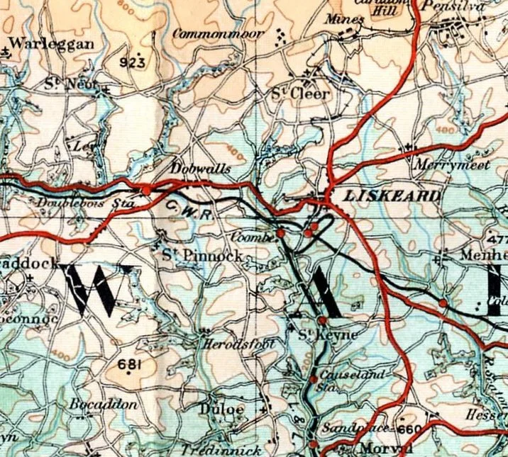

Liskeard
The Cornish element *Lis* means court, and that single syllable carries more weight than the rest of the town's history put together. Before there was Liskeard, there was Lis-Cerruyt, the seat of King Dungarth, a Dumnonian ruler whose memorial cross still leans into the wind a few miles north near St Cleer. The Normans wrote the name down as Liscarret in the Domesday Book, recorded the mill at twelvepence and the market at four shillings, and gave the manor to Robert, Count of Mortain. The court is gone. The market still trades on the second Saturday in July.
A Borough That Outlived Its Castle
Liskeard's Norman castle stood on the rise above the present town, and by the time the antiquary John Leland passed through in 1538, only a few stones remained to suggest where it had been. Sir Richard Carew, writing in 1602, agreed: the place that had once been a high-status court had let its fortifications slide quietly into the soil. Yet the borough itself thrived where the castle failed. Richard, Earl of Cornwall, brother of Henry III, granted the market charter in 1240, and from 1295 the town sent two members to Parliament. Liskeard sat among the seventeen *Antiqua maneria* of the Duchy of Cornwall, which meant tin coinage, stannary courts, and a steady current of money flowing through narrow streets. Wilkie Collins, visiting in the 1850s, dismissed the town as 'that abomination of desolation, a large agricultural country town.' He was passing through on his way to write about Cornwall's wilder corners, and Liskeard was too settled, too prosperous, to interest him.
The King in Stuart House
In August 1644, Charles I lodged at the house on Barras Street that now bears his cause's name. His army was chasing the Earl of Essex's parliamentarians westward across Cornwall, and Stuart House became, for a few summer nights, a royal headquarters. The king slept in a town that had already chosen its loyalties: four Liskeard MPs in that century were committed royalists, and Joseph Jane, born in Liskeard in 1595, served as a politician and pamphleteer for the Crown. Stuart House survives, restored, and now hosts arts and heritage events in rooms where royal dispatches were once unfolded. A few doors away, the town parade still curves past the Victorian fountain donated by Michael Loam, whose father, also Michael, invented the Man Engine that carried Cornish miners up and down shafts they could no longer climb by ladder.
Tin, Telegraphs and the Long Decline
The nineteenth century treated Liskeard well, at least at first. Tin from the Caradon mines flowed down through the town's coinage hall to be assayed and taxed. In 1863 the Electric and International Telegraph Company opened a station here alongside Truro, Redruth and Penzance, knitting the town into the imperial nerve system. Liskeard Guildhall, with its prominent clock tower, went up in 1859 to house courts and council. By 1890 the Public Hall had joined it on West Street. Then the tin price collapsed, the Caradon mines closed, and the town settled back into agriculture. The Liskeard livestock market, one of the last of its kind in Cornwall, kept trading until 2017. The town's grammar school produced Ian Donald, the physician who pioneered the use of diagnostic ultrasound in obstetrics, work that reshaped how the world sees pregnancy itself.
Trafalgar, a Spice Pot and a Sister in Ukraine
One of Liskeard's three commemorative walking trails honours Lieutenant John Richards Lapenotière, who carried news of Trafalgar from the Cape to the Admiralty in November 1805, riding post-chaises through twenty-one changes of horse to reach London with word of Nelson's victory and his death. King George III gave him a silver sugar sifter in recognition. It is now held at Liskeard Museum, brought out for the occasional civic occasion. Other Liskeard names travelled further. Emily Hobhouse, born here in 1860, exposed conditions in British concentration camps during the Second Boer War and spent her life campaigning against war itself. In 2023 the town announced a new twinning with Kopychyntsi in Ukraine, adding a wartime gesture to its older bond with Quimperlé in Brittany.
The Town You Can Still Walk Through
Liskeard today holds around eleven thousand people in a parish that has kept its Victorian shopfronts mostly intact. The A38 bypass carries the through-traffic south of the centre, leaving Fore Street to its cafes and the pantomime that still runs in the last week of January. St Matthew's Fair, chartered in 1266, was revived in 1976 and now occupies the streets each September. Just to the north, the Carnglaze Caverns, abandoned slate workings turned concert hall, host live music in chambers cut into the hillside. The Hurlers stone circles stand four miles north on Bodmin Moor. The Pipe Well, a holy well, still trickles in the lane that bears its name. The court of King Dungarth is fifteen centuries dissolved, but the place that carries his syllable is still here, trading.
From the Air
Coordinates 50.4536°N, 4.4651°W, on the southern flank of Bodmin Moor in south-east Cornwall, about 32 km west of Plymouth. Cruise at 4,000-6,000 ft for a clear view of the town's Victorian street grid with St Martin's Church tower as the main landmark; the dark mass of Bodmin Moor lies to the north-west, the Tamar estuary to the east. Nearest airfields: Plymouth City (former, now closed - use Bodmin EGLA, grass strip, or Newquay Cornwall EGHQ to the west). The A38 bypass is the most obvious linear feature south of town.
Nearby Stories
- Padstow 1.1 km away
- Hope Cove Lifeboat Station 3.5 km away
- Holsworthy 3.6 km away
- The Great Thunderstorm 6 km away
- Prehistoric Cornwall 9.2 km away
- Eddystone Lighthouse 14 km away
- Tiverton Castle 29 km away
- HMHS Glenart Castle 36 km away