
Shipwrecks of the Channel Islands
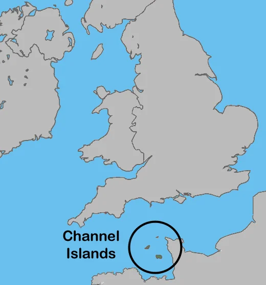
Sailors approaching the Channel Islands from the south have a saying: the rocks here outnumber the ships, and the ships keep arriving. Between Cap de la Hague on the French coast and the rocks of the Bailiwick of Guernsey, the English Channel narrows and the tide accelerates to nearly ten knots at spring flood, one of the fastest tidal streams in Europe. Add fog, granite reefs, and the relentless trade between England, France, and the wider Atlantic, and you get a graveyard. The list of recorded wrecks is long. The unrecorded ones are longer.
Why So Many
The hazard begins underwater. The Channel Islands sit on a shallow shelf of granite that breaks the seafloor into ridges and outliers, some submerged, some half-tide. The Casquets, eight miles west of Alderney, are a scatter of low rocks invisible until the breakers reveal them. The Hanois reef west of Guernsey, the Paternosters north of Jersey, the Minquiers and the Ecrehous between Jersey and France: each is a hazard that can sink a ship by inches in the wrong sea. The tides do the rest. The range here exceeds ten meters on a spring tide, second only to the Bay of Fundy among European waters. Streams that run northward at dawn run southward by lunchtime, and a vessel set off course by an unrecognized current can be on the rocks before the bridge realizes the bearings have shifted.
The Roll Call
The record stretches back centuries. Spanish, French, Dutch, English, Norwegian, and American hulls have left their timbers in these waters. Some wrecks are famous beyond the islands: HMS Boreas, lost on the Hanois in 1807 with 120 of her 155 crew, helped finally provoke construction of the lighthouse fifty years later. The Stella, a London and South Western Railway packet steamer, struck the Casquets in fog in March 1899 carrying Easter passengers from Southampton; the disaster killed 105 and turned the Casquets keepers and Guernsey lifeboatmen into newspaper heroes. The Marie Elizabeth from Copenhagen, lost off Rocquaine in 1816, was the wreck whose name appeared again and again in the petitions that eventually built Les Hanois Lighthouse. The list runs into the hundreds and continues, in smaller increments, into the present.
The People Who Pulled Them Off
Where there are wrecks there are rescuers. The first lifeboat on Guernsey arrived in 1803, ordered for 170 pounds from the boatbuilder Henry Greathead by twelve concerned members of the St Peter Port Douzaine. The Royal National Lifeboat Institution took over in 1861. Since then St Peter Port lifeboat alone has launched more than 1,500 times and saved more than 600 lives. Channel Islands Air Search, a volunteer-flown spotter aircraft, joins each call. French and British coastguards share the area, and the rescuers are often pulling people out of waters where the wrecks of their predecessors lie just below them. Two RNLI gold medals, fourteen silvers, and fifteen bronzes are kept at the St Peter Port station; the names on them belong to coxswains and crew who went out into seas that had already proved capable of killing.
What the Sea Keeps
Modern wrecks are rarer. Radar, GPS, and electronic charts have removed many of the old fatal surprises. But the Channel Islands still claim ships. Yachts in fog. Fishing boats on uncharted offshoots of known reefs. The cargo vessel MV Prosperity drove ashore in a gale on Guernsey in 1974 with twenty-eight aboard; despite a heroic lifeboat effort, all hands were lost in seas the rescuers could not approach close enough to help. Divers visit the older wrecks now: brass nails, broken plates, the curved black timbers of merchantmen that left ports in Le Havre or Hamburg and never made it home. Each rusting boiler and silted spar on the seabed once carried a crew with families waiting somewhere. The reefs do not remember them. The communities that built the lighthouses and lifeboats around these rocks do.
From the Air
The dangerous waters of the Bailiwick of Guernsey extend roughly from 49.40 to 49.75 N and from 2.20 to 2.75 W, with Saint Peter Port at 49.4553 N, 2.5264 W marking a useful overflight reference. Key hazards visible from altitude include the Casquets (49.72 N, 2.36 W), the Hanois reef west of Guernsey, and the Minquiers south of Jersey. Best viewed from 2,000 to 5,000 feet on clear days, when the green water over reefs contrasts sharply with deeper blue. Nearest airports: Guernsey (EGJB), Jersey (EGJJ), Alderney (EGJA). Expect rapidly changing visibility; sea fog and low cloud can close all three island airports within an hour.
Nearby Stories
- Pallot Steam, Motor & General Museum 29 km away
- HMS Affray 29 km away
- Operation Donnerkeil 29 km away
- German Submarine U-672 35 km away
- Action of 18 June 1793 60 km away
- Mont Saint-Michel: The Abbey That Becomes an Island Twice a Day 78 km away
- Basilica of Sainte-Therese, Lisieux 209 km away
- 1941 Santander Fire 642 km away