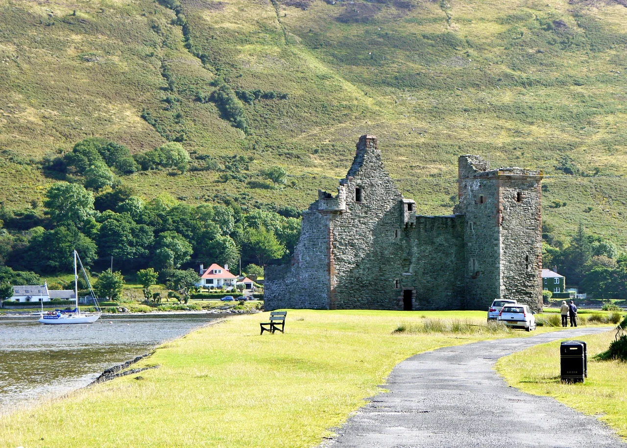

Lochranza Castle
From the road into Lochranza, the castle appears all at once - a ruined L-plan tower house standing on a flat spit of land between the head of the sea loch and the steep glen behind. There is no village wall, no fortification, no commanding ridge. The castle simply sits where it has always sat, half in water, half on rock, at the northern tip of the Isle of Arran. Most of what stands today is sixteenth-century work, raised on the foundations of something far older. The stones have outlasted three dynasties, an English occupation, a Norse claim, and a comic-book mix-up that fans still argue about.
MacSweens and Menteith
The earliest castle here dates from the 13th century, when the site was held by the MacSweens, a powerful kindred whose lands stretched along the western seaboard. In 1262, King Alexander III granted the castle and its lands to Walter Stewart, the Earl of Menteith - a redistribution that fitted Alexander's larger project of pulling the western isles firmly into the Scottish crown's orbit. It is widely believed that Robert the Bruce landed at Lochranza in 1306 on his return from Rathlin and Ireland, on his way to claim the Scottish throne. The story is part of Arran's identity, told at every viewpoint and in every guidebook, though the documentary trail is thin. What is certain is that the loch here is one of the best natural anchorages on the west coast of Scotland - a deep, narrow inlet sheltered from almost every direction. If Bruce did land at Arran, this is where he would have done it.
The Tower in Stone
The castle as it stands now is essentially a 16th-century L-plan tower house - two rectangular blocks meeting at right angles, with the entrance protected at the inner corner. The thick walls were designed for defence with firearms, not arrows, and the building has the unmistakable solidity of late medieval Scottish military architecture. In 1614 it was occupied by royal forces conducting military operations against the MacDonalds; in the 1650s, Oliver Cromwell's forces used it as a garrison during the Commonwealth's military occupation of Scotland. After the Restoration the Hamiltons, who held other estates on Arran, sold the castle to the Blackwood-Davidson family, who used it as their principal seat. By the time the building entered the modern era, it had lost its roof and most of its floors, but the shell remained largely intact - a tribute to the masons who fitted its stones together.
The Black Island That Wasn't
In 1937, the Belgian cartoonist Hergé sent Tintin to Scotland in 'The Black Island,' giving his hero a brooding castle on an island off the coast to investigate. For decades, Lochranza was identified as the model. The misunderstanding endured even after Hergé's own studio said otherwise. Charles Dierick, a researcher at Studios Hergé, has clarified that Lochranza is not the model: it has a square tower, and its silhouette is wrong. The artist Bob de Moor, who redrew the book for its colour edition, did visit Arran - but he sketched Brodick Castle, on the island's east coast. The Lochranza confusion persists nevertheless. In 2010, Channel 4 aired 'Dom Joly and the Black Island,' in which Lochranza Castle stood in for Kisimul Castle on Barra, in the Outer Hebrides - another case of one Scottish castle being used to play another, with the audience expected not to notice.
A Promontory in Care
Today Lochranza Castle is in the care of Historic Environment Scotland, a scheduled monument open to visitors year-round at no charge. The interior is open to the sky; staircases lead nowhere; small chambers hold nothing but the wind and whatever weather is coming off the loch. Across the water, red deer graze on the slopes of the golf course - the village's herd is famous, and the castle ruin is one of their preferred spots. The fishing village around the castle has shrunk to perhaps two hundred people, with a single hotel, a youth hostel that began life as a Victorian hotel in 1893-94, and the Arran Distillery a short walk to the south. The castle outlasts them all and will likely outlast whatever comes next. Promontories endure. Castles, with luck, follow.
From the Air
Located at 55.7053°N, 5.2903°W on the northern tip of the Isle of Arran. From altitude the castle is a small dark rectangle on a flat promontory at the head of Loch Ranza, a narrow sea loch opening north toward Kintyre. Best identified by the loch's distinctive Y-shape and the steep glen rising behind the village. Nearest aerodromes: Campbeltown (EGEC) about 25 nm southwest on Kintyre, Glasgow Prestwick (EGPK) approximately 35 nm to the east-southeast. Recommended viewing altitude 1,500-3,000 ft to make out the tower's L-plan footprint.
Nearby Stories
- Inverkip 3.4 km away
- Ardrossan Lifeboat Station 6.1 km away
- Turnberry Castle 7 km away
- Ardbeg Distillery 8.3 km away
- Tighnabruaich 13 km away
- Dunaverty Castle 14 km away
- Rathlin Island 16 km away
- Oronsay 21 km away