
Oronsay
You can walk to Oronsay. For roughly six hours twice a day - the tides do most of the deciding - a flat plain of mud and sand called The Strand is dry enough to cross on foot from southern Colonsay to the smaller island just to the south. Wait too long and the Atlantic flows back in and you are stranded for twelve hours. Cross at the wrong stage and you find yourself wading. Generations of islanders, monks, kelp gatherers, mail carriers and shepherds have made the crossing on tidal schedules that are still calculated by anyone who needs to visit. Seven people live on Oronsay. They depend on the tides for everything.
The Crossing
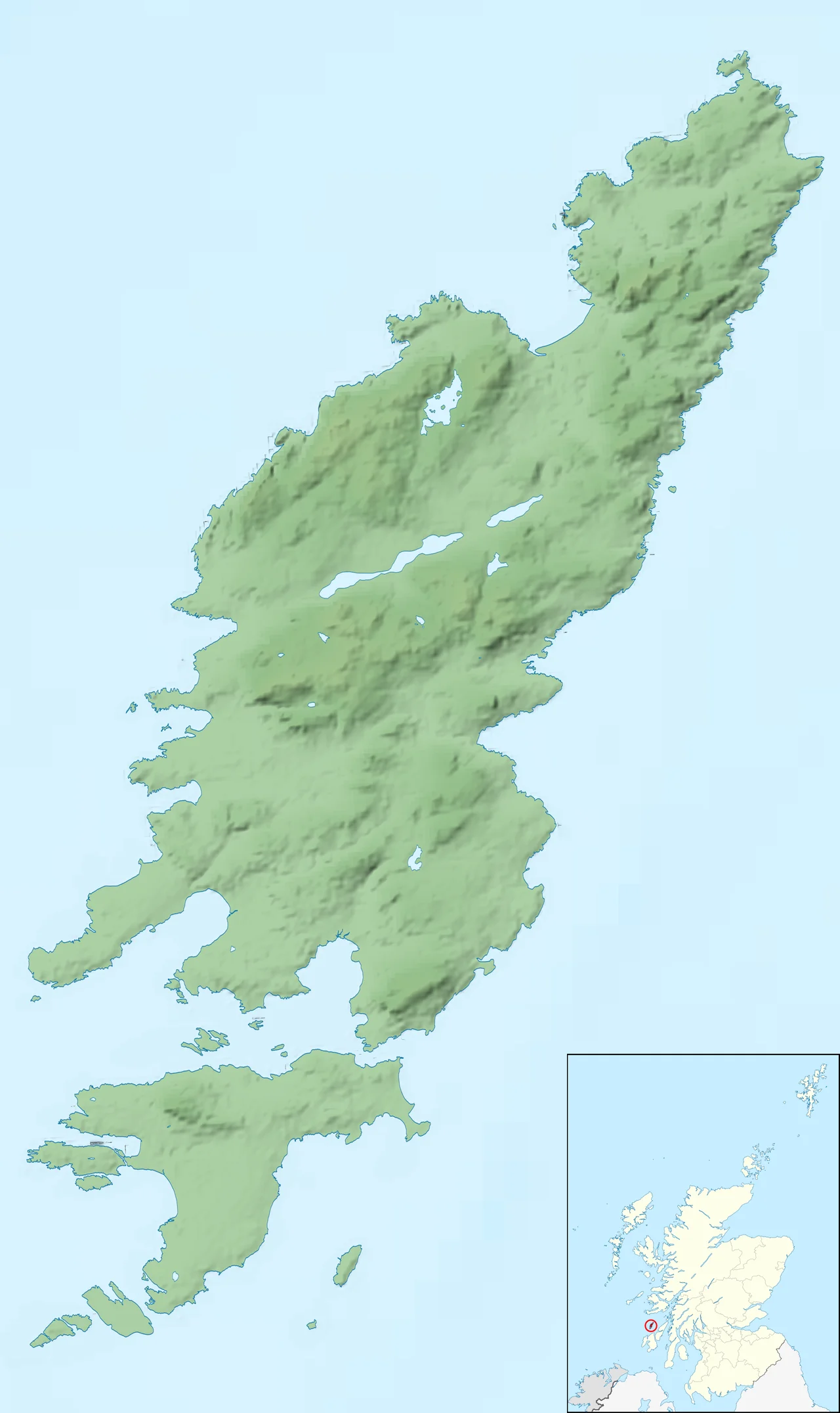
Oronsay is about two miles long and a mile and a quarter across, rising to a single hill - Beinn Orasaigh, 305 feet - that is just high enough to be visible from northern Colonsay on a clear day. The Strand that connects the islands is sand and mud flats, well-marked but unforgiving; the safe crossing window is roughly two hours either side of low water. There is a small grass airstrip south of the priory which, in W. H. Murray's memorable phrase, fights a losing battle with the rabbits. The official population in the 2001 census was five people. By 2022 it had risen to seven, all of them connected to the farm next to the priory ruins. The farm has been run by the Colburn family for several years as a working sheep and beef operation with a dedicated conservation programme; the RSPB manages much of the rest of the island. The name is probably Norse - Orfirisey, the island of the ebb tide - or possibly Gaelic, Eilean Orain, the island of Oran. Either way, the meaning ties to the daily uncovering of The Strand.
The Middens
When Victorian antiquarians opened three Mesolithic shell middens on Oronsay in the 1880s, they did not yet have the tools to read what was there. Decades later, carbon dating put a piece of bone in those middens at around 4600 BC and an oyster shell at 3065 BC. The middens themselves are vast accumulations of shells - mostly limpet, periwinkle, oyster - punctuated by the bones of saithe, seal, and otter. Detailed analysis of the saithe bones showed something unexpected: the ages of the fish caught indicate that the Mesolithic inhabitants of Oronsay lived here year-round and fished different parts of the coast in different seasons. This was not a seasonal hunting camp. It was a permanent settlement. People lived on these two miles of tidal island for centuries, ate from the sea more than the land, and left behind shell deposits so substantial they shaped the local topography. Strangely, the archaeological record then goes quiet between about 5250 and 4750 BC across Colonsay and Islay - a five-hundred-year gap that nobody has yet explained. People came back. The middens kept growing.
The Priory
The ruins of Oronsay Priory stand at the centre of the island. Built around 1380, possibly by John of Islay, Lord of the Isles, possibly on the site of an earlier church for which no physical evidence survives, the priory housed Augustinian canons through most of its working life. By the early sixteenth century a recognised school of monumental stone sculpture was operating here. Two free-standing Celtic high crosses survive at the priory site - massive, intricately carved, considered among the finest examples of late medieval Scottish-Gaelic stone art. Inside the chapel ruins are scores of carved grave slabs depicting warriors, galleys, hunting scenes, and the abstract interlace patterns shared across the Insular Celtic world. The last known Prior of Oronsay was Robert Lamont, elected in 1555. After the Scottish Reformation in 1560 the priory's lands were granted in commendam to Malcolm MacDuffie, and the monastic community ceased to exist. A nineteenth-century writer recorded that locals had used the priory stones as a quarry for nearby buildings, but enough remains - and was protected from further loss in the twentieth century - that the site is now one of the most important medieval monastic ruins in the Hebrides. Some historians have suggested that Oronsay was the lost island of Hinba mentioned in early lives of Saint Columba as a monastery associated with Iona. The case is unproven.
Choughs, Corncrakes, Bees
Oronsay and southern Colonsay together became a Special Protection Area in December 2007 - one of the most rigorous conservation designations available under European Union law, retained in UK law after Brexit. The protection targets two birds in particular. The chough is a small black corvid with a curved red bill and red legs, looking like a crow that has been borrowed by a herald. Choughs require short coastal grassland kept grazed by cattle or sheep; once common across the British coast, they survive in significant numbers only in west Wales, west Ireland, and a handful of Scottish islands including Islay and the Colonsay-Oronsay group. The other target species is the corncrake, a rail-family bird famous for its rasping mating call and its habit of nesting in tall hay meadows that traditional farmers used to cut by hand. Mechanised hay cutting drove the corncrake near to extinction in Britain; conservation farming practices on Oronsay and Islay have brought it back. The Colburn farm on Oronsay runs cattle and crops on schedules timed to corncrake breeding. And then there are the bees: Oronsay shares with Colonsay the legal protection of the European dark bee, Apis mellifera mellifera, under the 2013 ban on importing any other honey bee species to either island. The whole place is being run, in the end, on terms set by its non-human residents.
From the Air
Oronsay sits at 56.02°N, 6.24°W, immediately south of Colonsay and connected to it by The Strand tidal causeway. The island is small (roughly 2nm by 1.25nm) but the priory ruins and standing crosses are clearly visible from the air. There is a small grass airstrip south of the priory; PPR essential and conditions usually poor. Colonsay Airport (EGEY) lies 2nm north and is the practical landing option for visitors. Hebridean Air Services flies to Colonsay from Oban (EGEO, 35nm east-northeast). The Paps of Jura (785m) are visible 12nm to the southeast. Eilean nan Ron - Seal Island - sits just southwest of Oronsay and is a major grey seal pupping site (October-November). Expect strong winds, fast-changing weather, and significant tidal currents through The Strand and the surrounding sounds.
Nearby Stories
- Carsaig Arches 7.8 km away
- Ardbeg Distillery 9.5 km away
- Battle of Lagganmore 12 km away
- HMS Vandal 18 km away
- Loch Fyne 23 km away
- Skerryvore 28 km away
- German submarine U-218 48 km away
- HMS Sturdy (1919) 59 km away