
Longanikos
In 1668, the Ottoman traveler Evliya Çelebi passed through a town he called Longanik and found it half-empty. Of its 500 houses, only 100 were inhabited; the rest had lost their residents to plague or flight into the mountains. He noted a single mosque, eleven churches, and women still spinning silk in the ruins of a community that had once been larger. The village on the eastern slope of Mount Taygetos is still there — called Longanikos now, population 404 according to the 2021 census — and it has been continuously inhabited since at least the Mycenaean period.
A Position That Commands Everything
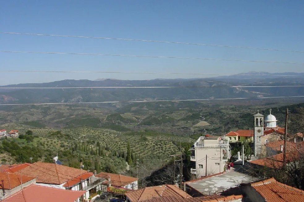
Longanikos sits where three prefectures — Laconia, Arcadia, and Messinia — converge without quite meeting, in the gap where Taygetos and Parnonas approach each other and create the Laconian valley of the Eurotas below. This is not an accidental village. Anyone moving armies or trade goods across the central Peloponnese had to reckon with this passage. The ancient name of the area may have been Velamini, mentioned by the geographer Pausanias roughly 1,800 years ago. The historian Stefano Magno documented the current name as early as 1453. The village has served, at various points, as a military outpost for Sparta and as a staging area for forces moving through the mountain passes. The slope it rests on is covered in fir trees; stone houses cluster along natural springs, and forest roads climb toward the highest points of Taygetos — Koutouni and Limna — above the village. Nearby, the monasteries of Rekitsa and Ampelaki survive close to the Arcadian border.
The Olive Oil That Isn't Italian
The main industry in Longanikos today is olive oil. The extra virgin oil produced in the surrounding groves is, according to local and industry accounts, purchased by Italian premium brands, which repackage and market it under Italian labels. It is a quietly ironic trade relationship: one of the oldest olive-growing landscapes in the Mediterranean producing oil that reaches consumers under a different country's name. The younger generation is shifting away from agriculture, commuting to Sparta or Megalopolis for jobs in public services and manufacturing. In the twentieth century — at the turn of the century and again in the 1960s and 1970s — large numbers of Longanikos residents emigrated to Athens, Sparta, the United States, Canada, Germany, South Africa, and Australia. The diaspora remains connected; summer brings returning families, and the village's population swells with people who have spent the year in very different places.
The Golden Greek of Lynn, Massachusetts
A particular concentration of Longanikos emigrants settled in Lynn and Lowell, Massachusetts, both historically gateway cities for immigrant communities in the northeastern United States. The most famous person connected to Longanikos was Harry Agganis, known as the "Golden Greek" — a standout athlete who played first base for the Boston Red Sox in 1954 and 1955 before dying of a pulmonary embolism in 1955 at age 26. Agganis grew up in Lynn, Massachusetts, the son of Greek immigrants, and his story is one of many that trace back to villages like this one in the Laconian mountains. The connection between a mid-century Massachusetts city and a hillside village above the Eurotas valley is maintained through family names, summer visits, and the kind of loyalty that distance tends to deepen rather than diminish.
Fir Slopes Above the Valley
Longanikos is at 37.233°N, 22.248°E, roughly 30 kilometers north of Sparta on the eastern flank of Mount Taygetos. From altitude, the village is visible as a cluster of stone and whitewashed buildings on a green slope above the valley, with the fir-covered upper ridges of Taygetos rising steeply behind it. The Eurotas valley spreads out below and to the east. The village lies close to the Laconia-Arcadia border — the landscape changes noticeably as the valley narrows and the mountains press in. The nearest airport is LGKL (Kalamata International), approximately 50 kilometers to the southwest. Approaching from Kalamata, the route crosses the main ridge of Taygetos before descending toward the upper Eurotas valley, where Longanikos is visible on the right slope.
From the Air
Longanikos is at 37.233°N, 22.248°E on the eastern slope of Mount Taygetos, approximately 30 km north of Sparta in the upper Eurotas valley. The village is visible at low altitude on the green fir-covered slope above the valley floor. Nearest airport: LGKL (Kalamata International), approximately 50 km southwest — the approach crosses the main Taygetos ridge. The Laconia-Arcadia border area is mountainous; VFR routing along the valley floor is advisable.
Nearby Stories
- Leonidio 1.4 km away
- Araklovon Castle 5.3 km away
- Battle of Valtetsi 5.3 km away
- Kardamyli 8.7 km away
- Pylos 8.9 km away
- Barony of Gritzena 9.7 km away
- Metamorfosi, Laconia 13 km away
- Arkadiko Bridge 19 km away