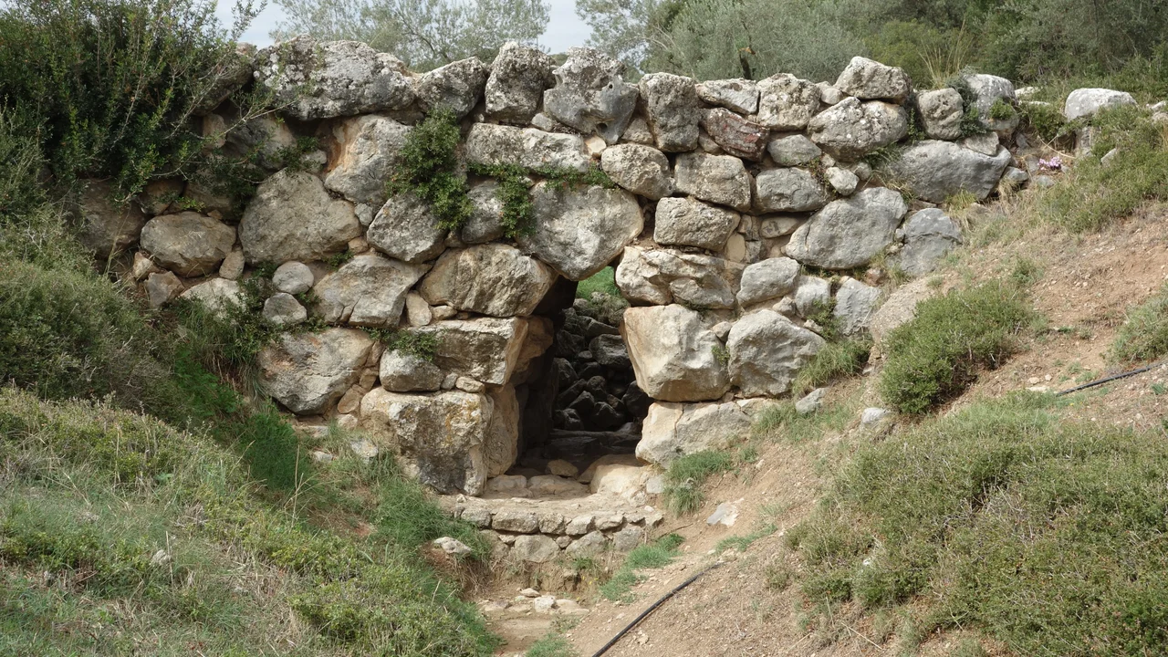

Arkadiko Bridge
Chariots once crossed this bridge. The stone curbs set into the roadway — still visible after more than three thousand years — were placed there deliberately to keep fast-moving wheels from skidding off the edge. The Arkadiko Bridge was built around 1300 BC, during the Late Helladic period of Mycenaean Greece, as part of a Bronze Age highway connecting the great cities of Tiryns and Epidauros. It is the oldest preserved bridge in Europe, and it still bears weight. Hikers walk across it today on a local track in the Argolid hills, completing a crossing that Mycenaean Bronze Age travelers made over a hundred generations before them.
Cyclopean Stone, Corbelled Arch
The bridge is built in the Cyclopean style characteristic of Mycenaean construction — massive, rough-cut limestone blocks fitted together without mortar, relying on their own weight and interlocking shapes to hold. The same technique was used to build the walls of Mycenae and Tiryns: structures so enormous that later Greeks assumed they must have been built by giants called Cyclopes, hence the name.
The structure employs a corbel arch — not the true semicircular Roman arch, but an older technique in which each successive course of stone projects slightly inward from the one below until the two sides meet at the top. The result is a pointed rather than curved opening, characteristic of Mycenaean and earlier construction. The bridge is 22 meters long and 5.60 meters wide at the base, standing 4 meters high, spanning a culvert just 1 meter wide. The roadway itself is about 2.50 meters across — enough for a chariot, deliberately so.
The Bronze Age Highway
The Arkadiko Bridge did not stand alone. It is one of four known Mycenaean corbel arch bridges in the vicinity of Arkadiko in Argolis, all part of the same Bronze Age road system connecting Tiryns and Epidauros. A second bridge, the Petrogephyri, crosses the same stream roughly one kilometer to the west. Similar in construction and age, it has a slightly larger span and a marginally higher vault, and it too remains in use on a local track. Its dimensions are comparable: 5.20 meters wide at the base, 2.40 meters at the top.
The road these bridges served was a real infrastructure achievement for its era — a maintained highway for military movement, trade, and the kind of administrative control that characterizes a sophisticated Bronze Age state. The Mycenaean palace system that built it collapsed dramatically around 1190–1150 BC, in the widespread Bronze Age collapse that ended dozens of civilizations across the eastern Mediterranean. The bridges outlasted the civilization that built them by three thousand years.
The Oldest Bridge in Europe
What makes the Arkadiko Bridge exceptional is not just its age but its persistence. Most ancient bridges were either rebuilt beyond recognition, collapsed into rivers, or were quarried for stone by later generations who needed building material and saw no reason to preserve what no longer served them. The Arkadiko survived because it is small, rural, and stubbornly useful — still serving the foot traffic of a local path even when no one of particular importance was paying attention to it.
The claim that it is the oldest preserved bridge in Europe, and one of the oldest arch bridges still crossable anywhere in the world, rests on this combination of antiquity and continuity. Other ancient structures are older, but they are ruins. The Arkadiko is still a bridge. You can still walk across it, and when you do, you step on the same stone surface that Mycenaean travelers, Bronze Age soldiers, and generations of Argolid farmers crossed before you. The stone curbs at the roadway's edge — placed to guide chariot wheels — are still in their original positions.
The Argolid's Bronze Age Landscape
The bridge sits in a landscape that is one of the most archaeologically dense in the world. Within a few kilometers lie Mycenae, the legendary seat of Agamemnon; Tiryns, with its massive Cyclopean walls; and the ruins of Epidauros. The Bronze Age settlements of this region were interconnected by the very road system of which the Arkadiko Bridge formed a part.
Modern visitors who follow the local track that crosses the bridge can stand on a structure that connects — physically, materially — to the world of the Iliad. The Mycenaean civilization that built this bridge also sent ships to Troy, according to Homer, and traded across the Aegean as far as Egypt and the Levant. Its collapse remains one of the great mysteries of ancient history. But the bridge they left behind is not mysterious. It is simply here, in the hills of Argolis, three thousand years later, still doing its job.
From the Air
The Arkadiko Bridge is located at coordinates 37.5936°N, 22.9376°E in the hills of Argolis, on the Peloponnese. From the air, it is a small structure in a rural landscape west of the Epidaurus road — not easily visible at altitude but clearly distinguishable on approach at lower altitudes due to its distinctive Cyclopean stonework against the hillside. The nearest major airport is Athens International (LGAV), approximately 110 km to the northeast. A viewing altitude of 1,500–3,000 feet over this part of the Argolid gives good visibility of the surrounding Mycenaean landscape including the hills between Tiryns and Epidauros.
Nearby Stories
- German Submarine U-133 (1941) 5.1 km away
- Battle of the Trench (1821) 5.4 km away
- Battle of Settepozzi 6.7 km away
- Stymphalus (Arcadia) 8.2 km away
- Kechries 11 km away
- Battle of Sellasia 13 km away
- Saronic Gulf 19 km away
- SS Heraklion 68 km away