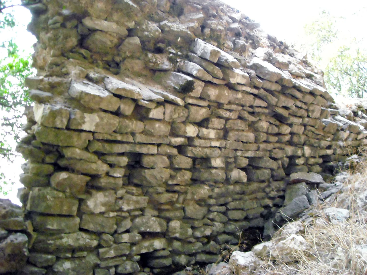

Araklovon Castle
When the crusading army of William of Champlitte and Geoffrey of Villehardouin swept through the Peloponnese in 1205, most of the peninsula fell to them quickly. The Byzantines had no organized resistance ready. But at a mountain fortress called Araklovon, guarding the pass from the coastal plain of Elis into the interior highlands of Skorta, a man named Doxapatres Boutsaras held firm. The Crusaders tried to storm the castle and failed. They left a force to maintain a siege — an on-and-off blockade that the Aragonese version of the Chronicle of the Morea says may have lasted until around 1210. Whatever happened inside those walls during those years, Doxapatres Boutsaras became a figure the chroniclers remembered.
The Key to Skorta
Araklovon's strategic logic was geographic. The region of Skorta occupied the mountainous interior of the central-western Peloponnese — a rugged country where the limestone ridges pile up one behind another, cut by river gorges and forested with oak and fir. Controlling Skorta meant controlling the approaches to Arcadia, and controlling the pass from the coastal plain of Elis into that interior meant controlling the trade and military routes that ran through the region. Araklovon sat at the mouth of that passage — a Byzantine-built fortress positioned exactly where it needed to be. The word droungos, used in medieval sources for the mountain pass itself, was a Greek term carried over from Byzantine military organization, a reminder that this frontier landscape was heavily administered and heavily guarded even before the Crusaders arrived. The castle's name has been much debated. One theory interprets it as meaning "mountain cage." Another links it, probably incorrectly, to a sanctuary of Herakles. The Western name — Bucelet, Bucello, Polcellecto, in various medieval French and Italian forms — is equally opaque.
Doxapatres and the Long Resistance
The Chronicle of the Morea is the primary source for Araklovon's resistance to the Crusaders, and it records Doxapatres Boutsaras in terms that convey extraordinary physical strength and tenacity. Boutsaras held Araklovon against the most successful military campaign the Peloponnese had seen since antiquity. The crusading forces that took the rest of the peninsula pressed on; a contingent remained to blockade the castle. Whether the resistance ended in negotiated surrender, starvation, or some other outcome is not clear from the sources. What is clear is that the siege lasted years, making Araklovon one of the last significant points of Byzantine resistance in the Peloponnese during the Latin conquest. After 1210 the castle disappears from the record until 1264, when the inhabitants of Skorta revolted against Frankish rule — a revolt that suggests the region never entirely accepted the new order. In the late 1270s, Geoffrey II of Briel seized Araklovon by a ruse, then called on the Byzantine forces of Mystras for support. A Frankish counterforce, the Captain of Skorta Simon of Vidoigne, defeated the Byzantine relief and forced Geoffrey to capitulate. The castle reverted to Frankish control.
The Barony of Karytaina
After the failed revolt of the 1270s, Araklovon's fate was bound up with the broader politics of the Frankish Peloponnese. The castle passed into the domain of the Barony of Karytaina — the great Frankish lordship that controlled much of the Arcadian highlands — and in the early 14th century it reverted to the princely domain of the Principality of Achaea directly. A record from 1391 notes that the settlement near the castle numbered 100 hearths — roughly 400 to 500 people, a substantial community for a mountain site. This was near the end of the Frankish period in the Peloponnese. At the beginning of the Ottoman-Venetian War in 1463, Venetian forces captured Araklovon. The Ottomans recovered it in 1467, and after that — nothing. The castle drops out of the written record entirely. By the 16th century, both the fortress and its name had disappeared from the documents and from local toponymy alike.
The Lost Castle
The disappearance of Araklovon from the historical record presents scholars with an unusual puzzle. Medieval fortresses do not usually vanish so completely — their walls persist even when their names are forgotten, and local memory tends to preserve some continuity of identity. But Araklovon left behind not even a garbled place name. The debates among later scholars about its location fill a small literature. Candidates include the ruined castles at Palaiokastro, at Platiana (now identified with medieval Acumba), at Samiko on the coast, at a site called Chrysouli near Mount Minthi, and on the peak of Mount Smerna. The two most commonly accepted identifications are the Chrysouli site near Mount Minthi and the Mount Smerna peak — the same Mount Minthi near whose western slopes the ruins of ancient Lepreum lie. The landscape in which Araklovon stood has not changed: the passes between the coastal plain and the Skorta interior are still narrow, still commanding, still the obvious points at which a determined defender could stop an army. The castle existed. Where exactly the walls rose is still being argued.
The Frontier That Shaped a Peninsula
The history of Araklovon compresses the history of the medieval Peloponnese into a single contested site. Byzantine control; Frankish conquest resisted, then completed; Greek revolt; Frankish reassertion; Byzantine revival; final Ottoman conquest. Each wave of control left its mark on the landscape and its records in the chronicles, and Araklovon appears in nearly every transition — not as a capital or a center of culture but as the lock on a door that everyone wanted to open. Doxapatres Boutsaras, whatever became of him, represents the figure who held that door against the most powerful military force of the early 13th century. His name survived in the sources when the castle itself vanished. The mountain pass he guarded still runs from the coast into the Skorta highlands, still the logical route for anyone moving from the Ionian plain into the interior of the peninsula.
From the Air
Araklovon Castle's most likely location is in the area of approximately 37.49°N, 21.78°E, near Mount Minthi in the eastern Elis / Triphylia border zone. Mount Minthi (reaching about 1,210 meters) is the dominant highland feature visible east of the coastal plain in this part of the Peloponnese — from altitude, the transition from flat agricultural land to broken limestone ridges is clear. The Alpheus (Alfeios) River crosses the plain to the north. The nearest major airport is LGRX (Araxos Airport), approximately 80 km to the northwest along the Gulf of Patras. Flying at 5,000 to 6,000 feet, the Minthi massif casts dramatic shadows in morning and afternoon light, and the narrow valleys cutting into it — the droungoi of the medieval sources — are visible as dark clefts in the limestone.
Nearby Stories
- Aroanios 4.6 km away
- Kyparissia 4.7 km away
- Strofades 7.6 km away
- Arcadia (region) 9.1 km away
- Longanikos 9.5 km away
- HMS Perseus (N36) 21 km away
- Astras 23 km away
- St. Mark's Roman Catholic Church 34 km away