
Aroanios
Pausanias came to the Aroanios River specifically to hear it. Not the river itself — rivers do not speak — but the fish. Locals around Cleitor had long maintained that the spotted fish of the Aroanios sang like thrushes. Pausanias waited until sunset, the hour the fish were supposedly most vocal. He heard nothing. He recorded his disappointment with the mild scrupulousness of a traveller who suspects he has been had, but notes the claim anyway, because the river was genuinely extraordinary even without singing fish. He was right about that.
Where the River Comes From
The Aroanios rises from the carbonate mountain range of Aroania — also known as Chelmos — whose peaks range from 1,500 to 2,300 metres above sea level. The mountain is limestone country, where water disappears underground and resurfaces unexpectedly, having travelled through rock for distances that defy surface mapping. After 12 kilometres, the Aroanios meets the Ladon River near the village of Helongospilia (Χελωνοσπηλιά). Along the way it has carried rock debris, soil, and organic material down from Aroania, depositing it over geological time into the valley below. Scree from surrounding peaks contributed further layers. The result is a valley floor of clayish, fertile soil — the "Katsana" valley — that residents have cultivated for centuries, turning it into a cultural landscape of fields, gardens, and trees that Pausanias would have recognised, though the modern village of Kleitoria, the valley's main town, has grown considerably on its hill above the plain where three tributary streams converge with the main river.
Forty-One Springs in a Plane-Tree Forest
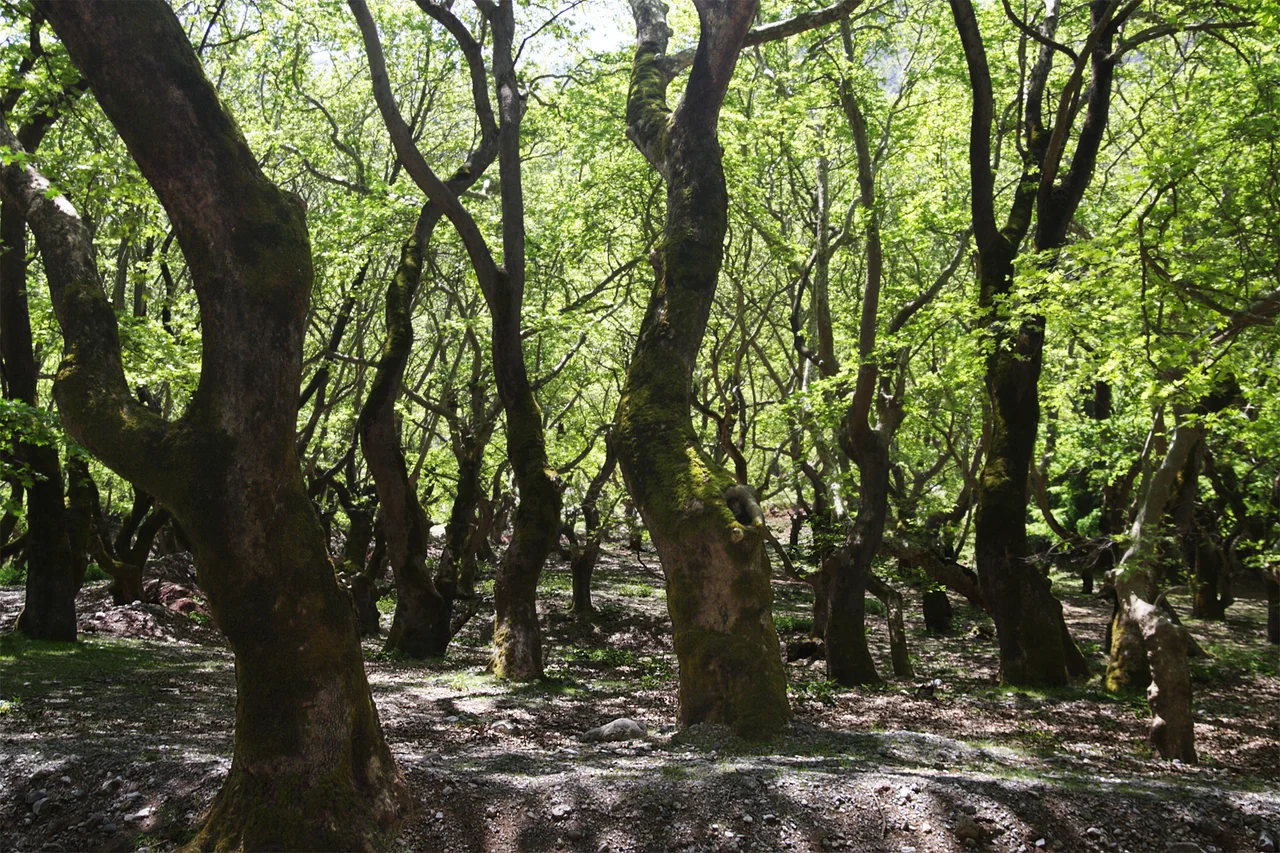
The most remarkable feature of the Aroanios is its source — or rather, its sources. At the village of Planitero in Achaea, the river is fed by 41 karst spring outlets emerging within a narrow woodland of Oriental plane trees barely 580 metres long and 30 metres wide. Each individual outlet is small. Together they release an enormous volume of cold, clear water, which the trees absorb so readily that their canopy and root systems have expanded far beyond what the local rainfall could sustain. An international geological study mapped all 41 outlets and established that the water emerges either directly from exposed karstic rock layers or rises from loose deposits of sand and gravel, having entered the limestone system somewhere far up the mountain and travelled through the rock unseen. The setting is striking: dense shade, cold air, the sound of water appearing from the earth in dozens of small surges beneath the plane tree roots. In summer, the site draws visitors from as far away as Patras by bus and car. Rainbow trout farms and restaurants have crowded the immediate area, which has strained the natural setting considerably.
The Spotted Fish of Antiquity
Pausanias's account of the singing fish refers to specific creatures he called poikilaiai — a Greek term meaning spotted or mottled fish. These were a distinctive species associated with the Aroanios. Polybius, writing in the 2nd century BC, and Pliny the Elder, writing in the 1st century AD, both confirm the river's ancient reputation, though they are less precise than Pausanias. The claim that the fish sang was almost certainly a local legend amplified by the acoustic oddity of the spring environment — karst outlets can produce gurgling and resonant sounds as water moves through rock — but the spotted fish were real enough to be worth a philosopher's time and a traveller's detour. The ancient city of Cleitor, whose walls Pausanias visited 1,300 metres west of modern Kleitoria, was closely identified with the river; Cleitor lent the Aroanios its older name, Katzanas or Katsanas, which the river bore at some point in its history.
A Geotope Under Pressure
The karst spring system at Planitero is, as one researcher has put it, a true geotope: a geological feature of exceptional scientific and natural value, rare not only in Greece. The plane tree forest is alive precisely because of the springs it shelters. The relationship is self-reinforcing — the trees stabilise the ground around the outlets, and the outlets sustain the trees — creating a micro-ecosystem that has persisted for millennia in the upper Peloponnese. The concern today is simpler than geology: commercial tourism has moved too close to the source. Verandas, sale points, and abandoned structures stand directly within the fragile natural zone. The springs that sustained Pausanias's spotted fish, the ancients' fertile valley, and generations of travellers' curiosity deserve more careful management than they have yet received.
From the Air
The Aroanios River valley lies at approximately 37.833°N, 22.160°E in the mountainous interior of northern Achaea/southern Corinthia, within the Peloponnese. From altitude the river and the Katsana valley are visible as a green corridor winding northeast from the foothills of Mount Aroania (Chelmos). The Planitero spring area appears as a dense woodland patch at the valley floor. Nearest major airport: LGRX (Araxos/Patras), approximately 55 km to the northwest. Recommended viewing altitude: 5,000–8,000 feet to follow the river course from the mountain springs down toward its confluence with the Ladon. Summer visibility is typically excellent; afternoon convective cloud can build over Chelmos by midday.
Nearby Stories
- Siege of Corinth (1463) 2.1 km away
- Aigeira 2.7 km away
- Oblou Monastery 3.7 km away
- Isova 4.9 km away
- Mantinea 5.2 km away
- Arkadiko Bridge 8 km away
- 1981 Gulf of Corinth Earthquakes 11 km away
- Battle of Lalas 20 km away