
Aigeira
The town of Aigeira perches on the Achaean coast where the Gulf of Corinth narrows toward Corinth, 26 kilometres southeast of Aigio. Below the modern town, the Gulf glitters. Six kilometres inland and uphill, the ancient city occupies an acropolis that has been inhabited, off and on, since roughly 5500 BCE. Homer called it Hyperesia. Pausanias, writing in the second century CE, recorded how it came to be renamed for the goats — aigeira — that saved it from destruction. Archaeologists from Vienna's Austrian Archaeological Institute have been excavating it since 1916, and the site still has not given up all its secrets.
Seven Thousand Years on One Hill
Settlement at Aigeira begins in the Middle Neolithic, around 5500 BCE. The earliest inhabitants left behind pottery — including vessels interpreted as containers for cheese-making — and obsidian blades brought from the island of Melos, already evidence of long-distance maritime contact. By the Early Helladic period (around 3100 BCE), the community was more permanent and more connected. In the Late Bronze Age, the site was destroyed by fire and rebuilt; the reconstruction produced the only fortification wall known from this period on the Greek mainland, a fact that marks Aigeira as an outlier in the archaeology of the Bronze Age Aegean. The settlement survived the Bronze Age collapse — which ended most Mycenaean centres — though it eventually contracted, and by the eighth century BCE, habitation had resumed around what appears to have been a sanctuary.
Goats and Leagues
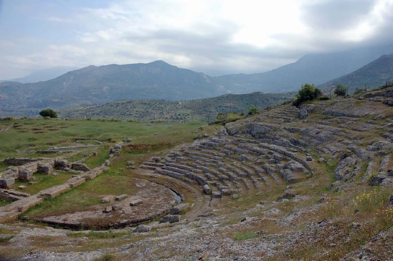
According to Pausanias, the old name Hyperesia was abandoned after the town used a herd of goats to deceive an invading enemy force — driving the animals toward the attackers at night, torches tied to their horns, creating the impression of an approaching army. Whether or not the story is true, the goat became the city's symbol, appearing on its coins through the Classical and Hellenistic periods. Aigeira was a member of the Achaean League, the federation of Peloponnesian cities that dominated the region's politics in the fourth and third centuries BCE, and it thrived under league patronage. The city's size increased by as much as fourteen times during the Hellenistic period. A circuit wall enclosed around 50 hectares. The theatre was built around 280 BCE, and its remains — uncovered by Otto Walter in 1916 — are still among the most visible structures at the site.
A City of Gods and Guests
Aigeira in its Hellenistic prime was a city with an unusually diverse religious life. Temples to Zeus, Apollo, Artemis Agrotera, Aphrodite Urania, and the Syrian Goddess stood in the upper town; Pausanias noted that Serapis and Isis were also worshipped there, reflecting contact with Ptolemaic Egypt. In the excavated 'guest house' — a building with mosaic floors dating to the mid-fourth century BCE — archaeologists conjecture that a hoard of nearly 600 silver coins was hidden in the course of a raid, left by someone who never returned to collect it. Fragments of a colossal statue of Zeus, made by the Athenian sculptor Eucleides in the second century BCE, eventually found their way to the National Archaeological Museum in Athens.
What the Ground Still Holds
After a third-century CE earthquake lifted the harbour structures four metres above sea level and ended the city's role as a port, Aigeira declined through Late Antiquity and the medieval period. By around 1900, ancient stone was being quarried for the 'Houses of the Raisin-Pickers.' Systematic excavation from 1916 onward has changed how Aigeira is understood — each generation of Austrian archaeologists has re-examined the evidence and revised the picture. The theatre has been excavated most recently, under Walter Gauss, between 2011 and 2018. What remains of it — the orchestra, sections of seating, the traces of adjacent shrines — offers a view from a hillside that the people of Aigeira once filled on feast days, looking out toward the Gulf below.
From the Air
Aigeira is located at approximately 38.147°N, 22.355°E, on the northeastern Achaean coast of the Peloponnese. The ancient archaeological site lies about 6 km inland and uphill from the modern town, on a ridge above the coast road. From the air at 3,000–5,000 feet, the Gulf of Corinth is visible running east-west below, with the modern town of Aigeira at the waterline and the plateau of the ancient site visible on the hillside behind it. The nearest major airport is LGRX (Araxos), approximately 55 km to the west. Flying east from Araxos, the Achaean coast runs below with the mountains of the northern Peloponnese rising steeply to the south; Aigeira appears as a coastal settlement backed by a prominent ridge that marks the acropolis site.
Nearby Stories
- Battle of Chaeronea (86 BC) 1.2 km away
- Mycenaean Cemetery of Voudeni 2.7 km away
- Battle of Lechaeum 4.8 km away
- Amfissa 5.5 km away
- Pheneus 6.3 km away
- 1981 Gulf of Corinth Earthquakes 7.3 km away
- Thermos (Aetolia) 13 km away
- Battle of Lalas 30 km away