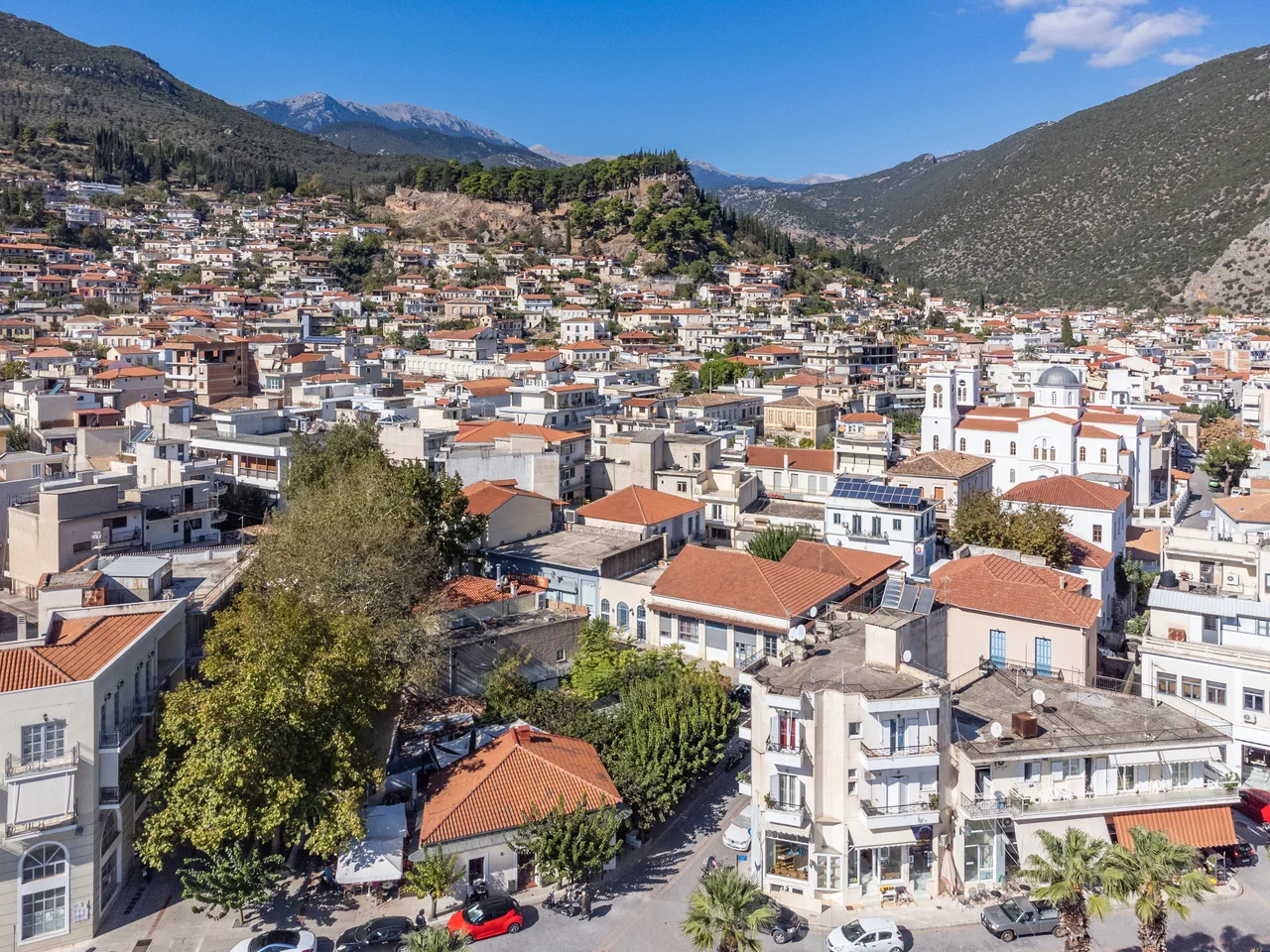

Amfissa
The name means surrounded, and so it is. Two mountains hold the town between them: Giona to the west, Parnassus to the east, their flanks dropping into the Crissaean plain where the olive forest begins. Amfissa sits at the plain's northern edge, the last town before the mountains close in, 20 kilometres from Delphi and a short drive from the sea at Itea. Its ancient name was Amphissa. Its medieval name was Salona. Both names have stuck in different contexts, used by different sources, which is fitting for a place that has been occupied, renamed, destroyed, rebuilt, and renamed again across three millennia without ever quite disappearing.
The Oldest City in Phocis
Amphissa has the longest continuous historical record of any city in Phocis. The claim of 3,000 years of occupation is supported by a Mycenaean tomb found at the eastern edge of town — in use from the 13th to the 11th century BC — and by the remains of the ancient acropolis walls, which date to the 7th and 6th centuries BC. The city was the chief town of the Ozolian Locrians, an ancient Greek tribal group, and it traded actively with Corinth and the towns of the northwestern Peloponnese by the 8th century BC. In 653 BC, settlers from Amphissa sailed to southern Italy and founded the colony of Epizephyrian Locri.
The geographer Pausanias, writing in the 2nd century AD, described Amphissa as beautifully constructed and located 120 stades from Delphi. He noted a temple of Athena on the acropolis with a bronze statue said to have been brought from Troy by the hero Thoas, tombs of mythological figures, and a temple of Asclepius. The city's coins carried Apollo's head on one side and a spear, the jawbone of the Calydonian boar, and a star or grapes on the other — a small catalog of the region's mythology pressed into metal.
Sacred Wars and Philip's Revenge
Amphissa's most consequential moment in ancient history came through a diplomatic quarrel at Delphi. During the Third Sacred War, the Amphissians had cultivated part of the Crissaean plain that belonged to the sanctuary, and established potteries at Kirra in violation of sacred land protections. In 339 BC, the Athenian orator Aeschines, in a counterattack during a heated debate over golden shields displayed in Apollo's temple, accused Amphissa before the Amphictyonic League — the council of Greek tribes that governed Delphi — of these violations. The council called on Philip II of Macedon to enforce the ruling.
Philip did not limit himself to enforcement. In 338 BC, in what became known as the Fourth Sacred War, he attacked and destroyed Amphissa, expelled much of its population, and transferred the territory to Delphi. The same year he defeated the combined forces of Athens and Thebes at the Battle of Chaeronea, effectively ending Greek city-state independence. Amphissa's agricultural dispute with Delphi had given the most powerful ruler in the Greek world a pretext, and he used it thoroughly.
Frankish Lords and the Castle of Salona
The city that emerged from antiquity into the Middle Ages carried a new name. After the Fourth Crusade in 1204 and the establishment of the Latin Empire in Constantinople, the Crusader lord Boniface of Montferrat swept through central Greece, and Amphissa became the seat of the Lordship of Salona. The new Frankish rulers built a castle on the hill where the ancient acropolis had stood — the Castle of Salona, also called the Castle of Oria. The ancient Greek name was replaced by Salona in Greek, La Sole in French, La Sola in Italian.
The Catalans held it next, ruling central Greece for more than eighty years after 1311. The Ottomans arrived in 1394. A major earthquake in 1580 destroyed much of the town. A brief Venetian interlude from 1687 to 1697 ended with the Ottomans returning. By the 18th century, Salona had about 6,000 inhabitants and little trace of its ancient grandeur — travellers of the period sometimes mistook it for ancient Delphi or Kirra, which says something about how thoroughly the city's past had been buried.
First Shot of Independence
The transformation from Salona back to Amphissa was not just a matter of renaming. It was earned. On 27 March 1821, the local revolutionary leader Panourgias led forces into the town. On April 10 the Greeks captured the Castle of Salona — and in doing so took the first Ottoman fortress to fall in Greek hands during the War of Independence. The garrison of six hundred was wiped out. The castle that had been built by Crusaders, held by Catalans, held by Ottomans, became a symbol of what the revolution could achieve.
In November 1821, a council held at Salona drafted the "Legal Order of Eastern Continental Greece," a proto-constitution, and established the Areopagus of Eastern Continental Greece — 71 notables representing the liberated territories. The city had been first in revolution and first in governance. When the independent Greek state was formalized in 1833, the ancient name Amphissa was officially restored. The modern spelling Amfissa is the current form, though the castle on the hill, the olive plain below, and the mountains enclosing the town on both sides have changed less than the name.
From the Air
Amfissa lies at approximately 38.53°N, 22.38°E at the head of the Crissaean plain in Phocis, between Mount Giona to the west and Mount Parnassus to the east. From altitude, the town is visible as a compact urban cluster at the upper end of the great olive plain that fills the Pleistos valley — look for the green expanse of the olive forest to the south and the castle hill (Castle of Salona/Oria) rising above the town to the north. The Gulf of Itea at Itea is roughly 15 km south, visible in clear weather. Recommended viewing altitude: 4,000–6,000 ft to take in the full Crissaean plain and its olive sea. Nearest major airports: LGRX (Araxos, ~85 km south across the Gulf of Corinth) and LGAV (Athens Eleftherios Venizelos, ~200 km east, the standard visitor gateway). Summer visibility is typically excellent; the olive groves have a characteristic silver-green shimmer that distinguishes the plain from the surrounding limestone terrain.
Nearby Stories
- Rio Castle 1.7 km away
- Hyampolis 5.6 km away
- Karpenisi 7.2 km away
- Ypati 7.8 km away
- French Cruiser Châteaurenault (1898) 7.9 km away
- Thermos (Aetolia) 12 km away
- 1981 Gulf of Corinth Earthquakes 13 km away
- Free and Real 20 km away