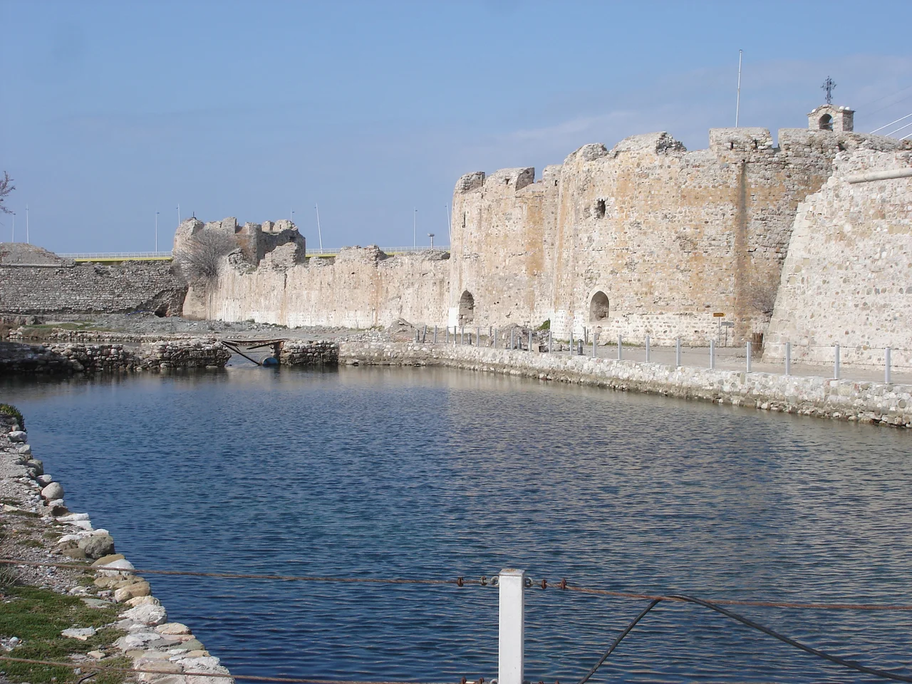

Rio Castle
The narrows here are only about two kilometers wide — one of the tightest passages in the Greek world, where the Corinthian Gulf squeezes between the Peloponnese and the Greek mainland before opening into the Ionian Sea. The Ottoman Empire understood this geography immediately. In 1499, Sultan Bayezid II ordered a fortress built on the Peloponnesian shore at Rio, above the ruins of an ancient temple dedicated to Poseidon, god of the sea. His builders finished within three months. Across the water at Antirrio, a twin fortress rose at the same time. Together, the two castles — one guarding each shore — earned a nickname from those who navigated between them: the Little Dardanelles.
A Temple Beneath the Stones
Before the Ottoman engineers broke ground, this promontory already carried centuries of sanctity. An ancient temple to Poseidon had stood at the tip of the Rio peninsula, looking out over the same waters the god supposedly commanded. When Bayezid II's builders arrived, they incorporated the old stones into the new construction — a practical choice that also, perhaps unintentionally, layered a Greek deity beneath an Ottoman fortress. The castle they raised was ingenious in its simplicity: the sea itself defended the northern wall, while a broad moat filled with seawater protected the landward side. Two ravelins — projecting outer bastions — guarded the moat's flanks, connected to the main fort by stone bridges. Two gates pierced the walls: one facing the land, one opening directly to the sea.
The Little Dardanelles
Whoever held Rio and Antirrio held the Corinthian Gulf. Every ship bound for Corinth, every supply convoy heading east, every warship deploying from the Adriatic had to pass between these two fortresses within cannon range. The Ottomans grasped the strategic logic perfectly, which is why losing the castle even briefly stung so badly. In 1533, the Genoese admiral Andrea Doria seized it — but the Ottomans took it back within the year. The real shift came in 1687, during the Morean War, when the Venetian commander Francesco Morosini captured both castles and pushed the Ottomans out of the Peloponnese entirely. Morosini's engineers rebuilt and strengthened Rio's walls, adding towers and raising the small chapel of the Life-giving Spring — Zoodochos Pege in Greek — inside the walls. The Ottomans returned in 1715, retaking the fortress during the brief war that ended Venetian rule over the Morea. They would hold it until a French general named Nicolas Joseph Maison arrived with an expeditionary force during the Greek War of Independence and accepted the castle's surrender.
Lepanto's Shadow
The Battle of Lepanto was fought in October 1571, just off this shore — close enough that the combatants on the castle's ramparts could hear the cannon fire. The largest naval engagement of the 16th century, Lepanto pitted the Holy League (Spain, Venice, the Papacy, and their allies) against the Ottoman fleet in the Gulf of Patras. The Christian coalition won decisively, sinking or capturing much of the Ottoman navy. It was celebrated across Europe as a turning of the tide against Ottoman expansion. Yet Rio Castle itself never changed hands because of Lepanto — the Ottoman Empire rebuilt its navy within three years, and the strategic balance at these narrows held. The castle stands today as a monument to all of that: the battle nearby, the empires contesting this pinch-point of geography, the long centuries of siege and surrender.
Prison Walls and Concert Nights
After Greek independence, the castle's fighting days ended but its use continued in a grimmer form. Between 1831 and 1912, Rio served as a military and then civilian prison. Inmates were regularly assigned to municipal labor — cleaning the streets of Rio — which gave the fortress an odd afterlife as an instrument of civil administration rather than war. The prison closed in 1912, and the castle eventually opened to visitors and cultural programming. Today it hosts concerts in the summer, the ancient stone walls acting as backdrop and acoustic boundary for music rather than artillery. The Rio-Antirrio Bridge — one of the longest cable-stayed bridges in the world when it opened in 2004 — now spans the same narrows the castle once controlled, its pylons visible just meters away. The Little Dardanelles now carry traffic rather than warships.
From the Air
Rio Castle sits at 38.3114°N, 21.7812°E, at the very tip of the Rio peninsula where the Gulf of Patras narrows to roughly 2 km. From the air, the castle and the Rio-Antirrio Bridge are immediately visible together — one Ottoman-era stone fortress and one modern cable-stayed span, side by side at the narrows. Approach from the west along the Gulf of Patras for the clearest view. The nearest major airport is LGRX (Araxos), approximately 30 km to the southeast. A viewing altitude of 1,500–2,000 feet provides an excellent overview of both fortresses — Rio on the south shore and Antirrio (Castle of Rumelia) directly opposite on the north — along with the geometry of the narrows they were built to command. In clear weather the Corinthian Gulf extends visibly eastward toward Corinth.
Nearby Stories
- Thermos (Aetolia) 8.2 km away
- 1861 Eliki Earthquake 9.6 km away
- Pheneus 14 km away
- Battle of the Echinades (1427) 15 km away
- HMS Perseus (N36) 19 km away
- Amfissa 20 km away
- Astras 21 km away
- Acarnania 28 km away