
Looe
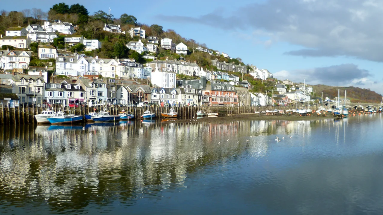
In June 1625, Barbary pirates rounded the headland and rowed into the cobbled streets. They had come from North Africa, two thousand miles across the sea, to raid an English fishing port. Looe had been forewarned - villagers were already scattering into the orchards and meadows when the raiders arrived - but the pirates still managed to seize eighty mariners and fishermen, chain them, and march them back to their ships. The captives were taken to North Africa and sold into slavery. The town itself was set on fire. Four centuries later, Looe is two small towns built into a steep V where the East and West Looe rivers join the sea, connected by a nine-arched Victorian bridge built in 1853 to replace a stone medieval bridge that had stood since 1436. Pleasure boats now share the harbour with the working fleet. Some of the descendants of the men taken in 1625 are likely still here.
Two Towns, One River
Looe developed as two separate settlements, East Looe and West Looe, each with its own borough charter and its own parish church. West Looe was chartered by Richard, Earl of Cornwall, sometime between 1225 and 1257. East Looe gained the right to hold a market by 1189 and was taxed as a borough from 1306, granted its first formal charter in 1320. Both sent two members to Parliament from the Tudor era until 1832 - by which point they had become textbook "rotten boroughs," tiny constituencies with disproportionate representation, and were abolished. The first wooden bridge across the river was in place by 1411, burned down, and was replaced by the stone bridge of 1436. That bridge had a chapel of St Anne built into its centre, dedicated for travellers' prayers. The current Victorian bridge has no chapel, but it has the same essential job: knitting the two halves of the town together while letting the tide run underneath.
Ictis, Maybe
Just off the coast lies Looe Island, a small green hump in the bay that has been called many things. Some time before 1144, Benedictine monks settled there, built a chapel, and set up a rudimentary lighthouse using beacons - one of the earliest navigation aids on the Cornish coast. A small hoard of late Roman coins was recovered from the island in 2008, found in shallow ditches around a pear-shaped enclosure that may have framed the later chapel. More provocatively, a large bronze ingot was found by divers to the south of the island, and a series of Roman amphora pieces, stone boat anchors, and other finds have led some historians to argue that Looe Island might be Ictis - the tin-trading island described by the Greek navigator Pytheas around the fourth century BC and recalled by Diodorus Siculus three centuries later. The evidence is not conclusive. The argument is unresolved. The island sits offshore either way.
Lead, Silver, and the Banjo Pier
By 1800 Looe was in decline. The Napoleonic Wars and the blockade of 1808 had cut off the fishermen from their pilchard grounds. Storms and flooding battered the town in 1817. Then the copper boom on Bodmin Moor's Caradon Hills opened a new market. The Liskeard and Looe Union Canal arrived in 1828, the railway followed in 1860 along the canal's towpath, and Looe became a working port again - exporting Herodsfoot lead, which produced 13,470 tons between 1848 and 1884, and more than seventeen tons of silver between 1853 and 1884. East Looe got its large quay in 1856 to handle the shipping. In 1877 a new Guildhall went up, still standing on Fore Street. Then the architect and civil engineer Joseph Thomas (1838-1901) designed the Banjo Pier - a curved breakwater shaped like its namesake instrument, completed in the late nineteenth century to protect the harbour entrance. It still does. It is also one of the most photographed structures in south-east Cornwall.
Katherine Mansfield in Red
In the spring and summer of 1918, the New Zealand short-story writer Katherine Mansfield came to Looe to recover from tuberculosis. She joined her long-time friend Anne Estelle Rice, an American painter living in the town. While Mansfield rested, Rice painted her - a vivid portrait of the writer in a red dress against an intense red ground, eyes turned toward the viewer with an almost feverish directness. The Portrait of Katherine Mansfield has been in the Te Papa Tongarewa museum of New Zealand since 1946 and is one of the most recognisable images of any twentieth-century writer. Mansfield died of TB in 1923, five years after that summer in Looe. The portrait outlasted her, the friendship, and the brief season when an English fishing town doubled as a recuperative refuge for two women working at the edge of modernist art and literature.
Fancy Dress and Shark Fishing
Modern Looe lives between two reputations. It is still a fishing town - a fleet of small boats lands fresh fish daily on the East Looe quay, and the town hosts the Shark Angling Club of Great Britain - and it is also a tourist resort, with hotels and guest houses crowding the steep streets, Cornish pasty shops, ice cream stands, and the regular crush of summer visitors. The Looe Music Festival arrives in late September, drawing thousands to temporary venues around the harbour and on the beach. On New Year's Eve, the entire town wears fancy dress - a tradition that has put Looe on the UK top-ten lists for New Year celebrations more than once, ranking third in 2007-08. The BBC crime drama Beyond Paradise, which first aired in 2023, films here and uses Looe as the fictional Devon town of Shipton Abbott. The Banjo Pier appears on screen most weeks. Locals know which boat their fish came in on.
From the Air
Located at 50.353°N, 4.454°W on the south coast of east Cornwall. Recommended viewing altitude 1,500-3,000 ft AGL. Visual landmarks: the tight V-shape of the harbour where East and West Looe meet; the Banjo Pier curving from the eastern side; Looe Island roughly 0.5 nm offshore to the south-west. The A387 winds north toward Liskeard along the Looe Valley. Plymouth (no civilian field) lies 17 nm east. Nearest civilian airports: Exeter (EGTE) 48 nm east-north-east, Newquay (EGHQ) 30 nm west. Watch for sea fog rolling in from the Channel in spring and autumn; the harbour and pier are best photographed at falling tide.
Nearby Stories
- Launceston Castle 2.7 km away
- East Wheal Rose 8.5 km away
- Castle Drogo 8.8 km away
- Hope Cove Lifeboat Station 13 km away
- Goonhilly Satellite Earth Station 19 km away
- Battle of Plymouth (1652) 20 km away
- HMHS Glenart Castle 55 km away
- HMS Affray 70 km away